Crossing the dunes, the unspoiled beach at Canaveral National Seashore has a special feeling about it.
Terns scamper along the tide line to a symphony of rolling surf, pecking at bubbles in the sand that likely will yield a dinner of mole crabs, tasty little crustaceans known more commonly in these parts as “sand fleas.”
There’s not a soul in sight, but even if there were, there’s plenty of space. Kick off your shoes.
This is Canaveral National Seashore, the longest unspoiled beach in Florida, 24 miles of pristine coastal sanctuary for people and wildlife, and access is limited. Rangers count entries and cut them off when the park is full.
I have been visiting Canaveral National Seashore since the mid-1970s, returning often to swim and sun, fish in the surf or around oyster bars in the Mosquito Lagoon, kayak through backcountry islands and hike coastal hammocks.

Canaveral National Seashore is a food factory for wildlife, an amazing terrestrial and marine ecosystem that supports a diversity of creatures who inhabit its dunes, hardwood hammocks, unspoiled islands and lagoons.
On your drive along the six-mile beach road, you probably saw an armadillo scurry into the scrub, or perhaps you saw a white-tailed deer while hiking the Castle Windy Trail.
On the beach, you will almost certainly spot a sea turtle nest during spring, summer and fall. Each year, thousands are identified here.
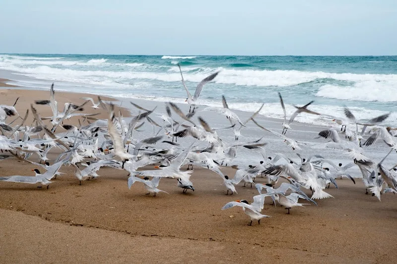
The two entrances to Canaveral National Seashore are through New Smyrna Beach on the north end, Titusville and Merritt Island National Wildlife Refuge on the south end. The entrance roads do not meet in the middle. On both sides, they dead end, leaving a six-mile stretch of untouched beach in between.
The north entrance offers a more diverse selection of activities and sightseeing.
Best time to go: Weekdays and mornings. There are caps on the number of visitors at both entrances, and the beach lots are often at capacity on summer weekends. Entry Fee: $20 for cars; $15 for motorcycles; $10 for pedestrians, bicyclists. The pass is valid for seven consecutive days. Annual passes are $40.
- North Entrance via New Smyrna Beach
- Turtle Mound at Canaveral National Seashore
- Historic Eldora at Canaveral National Seashore
- Kayaking, paddleboards and canoeing at Canaveral National Seashore
- Fishing, clamming and oysters at Canaveral National Seashore
- Hiking at Canaveral National Seashore
- Backcountry camping at Canaveral National Seashore
- South Entrance via Titusville
- Contact Information for Canaveral National Seashore:
- Articles related to Canaveral National Seashore
North Entrance via New Smyrna Beach
The north entrance offers access to five beach parking lots with limited parking along the six-mile beach road below the park entrance. Roadside parking is strictly prohibited outside designated areas, which are clearly marked.
During the week, you rarely have a problem finding parking, but on weekends, plan to arrive early.
Surf anglers at Canaveral National Seashore gravitate to lots 2 to 4 early, but they also leave early. These three beaches have shifting near-shore sandbars that trap fish on outgoing tides, giving anglers a leg up when casting into the currents between the sandbars.
- Lot No. 1: 89 spaces with handicap access. Most crowded part of the beach.
- Lot No. 2: 25 spaces. Solitude. Surf fishing.
- Lot No. 3: 25 spaces. Most popular for surf fishing. Handicap access to the deck on the boardwalk.
- Lot No. 4: 25 spaces. Solitude. Surf fishing.
- Lot No. 5: 37 spaces with handicap access. Nude beach.
Be aware that the last parking lot, No. 5, provides access to a clothing-optional beach. Sunbathers trek a few hundred yards south of the lot, putting a little distance between themselves and other beach-goers.
In any case, this lot is often full and should be avoided on weekends.
Chemical toilets, recycling bins and trash containers are available at every beach parking lot. Alcohol is permitted, but bottles are prohibited.
Turtle Mound at Canaveral National Seashore
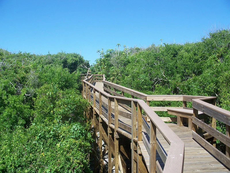
The Turtle Mound is a prehistoric archaeological site where native Timucuan Indians would cast their oyster shells after dinner. It is the largest shell midden in the United States, 600 feet long and rising 50 feet.
A boardwalk trail takes you to a viewing platform at the top, providing sweeping views of the dunes, beaches and Indian River Lagoon from the highest point in the park.
Our little secret: Behind the mound is a beach hidden from the road where you can picnic and launch kayaks, paddle boards or canoes into the lagoon.
Historic Eldora at Canaveral National Seashore
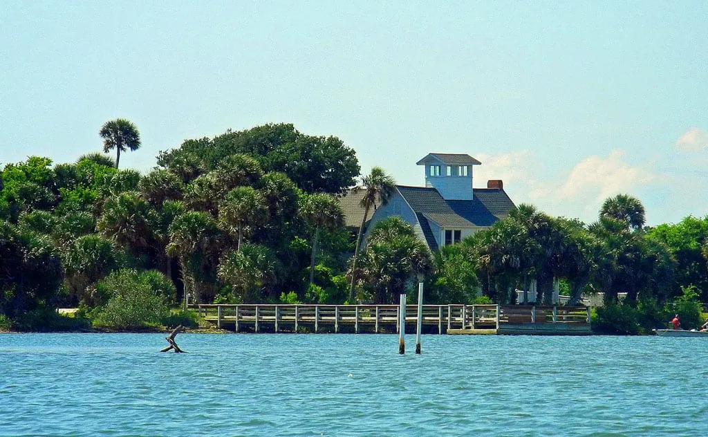
The Eldora Loop Road takes you back through subtropical tree hammocks to Eldora, once a small agricultural community on the Indian River Lagoon where orange groves once thrived.
Only two of the town’s original buildings remain, including a home known as the “State House” that has been restored to serve as a museum showcasing the history of the area. The museum is only open on Friday, Saturday and Sunday.
There are a couple of small parking lots along the Eldora Road with access to trails and fishing in the lagoon.
Kayaking, paddleboards and canoeing at Canaveral National Seashore
A wonderland for paddlers, you can put in at several locations on the lagoon:
- Turtle Mound — Launch from the open picnic area behind the midden.
- Ranger Station — Canoes and kayaks can be rented here.
- Eldora Parking Lot No. 7 — This parking lot provides excellent access to the islands and fishing.
- Beach Parking Lot No. 5 — There is a hard-pack sand road that dips off the beach road on the west side of the dunes.
Fishing, clamming and oysters at Canaveral National Seashore
Surf fishing is almost a religion on the beaches of Canaveral National Seashore.
Anglers are out on the beaches at 6 a.m., when the park opens, casting their long rods into the surf or using their rakes to sift through the sand for the “sand fleas” they use as bait.
You can also buy sand fleas and live shrimp at the only bait shop in Bethune Beach, a mile or so before the park entrance.
Sand fleas are actually mole crabs that burrow into the sand under the trailing surf. Their burrows can be identified by bubbles as the waves roll in and out. When you see terns pecking along the surf line, they are pecking into those burrows.
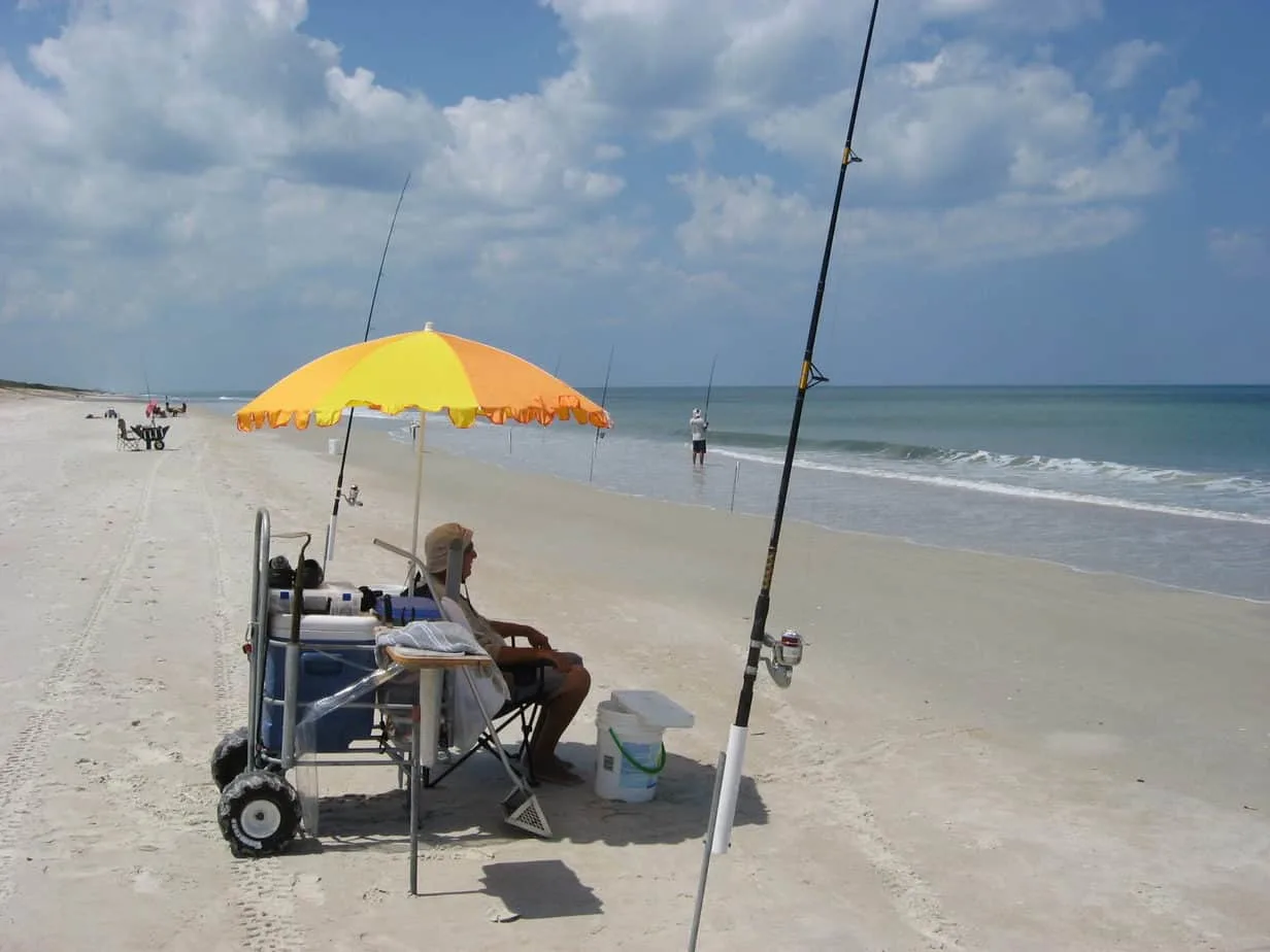
Surf anglers come well prepared to spend the day. Many have beach carts loaded with umbrellas, coolers, bait and tackle.
Read more: Surf fishing basics
Aside from surf fishing, there are several prime fishing areas in the lagoon that are accessible from the Eldora Road, including a fishing pier that juts out about a hundred yards over the lagoon.
Fly-fishers are often seen wading in this area, although I personally have not had much luck here. I find that paddling out from either Eldora or Turtle Mound will provide the best access to backcountry channels and oyster bars, where you will enjoy the company of tailing redfish.
Clam beds and oyster bars abound in the lagoon, and clamming is permitted in some areas. Leased beds are marked, and you should (must) avoid those areas. If you are in doubt, contact the Ranger Station for more information about permitted areas.
Related Article: Surf fishing: Family fun for your beach day
Hiking at Canaveral National Seashore
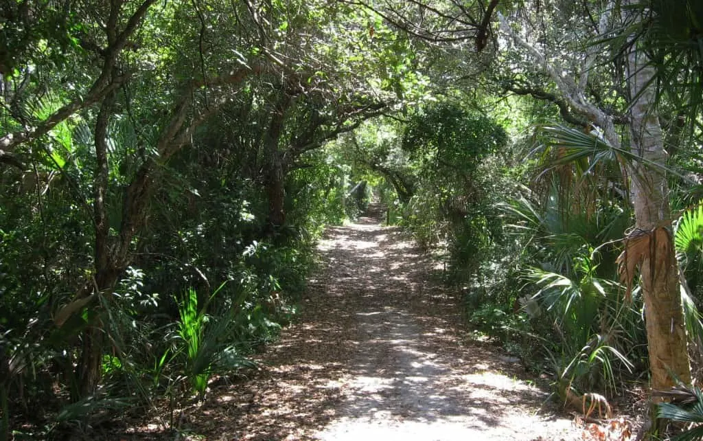
The two primary hiking trails are the Castle Windy Trail, across the road from Beach Parking Lot No. 4, and the Eldora Hammock Trail, on the Eldora Road. Both of these hikes are short and shaded, so you can hike here comfortably in summer.
There are unnamed trails at two Eldora Road parking lots that provide access to the lagoon for fishing and swimming.
Related Article: Castle Windy Trail
Backcountry camping at Canaveral National Seashore
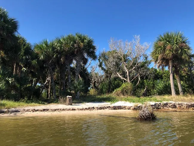
No RVs here.
There are 14 primitive tent sites on select islands in Mosquito Lagoon, accessible only by boat. Each has a picnic table and fire ring. Nothing else.
Bring the bug spray. It was named Mosquito Lagoon for good reason. Truth be told, the no-seeums here are worse than the mosquitos, and the mosquitos are abundant.
To camp on these islands, you must obtain a backcountry permit online from Recreation.gov. The permit fee is $20 per night.
Locals know the back country and camp for free on islands north of the park boundary.
There is a boat ramp near the entrance to the park that provides access for bigger boats, as well as kayaks and canoes. There are also boat ramps in Oak Hill and Edgewater on the mainland.
Most areas of the Indian River and Mosquito Lagoons are shallow flats with deeper channels snaking between islands, requiring boaters to be on constant alert for oyster bars, coral outcrops and shoals.
Local knowledge, or at least a nautical chart and depth-finder, as well as a keen eye, are highly recommended for motorboats. Oyster bars are everywhere, and the tidal flow varies significantly throughout the lagoon.
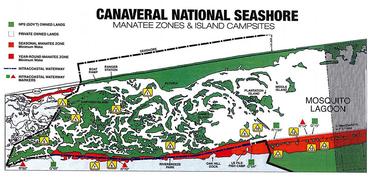
Map Key: Mosquito Lagoon Boat-In Camp Sites with GPS (Permit required)
- Site 1: Orange Island — N 28 54′ 46.6″ W 80 49′ 45.6″
- Site 2: Homes1ead Island — N 28 54′ 59.0″ W 80 50′ 17.2″
- Site 3: Shipyard — N 28 56′ 27.3″ W 80 50′ 41.3″
- Site 4: Headwinds — N 28 56′ 16.6″ W 80 50′ 41 .5″
- Site 5: Government Cut — N 28 57′ 02.3″ W 80 51′ 52.0″
- Site 6: Jones Canal — N 28 55′ 08.2″ W 80 51′ 32.6″
- Site 7: Brickhouse Cove — N 28 54′ 55.7″ W 80 51′ 25.6″
- Site 8: Bissette Bay — N 28 53′ 39.7″ W 80 50′ 49.6″ 1
- Site 9: Middle Dredge — N 28 51′ 58.3″ W 80 49′ 35.8″
- Site 10: South Middle Dredge — N 28 51′ 51 .0″ W 80 49′ 29.0″
- Site 11: Scout Island. — N 28 51′ 30.1″ W 80 49′ 35.6″
- Site 12: South Dredge — N 28 51′ 30.1″ W 80 49′ 35.6″
- Site 13: East Winds — N 28 50′ 41.3″ W 80 49′ 05.4″
- Site 14: County Line — N 28 50′ 26.9″ W 80 48′ 56.4″
Related Information: Backcountry camping at Canaveral National Seashore
South Entrance via Titusville
Playalinda Beach was heavily damaged by Hurricane Nicole and remained closed as of Nov. 22, 2022. Go here for updates.
The South District tends to draw more people, largely because of its proximity to the Kennedy Space Center and the Merritt Island Wildlife Refuge. Throw in a popular nude beach, and there you have it.
You have to drive through the refuge on State Road 402 to get the beach entrance.
Canaveral National Seashore and Merritt Island National Wildlife Refuge provide a wilderness buffer around the north border of the secure Kennedy Space Center, which still functions as a venue for frequent rocket launches even though the shuttle program has come to an end.
Once you pass the south entrance station, you have four miles of beach road with parking lots similar to those along Apollo Beach in the North District.
However, don’t expect to drive north to the North District!
There is a 10-mile stretch of “back country” beach, known as Klondike Beach, that strings out along a thin ribbon of barrier island that has been left untouched. No roads.
If you wish to hike or camp on Klondike, you will need a backcountry permit, which you can obtain at the entrance Ranger Station.
There are 13 beach parking lots along the four-mile beach road serving Playalinda, and if you don’t find parking at one beach, you will almost surely find a spot somewhere.
- Lot No. 1 — Has nearly 80 parking spots, but keep in mind that it’s the closest to the entrance is will likely fill up faster than the others further up the road.
- Lot Nos. 8, 10, 11 & 12 — These lots provide handicap beach access.
- Lot No. 13 — The last lot is at the end of the road, and you’ll see a radar complex that monitors launches from Kennedy Space Center. Lot 13 also serves Playalinda’s clothing optional beach.
Is Playalinda Beach clothing optional?
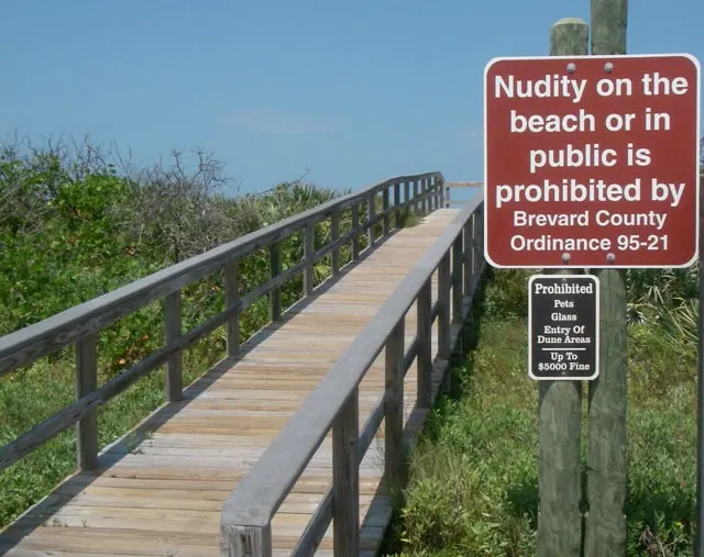
You will see several signs along Playalinda’s Beach Road warning that “Nudity on the beach or in public is prohibited by law.”
Here’s the catch: Public nudity is against the law in Brevard County, but there are no restrictions north of the Volusia County line within Canaveral National Seashore.
Playalinda Beach straddles the border of both counties, so sunbathers who wish to shed their clothes need only drive out to Lot No. 13 — into Volusia County.
Fair warning: Nude sunbathers on Playalinda are not as discreet as they are on Apollo Beach. If you are offended, stay south of the Volusia-Brevard county line, which is clearly marked.
Related Article: Playalinda Beach by the BeachHunter
Contact Information for Canaveral National Seashore:
- Park Headquarters (Titusville): (321) 267-1110
- Apollo Beach Visitor Center: (386) 428-3384
- For island camping reservations, call the Visitor Center at (386) 428-3384, Ext. 0
Articles related to Canaveral National Seashore
- Castle Windy Trail
- Bioluminescence kayak tours: Eerie glow at night on Mosquito Lagoon
- Explore this outpost on Mosquito Lagoon for Goodrich seafood, historic site at Seminole Rest, good to place to launch a kayak or fish
- Merritt Island National Wildlife Refuge: Birds and beauty galore
- Driving on the beach near Canaveral Seashore
- JB’s Fish Camp for fresh seafood, Old Florida ambiance
- Free days at national parks
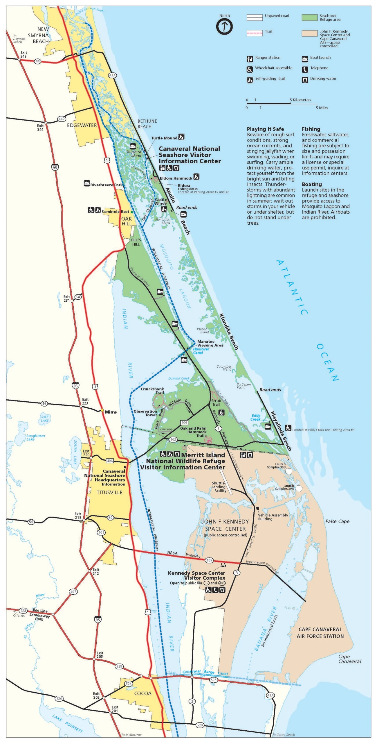
Full Size Map Canaveral National Seashore, including Merritt Island National Wildlife Refuge
Read More about the Merritt Island National Wildlife Refuge

Bob Rountree is a beach bum, angler and camper who has explored Florida for decades. No adventure is complete without a scenic paddle trail or unpaved road to nowhere. Bob co-founded FloridaRambler.com with fellow journalist Bonnie Gross 14 years ago.

Juan
Sunday 26th of March 2023
Would I be allowed to ride my bicycle (non-motorized) on the Klondike Trail/Beach from Apollo Beach to Playalinda Beach and back?
Bob Rountree
Monday 27th of March 2023
No way. It's hard enough to hike the trail through the soft sand.
Gary Cole
Saturday 13th of July 2019
If the scooters are recreational, they will not be allowed for sure. This is a very special protected place. I'd be happy to report you:-) I too have never seen anything motorized apart from the authorized service vehicles. Rangers on 4-wheelers patrolling occasionally and responding to emergencies.