Other than being famous for bass fishing, you hear about Lake Okeechobee for three reasons: Its water level is too high, the water level is too low or the water is teeming with toxic blue-green algae.
Of course, you can’t help but be curious about Lake O – it’s so big; at more than 730 square miles, it’s the second largest fresh water lake in the United States.

If I hadn’t seen it from the air, I might doubt its existence because every time I’ve stopped on a drive and trekked up to the top of dike for a view, all I saw was grassy vegetation. (The dike on the west side of the lake overlooks large areas of land and marsh rather than open water.)
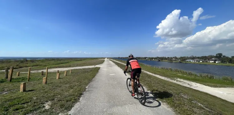
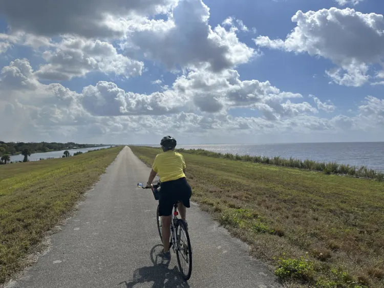
Bicycling one of the more scenic sections of the Lake Okeechobee Scenic Trail (LOST), however, I finally got a view of big famous lake, and it was beautiful. And if you’re an avid cyclist, the type who wants to ride fast and far without crossing a road, the Lake Okeechobee Scenic Trail is beautiful too.
Like the lake itself, the Lake Okeechobee Scenic Trail is big. It’s a 110-mile loop located atop the 35-foot-high Herbert Hoover Dike encircling the lake. More than half of it is an eight-foot-wide paved pathway, ideal for bicycling. The rest is two-track gravel roadway, better for hiking and mountain bikes.
Why isn’t it better known?
Many sections of LOST have been closed on and off for years for a $1.5 billion project to rebuild the dike. Finally, in January 2023, that project was completed and the trail is again open around the lake for bikers, hikers and rollerbladers.
Bicycling the Lake Okeechobee Scenic Trail
So does LOST live up to its potential?
This is an amazing bike trail, BUT it’s mostly terrific for the fast-and-far bicyclist.
You can summarize the pros and cons this way:
- No glass.
- No litter.
- No street crossings.
- No traffic.
- No hills.
- No trees.
- No shade.
- No bathrooms.
- No people. (Well actually some, but very few)
I’m not the sort of bicyclist who racks up the miles going 20 miles per hour. I’m the one you pass if you’re doing that. I like to stop and admire the scenery, take some pictures and get out binoculars to see birds along the way.
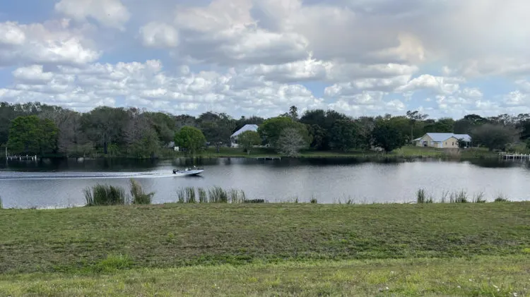
But my husband and I quite enjoyed LOST on this, our third try at biking the trail over the years. This time, we rode north from the Port Mayaca Trailhead, which is about 20 minutes west of Indiantown. Here, the trail runs right along the shoreline of Lake Okeechobee with big views of the blue water and the fabulous Florida sky the whole way.
Previously, without doing any research, we had ridden a section where the lake can be as much as a mile away from the trail. I recall I was not impressed with the scenery, which got boring pretty quickly.
A few years ago, we also tried a section west of the town of Okeechobee. It was scenic but it was an extremely windy day, which caused us to keep the ride very short. (Wind is an issue and something to consider when planning a LOST ride.)
Things to like about the Lake Okeechobee Scenic Trail
This time, we had a perfect sunny 82-degree February day with some wind, but not enough to be an issue. We saw one other person on the trail, an avid cyclist visiting from New Hampshire with whom we chatted after he’d ridden 17 miles of his planned 70-mile round trip. He was thrilled about the quality of the trail for his long ride.
Me? I was thrilled by the views, the birds, the novelty of exploring a new trail and the opportunity to watch boats go through the locks.
At Port Mayaca, there were several fishermen around and, like them, we parked our cars up on the dike berm. (At other starting points, you have to park on the other side of the canal and bring you bikes up to the top of the dike.)
Shortly after starting our ride at Port Mayaca, I had to stop and gaze through binoculars at half dozen big white birds out on the lake – white pelicans! Then there were at least a hundred scaups in clusters on the lake. Such striking birds; the males have black heads and white backs. You could see them without binoculars, but at quite a distance.
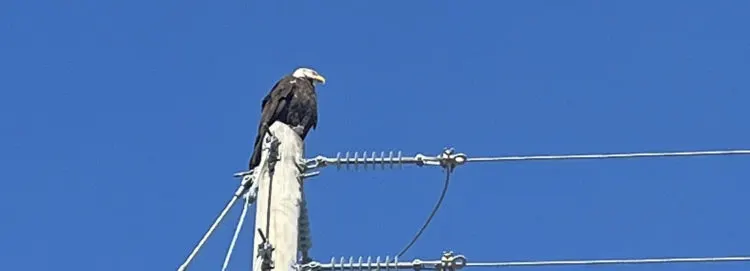
The most amazing bird, though, was at the Nubbins Slough Trailhead, where an American Eagle was perched atop a utility pole in the parking lot!
As you pedal any section of LOST, you’ll have a canal adjacent to the trail on one side, which often attracts great blue heron, wading birds and where you might see alligators. (The canal is where the dirt came from to build the dike.)
Development across that canal varies. On a section we rode north of Port Mayaca, there were large private homes, which were interesting to view. On a shorter section we rode closer to Okeechobee, the view was of RV and trailer parks. In some areas, you see sugar cane and cattle.
There are several locks allowing boats to enter and leave Lake O and we stopped for 15 minutes at one, at the Henry Creek Trailhead 17 miles north of Port Mayaca. We watched with interest as the water level was raised and lowered inside the lock when a boat was inside.
Designated as part of the Florida National Scenic Trail in 1993, a key advantage to LOST is its height. Being 35 feet above the lake and adjacent land gives you great views. But the scenery really doesn’t change much mile after mile.
So is Lake Okeechobee Scenic Trail one of my favorite Florida trails? I enjoyed exploring it, but it’s not ideal for my kind of ride. I do think, however, that there are riders for whom this is the trail they’ve been looking for.
Tips for riding the Lake Okeechobee State Trail
Take a good look at the LOST map and plan your route. (Note: Google maps says the Henry Creek Trail head is “permanently closed.” But it was not closed when we visited. It’s a fine place to start your ride.)
We liked the section of the trail around the northeastern quadrant of the lake. We checked out the trailheads at Port Mayaca, Chancy Bay Creek, Henry Creek and Nubbins Slough and all would make good starting points. From Port Mayaca, you will want to head north as the section south of there is unpaved. It’s 26.3 miles between Port Mayaca to the end of the paved section at the Kissimmee River a few miles past Okeechobee.
The other long paved section is between Moore Haven and Pahokee, where you can ride 38 miles on paved trail. I’ve read bloggers who say they think the prettiest section is Clewiston to Moore Haven.
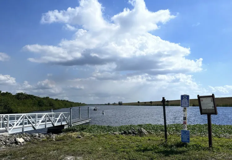
Come with an empty bladder and be prepared to rough it. The lack of restrooms is one of the serious flaws in the Lake Okeechobee Scenic Trail. None are provided, so it’s go-in-the-bushes for most of the trail.
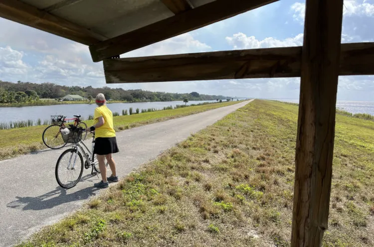
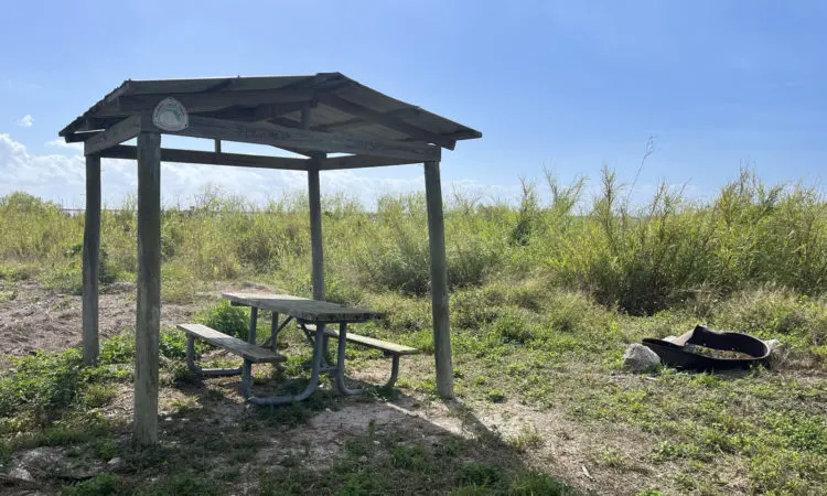
The other flaw is the complete lack of trees. This trail is all sun all the time. About every two miles there is a small covered bench where you can stop for a break, but you should slather on sunscreen, ride early in the morning or at sunset and avoid this trail during Florida’s hot months.
If you’re serious about experiencing the trail, there are 14 sites designated as campsites along the trail. We checked out two of them, and primitive they are. Basically, you get a picnic table and a fire ring. There are no trees sheltering the campsites either. (I understand there were some, but non-native trees were removed.) Restrooms? The bushes again.
LOST-map-508Useful info for planning your ride on the Lake Okeechobee Scenic Trail
- US Army Corps of Engineers page on trail
- Another good Army Corps map with details on access areas
- See more opinions on the trail at Traillink.
Be aware, you are quite isolated on this trail. You won’t pass many people. You can only enter and exit it at the trailheads, as there is a wide canal between the trail and any roads and development. So if you have a problem, you might have to travel several miles to get help. Bring plenty of water, some snacks, sun screen and a well-charged cell phone. Because of its remoteness, wear your bike helmet even though you don’t have to worry about traffic. This is not the place to fall and crack your head.
Be sure you have a good weather forecast and take lightning very seriously. If there is lightning, do not stay at the top of the berm, where you are the highest spot in the landscape.
There are markers in the pavement noting each mile as your ride.
FAQS on Lake Okeechobee
What does Okeechobee mean? Lake Okeechobee means “big water” in the Seminole Indian language
How deep is Lake Okeechobee? It’s big but shallow. The water level is carefully managed, maintained within three or five feet of its 15 foot average. Here’s today’s level.
Will you see alligators along the trail? We did not, although I am certain they are present, especially in the canals.
Why is there a dike around Lake Okeechobee? The main purpose of the dike is to prevent flooding. In 1928, water from a hurricane overfilled the lake and broke through the crude embankments of the day. Some 2,000 people in Pahokee, Belle Glade, South Bay, and Lake Harbor drowned in the flood that brought a 20 foot wall of water over the area. As a result, the U. S. Army Corps of Engineers constructed the levees between 1932 and 1938. Background from the Army Corps.
More bike trails
Here’s a Florida Rambler guide to 23 top bike trails in Florida. The closest trails to the Lake Okeechobee Scenic Trail are the Lake Trail in Palm Beach, Riverbend Park in Jupiter and Beach Road on Jupiter Island,

The author, Bonnie Gross, travels with her husband David Blasco, discovering off-the-beaten path places to hike, kayak, bike, swim and explore. Florida Rambler was founded in 2010 by Bonnie and fellow journalist Bob Rountree, two long-time Florida residents who have spent decades exploring the Florida outdoors. Their articles have been published in the Sun Sentinel, the Miami Herald, the Orlando Sentinel, The Guardian and Visit Florida.

Denise
Saturday 30th of December 2023
Thank you for this information, so usefull.
Nancy Bryson
Wednesday 1st of March 2023
Thank you for this very helpful description of LOST and especially the pros and cons for cyclists.