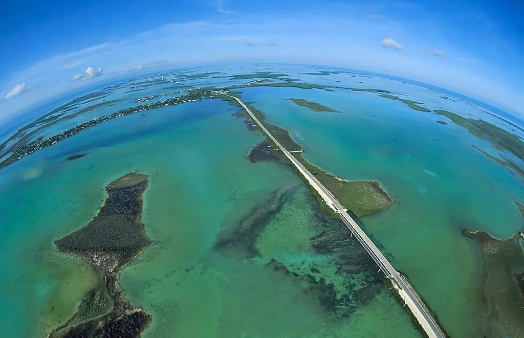
The scenic Overseas Highway is the spine of the Florida Keys, the lifeblood of a 113-mile chain of islands to which 3 million visitors flock every year.
From its start in Florida City through Key Largo, Islamorada and Marathon, across the 7 Mile Bridge into the picturesque Lower Keys and Key West, the Florida Keys Overseas Highway is one of the most scenic highways in America.
Our Florida Keys Mile-Marker Guide is your travel companion across these islands with notes on things to do, historic points of interest, tiki bars, restaurants and more.
Copyright © 2024 Florida Rambler Media. All rights reserved.
The Overseas Highway
The Overseas Highway was built on the rail bed of Henry Flagler’s Overseas Railroad, built in 1912. The railroad served the Keys until 1935 when it was partially destroyed by a hurricane. The state of Florida purchased the right-of-way and built the highway using the narrow-gauge railroad trestles as a roadbed. Those bridges were replaced with modern spans in the 1980s.
MM 127 — You are leaving Florida City, Gateway to the Keys, for a 20-mile southbound crossing of Everglades wilderness. Two lanes; wait for passing zones.
Mile Marker 126.5 — Card Sound Road
Branches left (east) off U.S. 1 to North Key Largo across the Card Sound Bridge (toll). Merges back to U.S. 1 at Mile Marker 106.
- Alabama Jack’s, a funky outdoor restaurant and dockside bar, just before the Card Sound Bridge.
- Ocean Reef Club (Private) and the Key Largo Anglers Club (Private)
- Crocodile Lake National Wildlife Refuge
- Crocodile Lake Community Butterfly Garden
- Key Largo Hammock Botanical State Park
Read More: Alabama Jack’s: Classic start to the Florida Keys
MM 112.5 — Monroe County Line.
MM 110.8 — KAYAK — Little Blackwater Sound Boat Ramp, bayside.
MM 108.5 — Gilbert’s Resort. Classic Keys pit stop with the largest waterfront tiki bar in the Keys. Watch for the off-ramp just before the Jewfish Creek Bridge.
Read more: Florida Rambler story about Gilbert’s
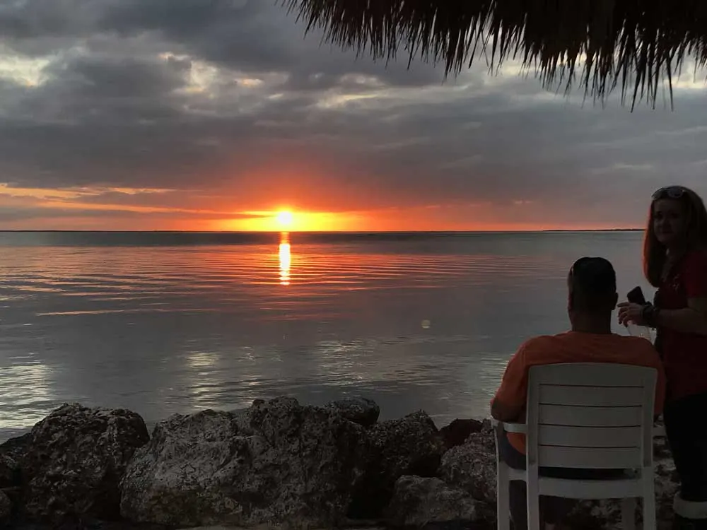
MM 108 — Jewfish Creek Bridge crosses the Intracoastal Waterway, the inside passage for boaters going to the Florida Keys from Biscayne Bay.
MM 107.5 — Lake Surprise. Named after an unexpected encounter by workers building Henry Flagler’s Florida East Coast Railway. The lake had not appeared on surveys. When crews tried to build a causeway, the fill material was swallowed by the lake. (Credit: FloridaMemory.com)
Key Largo — Mile Marker 107
“Dive Capitol of the World”
MM 106 — Buzzard’s Roost, Oceanside. Dockside bar off U.S. 1 in the Garden Cove Marina, 21 Garden Cove Drive, Key Largo.
MM 106 — DIVE — Silent World Dive Center, Garden Cove Marina, 51 Garden Cove Dr.
MM 106.0 — Key Largo Chamber of Commerce, bayside. Rest rooms, brochures, maps and discount coupons.
MM 106 – Key Largo Hammock Botanical State Park
Turn sharp left at Mile Marker 106 and go north a half-mile. Park features one of the largest tracts of West Indian tropical hardwood hammock in the U.S. and home to 84 protected species of plants and animals, including wild cotton, mahogany mistletoe, and the American crocodile. Most of the park’s six miles of trails are accessible to hikers and bicycles, including a wheel-chair accessible self-guided nature trail. Day use: $2.50 per person. Dagny Johnson Key Largo Hammocks Botanical State Park, County Road 905, Key Largo FL 33037. Phone: 305-676-3777.
Read More: Florida Keys state parks: 11 remarkable parks (with insider tips)
MM 105.6— Railroad depot and Key Largo town center from 1910 to 1940. The depot was in the highway median. The community was bayside.
MM 105.3 — Winn Dixie Supermarket.
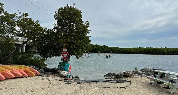
MM 104.5 — KAYAK— Florida Bay Outfitters. Small fee to launch. The friendly folks here will give you advice on kayak routes and rent kayaks, paddle boards.
MM 104.5 — Rowell’s Waterfront Park Kayak
This former marina is now a countypark with a swimming hole, kayak launch, picnic tables and restrooms.
Read more about Rowell’s Waterfront Park.
MM 104.3 — Amy Slate’s Amoray Dive Resort (Bayside)
MM 104.2 — Keys Palms RV Resort (Bayside)
MM 104.1 — Caribbean Club in Key Largo (Bayside) Its exterior was used in the classic Humphrey Bogart film “Key Largo,” which inspired the community to change its name. This dive bar is plastered with movie memorabilia.
Read more about Humphrey Bogart in Key Largo.
MM 104 — Jimmy Johnson’s Big Chill (Bayside) Sports bar and restaurant. Owned by the former football coach and Fox NFL commentator, who lives down the road.
MM 104 — Key Largo Bay Marriott Beach Resort.
MM 103.9 — Senor Frijoles and Sundowners, bayfront restaurants overlooking Blackwater Sound.
MM 103.8 — DIVE — Pirates Cove Watersports. Diving, snorkeling paddleboards, kayaks.
MM 103.6 — DIVE — Quiescence Diving Services
MM 103.5 — The 1920s Key Largo Rock Castle, end of Oceana Drive, ocean side.
MM 103.5 — RV. King’s Kamp RV Park, Oceanside. Private campground with many waterfront sites. Packed in winter, but OK the rest of the year. Shaded tent sites along north fence.
MM 103.4 — Marvin Adams Waterway Bridge (The Cut), a canal that connects Atlantic to Florida Bay
MM 102.5 — Lazy Lobster. Popular Keys restaurant across from Pennekamp State Park.
Mile Marker 102.5 — Pennekamp Coral Reef State Park
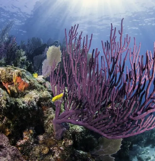
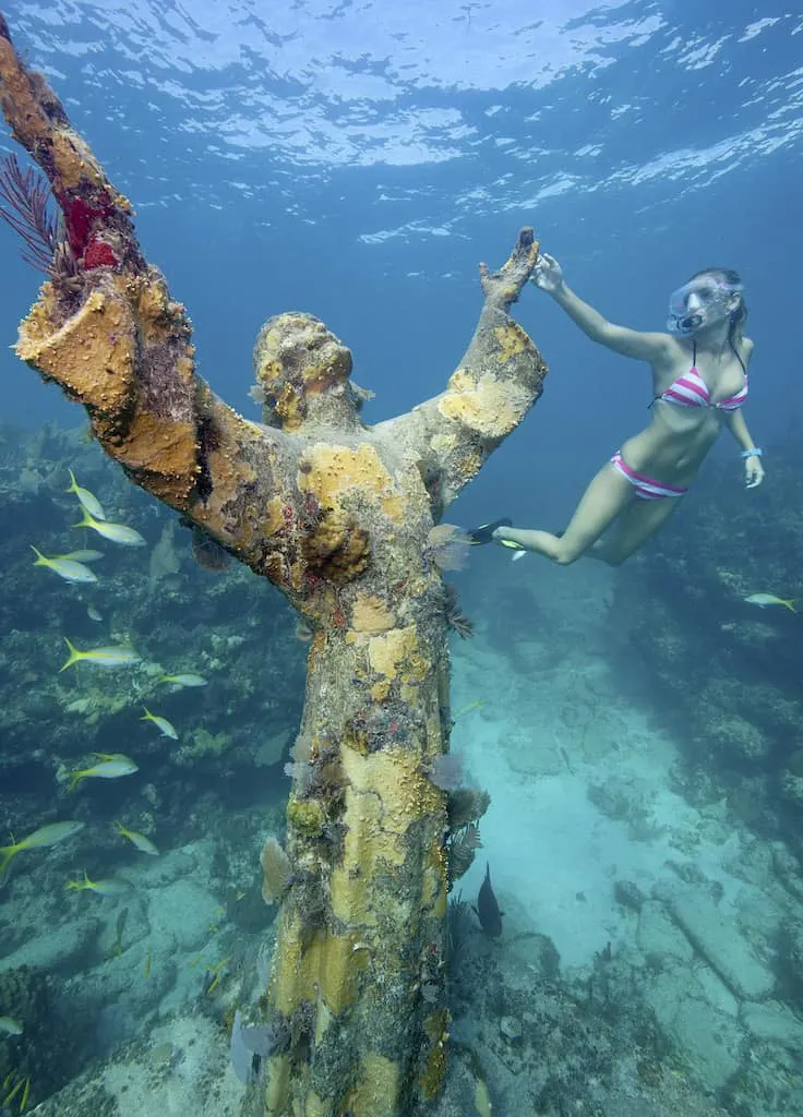
Life on Key Largo revolves around scuba diving and snorkeling on the coral reefs in this 21 mile-long underwater park. The park has two beaches, a marina, glass-bottom tour boats, dive/snorkel tours, boat ramp, kayak trails, and a campground.
Read More: John Pennekamp Coral Reef State Park: Snorkel, dive, camp, kayak
MM 102.4 — The Fish House and Fish House Encore Restaurants. Popular restaurants serving fresh Keys seafood. | TripAdvisor reviews
MM 102 — Peace Park (Bayside), behind the Key Largo government center. Covered picnic tables, restrooms. Transient boaters shelter offshore.
MM 101.7 — Hobo’s Cafe. Oceanside. Long one of Bob’s favorites. Good food at moderate prices. | TripAdvisor reviews
MM 101.7 — Largo Resort.
MM 101.5 — RV — Key Largo Kampground and Marina, at the end of Sampson Road.
MM 101.5 – – RV – Calusa Campground and Marina, bayside at 325 Calusa St.
MM 101.4 — Tradewinds Plaza (Oceanside) Shopping center partially hidden by a wall of trees. Publix Supermarket.
MM 101.3 — Friendship Park (Oceanside) Playground, picnic tables, ball field, basketball courts. This was once the center of the 1880s community of Newport.
MM 100.8 — DIVE — Rainbow Reef Dive Center
MM 100.6 — DIVE — Key Largo Dive Center.
MM 100.6 — Tower of Pizza Key Largo.
MM 100.5 — Key Largo Chocolates. Key Lime Pie on a stick, chocolate treats.
MM 100.2 — Key Largo Conch House.
MM 100.0 — Marina Del Mar Resort and Marina.
Mile Marker 99.7 — The African Queen
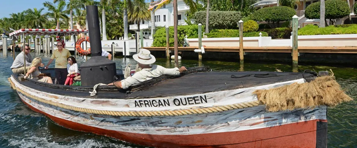
The original African Queen from the film classic starring Humphrey Bogart and Katherine Hepburn. The 100-year-old steamboat is docked at the Holiday Inn. Take a 90-minute cruise or 2-hour dinner trip. Phone: 305-451-8080.
Read More: Key Largo: African Queen boat is for Bogart fans
MM 99.7 — Holiday Inn Key Largo. Book your excursion on the African Queen or the Key Largo Princess glass-bottom boat in the hotel’s gift shop. Check out the waterfall and tiki bar at the hotel swimming pool.
MM 99.6. Follow Caribbean Drive to Skippers Dockside, popular restaurant/bar at 528 Caribbean Drive; Sharkey’s Pub and Galley, 522 Caribbean Drive. Multi-level outdoor decks overlooking waterway. View the African Queen cruise past.
Read more: Best tiki bars in the Keys
MM 99.5 — DIVE — Divers Direct. Mega-store for divers, snorkelers, and other water sports. In this shopping plaza, you will also find a Thai restaurant, Office Depot, Walgreens, and Bank of America
Mile Marker 99.4 — Port Largo
Key Largo Traffic Light before the highway spilts
East at the light onto Atlantic, then an immediate right onto Homestead, then left on Ocean Bay Drive to seek out these hidden treasures:
- American Legion, 2 Seagate Blvd Large, shady outdoor seating with an entertainment stage. This place rocks on weekends. Open to the public. Profits benefit veterans’ causes. Phone: 305-451-0307 | TripAdvisor reviews
- Pilot House Marina and Restaurant, 13 Seagate Blvd, Key Largo. Glass bottom bar over water.
- Key Largo Fisheries, 1313 Ocean Bay Drive. Wholesale and retail fish house with stone crabs and Florida lobster (in season), local shrimp, fresh-caught snapper and mahi-mahi. Best seafood market in the Keys. | TripAdvisor reviews
MM 99.4 — Bayside Grille and Sunset Bar (Bayside) Hideaway bar (downstairs) and restaurant (upstairs), behind DiGiorgio’s Cafe Largo overlooking Florida Bay.
MM 99.3 — Mrs. Mac’s Kitchen, (Southbound lanes) Iconic roadside eatery for breakfast and lunch. Check out their fish and grits.
MM 99.0 — Mrs. Mac’s Kitchen II. An extension of the original in the median, accessible from both southbound and northbound lanes. Lunch and dinner only.
MM 98.3 — Reef Environmental Education Foundation (REEF). Nature center about ocean conservation. REEF HQ is an historic conch house, the oldest building in the upper Florida Keys still in its original location.
MM 98.0 — Landings of Largo, Bayside; Moose Lodge, Oceanside; Everglades Park Ranger Station, Bayside. 1st Baptist Church, Oceanside; Rock Harbor Club, Bayside.
MM 98.0 — Shell World. In the center median.
MM 97.8 — Kona Kai Resort, Gallery & Botanic Gardens, cottages set amidst a botanic garden on Florida Bay.
MM 97.8 — Ballyhoo’s Seafood Grill. Oceanside. Dine at a historic conch house built in the 1930s. TripAdvisor
MM 97.5 — RV — Blue Fin Rock Harbor Marina & RV Park. Full hookups. 36 sites. Reviews on TripAdvisor
MM 95 to 100 — Historic community of Rock Harbor. The name was changed to Key Largo after the the Humphrey Bogart-Lauren Bacall film of the same name.
MM 97.0 — Playa Largo Resort.
MM 95.8 — Harriette’s Diner. Legendary eatery for locals. Home cookin’.
MM 95.4 — The Drift Key Largo. Small bayfront lodging, an updated version of a classic Keys-style motel.
MM 95.3 — KAYAK — Sunset Road to Mike Forster Memorial Park, Bayside. Immediately past the Drift Motel, turn right from U.S. 1 onto Sunset Road to this 3-acre park w/boat ramp. No facilities, limited parking, great kayak launch.
MM 95.2 — Florida Keys National Marine Sanctuary headquarters, not a visitor center. The visitor center is Florida Keys Eco-Discovery Center, 35 Quay Road, Key West.
MM 94.5 — Snapper’s Restaurant, 139 Seaside Avenue. Popular waterfront restaurant with dockage. Peckerheads not allowed.
Tavernier — Mile Marker 94
“In early writings, the harbor between Tavernier Key and Key Largo is mentioned as a rendezvous area for Bahamian wreckers, offering a haven from Atlantic gales and a good view of the Upper Keys reefs. In the early 1820s, it is believed slaves were gathered on Key Tavernier to be smuggled into the Bahamas by wreckers, but this has never been documented. It was used, however, as a relay point for escaped slaves en route to the Bahamas.” — keyshistory.org
MM 93.6 — Florida Keys Wild Bird Center
Boardwalk through coastal mangroves at volunteer-run bird rehab facility with an informal backyard feel. The center is free, donations welcome. Open sunrise to sunset. Great stop for kids.
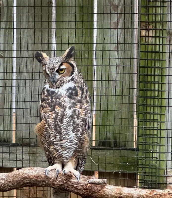
Read More: Wild Bird Center is worth a quick stop
92.6 — Kayak — Harry Harris Beach and Park oceanside. Pet-friendly park with groomed beach, picnic tables, picnic shelters, boat ramp, ball fields and a playground. Free admission weekdays. Monroe County residents free anytime. Non-residents: $8/person on Saturday, Sunday; $15 on holidays and lobster mini-season. Boat ramp fee for boats with trailers, $40. Incidentally, the early community of Planter was here.
Read More: Our 15 favorite beaches in the Florida Keys
92.3 — Italian Food Company Express, Bayside. Restaurant and Italian food market serving “Roma” style pizza, panini, salads and pasta dishes. Fresh Italian bread-to-go made in-house. Open for lunch and dinner, Mon-Sat. Recently opened (2023).
92.2 — Blond Giraffe Key Lime Pie Factory, bayside.
92.0 — KAYAK — Bottle Key Launch, Bayside. Tiny public kayak launch at the end of Jo-Jean Way. No parking at the launch. Limited residential street parking nearby.
92.0 — Ace Hardware. We like Ace for basic RV and camping gear and beach supplies.
91.9 — Old Tavernier Post office; Old Settlers Park, oceanside; historic Tavernier Hotel, oceanside. This was the center of the early community of Tavernier.
91.7 — Mangrove Marina Houseboat Rentals for unique overnight lodging, 200 Florida Ave., Tavernier. Bayside.
91.5 — Hospital — Baptist Health Mariner’s Hospital, Bayside.
91.2 — Tavernier Towne Shopping Center. Winn-Dixie Supermarket, CVS Pharmacy, multiple eateries, movie theater, liquor store, U.S. Post Office.
90.8 — Tavernier Creek Bridge; Tavernier Creek Marina, Plantation Marina. Bayside.
Plantation Key — Mile Marker 90.7
Agricultural community (coconuts and pineapples) inhabited by Bahamian immigrants until Henry Flagler’s railroad plowed through in the early 20th Century. During Prohibition, the island was dominated by bootleggers because of its proximity to the Bahamas.
90.6 — Creekside Inn, 90611 Old Highway, Tavernier. Waterfront motel rooms with dockage. Rates vary with the season. Clean rooms, courteous staff. Breakfast and lunch served dockside on premises. Walk along the dock to the Kayak and SUP launch and rentals by Paddle! in Casa Mar Village, which also includes a seafood market and Captain Slate’s Scuba Adventures.
90.5 — Angler Eddy’s Live Bait & Tackle, 90515 Old Highway.
90.4 — Florida Keys Dive Center
90.1 — Captain Craig’s Restaurant. Seafood.
90.1 — Plantation Key Colony community entrance, Bayside. Large Indian mound in the center of the subdivision.
89.0 — Enrico’s Pizza, 20 High Point Rd. @ U.S. 1, Tavernier, FL 33070. Phone: (305) 852-2200 — TripAdvisor Reviews
88.0 — Marker 88 Restaurant, bayside. A favorite of former President George H.W. Bush (No. 41). TripAdvisor Reviews
88.0 — M.E.A.T. Eatery and Taproom, oceanside. Burgers and beer milkshakes. Readers Digest says M.E.A.T has the best hamburgers in Florida.
87.7 — Twisted Shrimp. Shrimp dishes are the specialty. We liked the menu but disappointed with our overcooked coconut shrimp basket and undercooked breaded fried shrimp. More opinions in TripAdvisor Reviews.
MM 87 — Founders Park
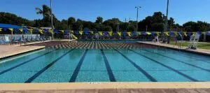
Large public park with beach, Olympic size pool, amphitheater, marina, boat ramps, baseball fields, tennis complex, pickleball, basketball court, fitness and walking trails, picnic areas, fishing jetty, skate park, kayak rentals. Non-resident entry fee: Adults $8; Youth (3-17)/Senior $5. ($15 adults for holidays)
MM 86.7 — Rain Barrel Artisan’s Village

Rain Barrel Artisan’s Village. It’s fun to browse the arts and crafts here. And everybody has to get their picture taken with Betsy, the giant lobster out front. This anatomically correct Florida lobster is 30 feet high and 40 feet long and was created by Marathon artist Richard Blaze three decades ago.
85.5 — Snake Creek Bridge; Coast Guard Station, gulfside. Enter Windley Key.
Islamorada — Mile Marker 85.3
“Sportfishing Capital of the World”
85.3 — Hog Heaven Bar & Grill. A popular sports bar and seafood eatery. You can’t miss the sign. The restaurant is tucked behind a building on the oceanside. A frequent stop for bikers and tourists.
84.9 — Windley Key Geological Site
Learn about the fossilized coral reef that underlies the Florida Keys. The park is an old quarry for rock used in building Flagler’s Overseas Railroad in the early 1900s. Visitors walk along 8-foot-high quarry walls to see cross sections of ancient coral. Windley Key State Fossil Reef Geological Site. Phone: 305-664-2540
84.8 — Coconut Cove Beach Resort and Marina. | TripAdvisor reviews
84.3 — Community of Quarry thrived during railroad construction.
84.2 — Theater of the Sea, since 1946, is the second oldest marine mammal attraction in the world. Its saltwater lagoon was originally a quarry. Live dolphin shows, exhibits, swimming, and various ways to interact with dolphins, sea lions, or rays.
84.2 — Pelican Cove Resort
84.2 — Postcard Inn Beach Resort and Marina (formerly Holiday Isle)
84 — KAYAK and KITEboarding. Whale Harbor Bridge. The bridge causeway is a popular launch for kayaks, paddleboards and kite-boarders.
MM 83.5 — Whale Harbor: Marina and Restaurants
- Wahoo’s Tiki Bar. Bar and restaurant with second-floor views of Whale Harbor.
- Whale Harbor Marina. Fishing charters; jet ski and paddle board rentals.
- Shuck ‘n’ Dive. Waterfront outdoor cafe serving Cajun cuisine.
- Whale Harbor Seafood Buffet. All you can eat for $40.
- The Sandbar. Open-air rooftop lounge with a fabulous view.
83.0 — Ziggie and Mad Dog’s. (Warning: Audio blasts when you click on the link.)
83.0 — History of Diving Museum. Museum collects, preserves, displays, and interprets artifacts, antiques, books, documents, photographs, and oral history relative to the History of Diving.
Read More: Things to do in Islamorada
82.5 — Square Grouper Bar and Grill. Spinoff of the original on Cudjoe Key.
82.2 — Sunset Inn Motel.
82.2. — Islamorada Beer Company, a craft brewery and tap room. (Included in our brewery tour of the Keys.)
82.1 — Islander Resort. Renovated resort with 114 rooms and cottages.
82.1 — Key Lantern Blue Fin Inn.
82.1 — Florida Keys History & Discovery Center. Learn about the fascinating history of the Keys.
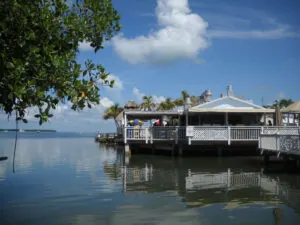
82 — Lorelei Restaurant and Cabana Bar. One of the most popular tiki bars in the Florida Keys. Look for the mermaid sign bayside.
81.8 — The Moorings. Beach Road, oceanside. Luxury cabins on palm-tree beach. Pricey but gorgeous. Netflix filmed scenes here for “Bloodlines.”
81.8 — Cheeca Lodge and Spa. Upscale lodging with private beach, newly renovated after Hurricane Irma.
81.6 — Bob’s Bunz Islamorada Restaurant & Bakery. Home of the “famous” Cinnamon Bunz and Sticky Bunz. Open 7 am-1 pm. TripAdvisor
MM 81.5 — Morada Way Arts & Cultural District
- Florida Keys Brewing Company Local craft brewery with a lovely garden.
- Morada Bay Beach Cafe. Waterfront cafe and bar.
- Hurricane Memorial. Monument remembers the devastating 1935 hurricane. Good place to explore the Morada Way Arts and Cultural District.
- Pasta Pantaleo Signature Gallery, 81599 Old Highway.
- Redbone Gallery, 200 Morada Way.
- Larabelle Boutique, 81641 Old Highway, Suite B
81.57 — Islamorada Moose Lodge
81.5 — Worldwide Sportsman. The temple of fishing, outdoor gear, boating accessories, clothing, bar, restaurant, fishing charters. A full size replica of Ernest Hemingway’s wooden fishing boat, the Pilar.
81.5 Islamorada Fish Company, popular seafood market, outdoor dining and sunset tiki bar, now part of Worldwide Sportsman.
81.3 — Green Turtle Inn. Iconic eatery dating to the 1940s. Popular port of call for “barstool sailors.” | TripAdvisor reviews.
81.0 — Kon Tiki Resort. Bay side
80.0 — Roadside park, Bayside
80.0 — Amara Cay Resort.
79.9 — Lazy Days Restaurant, ocean side. Excellent food, oceanfront patio. | TripAdvisor reviews
79.8 — Bud and Mary’s Marina. Drift fishing, charters.
79.1 — Tea Table Channel Bridge
78.5 — KAYAK. Indian Key Bridge.
MM 78.5 — Indian Key Causeway
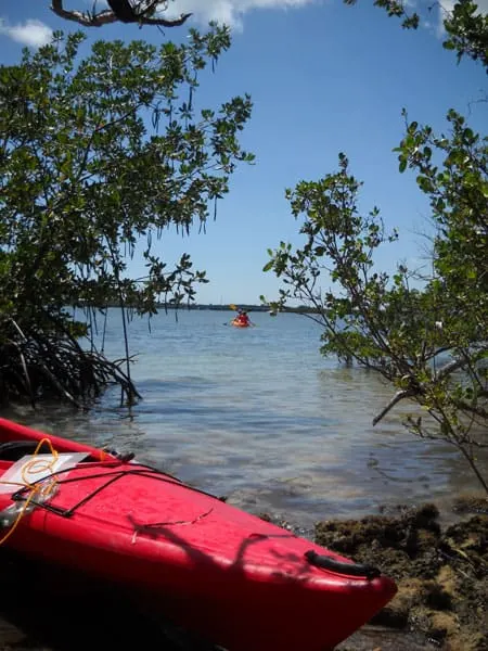
Kayak and SUP launches, swimming, fishing, access to 3 historical state parks.
- Lignumvitae Key Botanical Site, bayside, virgin tropical hardwood forest with a 1919 home with a windmill for electricity and a cistern for water. Accessible by boat.
- Indian Key Archaeological Site, oceanside. First county seat of Dade County (1836) and home to salvagers, now a ghost town. Accessible only by boat.
- San Pedro Underwater State Park, oceanside, underwater preserve features a submerged shipwreck from a Spanish fleet that ran aground in a 1733 hurricane.
Read More: Indian Key: Favorite Florida Keys kayak trail to historic island
77.9 —KAYAK — Lignumvitae Bridge.
MM 77.5 — Robbie’s Marina — Feed the Tarpon
Rent kayaks at the Kayak Shack. There’s a good restaurant overlooking the water, The Hungry Tarpon. We also love the key-lime-pie ice cream at Charli’s Shave Ice at Robbies.
Read more: Feed the tarpon at Robbie’s Marina.
MM 75.0 — Sea Oats Beach. Not much beach left after Hurricane Irma.
73.5 — Habanos Restaurant at Caloosa Cove. Cuban-influenced menu. Popular with locals.
73.5 — Caloosa Cove Resort and Marina. Hardware store, fishing charters, restaurant, hotel.
73.6 — Boy Scouts Sea Base, bayside — Former camp for WW-I veterans. Many died in the 1935 hurricane.
MM 73.4 — Anne’s Beach
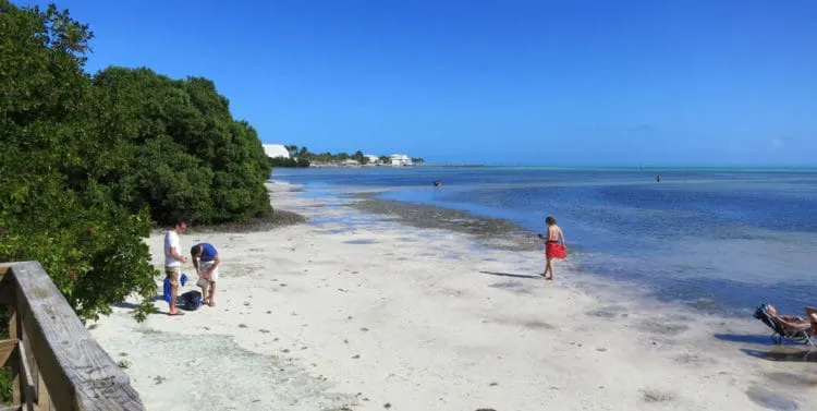
A favorite stop for wading along the beach and picnicking on the boardwalk at the southern end of Lower Matecumbe Key. Free access. The water is very shallow and waders venture hundreds of yards.
Read more: Anne’s Beach worth a stop
73.0 — Channel 2 Bridge. Offshore on the bayside are the remains of bridge pilings built by WW I veterans. Parking. Walk out on the old bridge, now a fishing pier and bike trail.
71.8 — Craig Key. Originally named Camp Panama. President Herbert Hoover sailed his yacht out of Craig in the 1930s. Landfall of 1935 Labor Day Hurricane.
71.0 — Channel 5 Bridge. Considered by locals to offer the best bridge fishing in the Keys. Mangrove snapper, yellowtail snapper, grouper, amberjack, tarpon are abundant.
The Middle Keys — Mile Marker 70
The Middle Keys encompass 13 islands in the Florida Keys, from Long Key to the Seven Mile Bridge, including Marathon, and boasting some of the best deep-sea, reef, and flats fishing in the Keys.
Read this article: Things to do in Marathon
70.0 — RV — Fiesta Key RV Resort. Very nice RV park with waterfront cottages and guest rooms, beach bar, boat launch and dockage. Swimming pool. General store on premises.
MM 67.5 — Long Key State Park
Once-popular oceanfront campground wiped out by Hurricane Irma, and restoration efforts were stymied by subsequent storms. The day-use area remains popular for picnics, swimming, kayaking, and fishing. Limited primitive camping on back-country trails.
Read More: Long Key State Park: Florida Keys gem but camping limited
66.5 —KAYAK Pullover on the bay side. Drop your kayak over a low sea wall.
65.8 — Henry Flagler’s Long Key Fishing Camp, visited by presidents Theodore Roosevelt and Herbert Hoover. Author Zane Grey spent 14 winter seasons here fishing and writing. The fish camp no longer exists, replaced by residential housing.
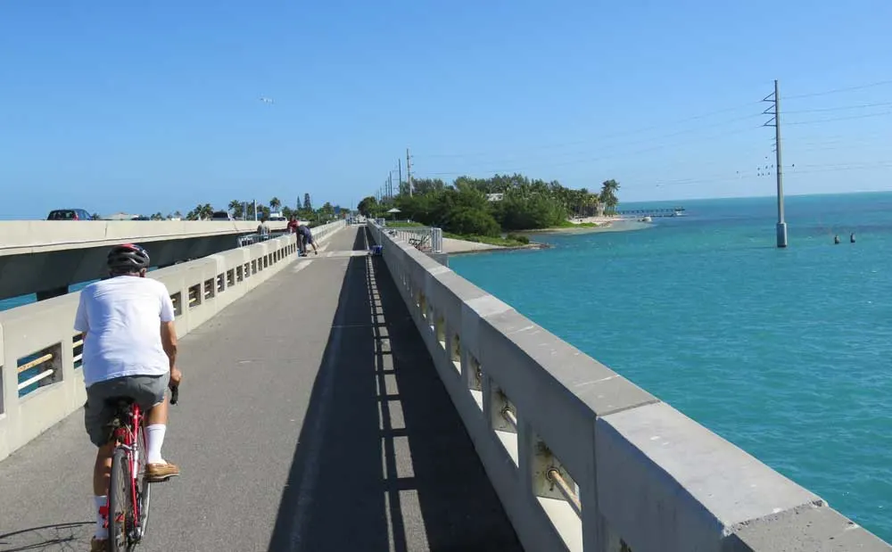
65.0 — Long Key Bridge, the second-longest bridge (3 miles) of Flagler’s railroad. The old bridge parallels the new one and has been resurfaced for bicycles, hikers and anglers. Considered one of the best fishing bridges in the Keys.
Read this article: Florida Keys Overseas Heritage Trail
62.2 — Walker’s Island (Little Conch Key)
61.2 — Tom’s Harbor Cut Bridge
61.1 — Hawk’s Cay Resort, Duck Key, luxury resort oceanside with swim-with-dolphins in a lagoon.
60.6 —KAYAK Tom’s Harbor Channel Bridge. Oceanside launch and pullover. Good fishing!
59.9 — Marathon city limits
59.3 — RV — Jolly Roger Travel Park. Bayside.
59 — Dolphin Research Center, Bayside on Grassy Key. Nonprofit education facility. Rather than choreographed shows, trainers hold informative sessions as visitors view dolphins. Many ways to interact with dolphins are available for a fee.
58.7 — RV — Grassy Key RV Park & Resort
58.0 — Rainbow Bend Resort and the Hideaway Cafe.
MM 56 — Curry Hammock State Park
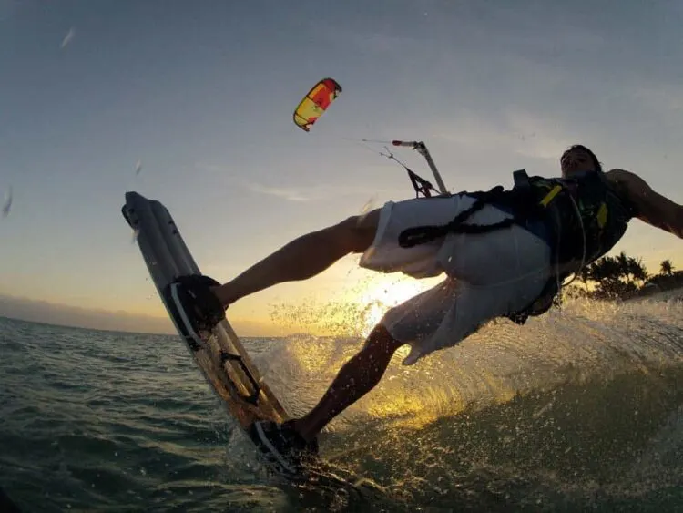
Curry Hammock is a popular destination for kayakers, paddle boards and kite-boarders, who cram the day-use area on windy weekends. The fabulous beachfront campground accommodates RV’s or tents.
Read more: Curry Hammock: Our new go-to campground in the Keys
55 – A 1.5 mile bayside nature trail, part of Curry Hammock State Park. Look for a roadside parking area a mile after the park entrance and walk back 300 yards to trail. Trail winds through a hardwood hammock to an overlook on Florida Bay. Uneven terrain — not for flip-flops.
54.5 — Kayak — Coco Plum Beach. Modest, quiet public beach on Coco Plum Drive. From the traffic light on U.S. 1, follow Coco Plum Drive a mile to the beach parking lot. Expect kite surfers on windy weekends. Launch your kayak here and paddle to trails in Curry Hammock State Park.
54 — Village of Key Colony Beach, Oceanside. Take Sadowski Causeway to the end and turn right on West Ocean Drive for the Key Colony Inn, one of the best restaurants in the Keys. Also on the causeway, Sparky’s Landing with indoor and outdoor seating.
Marathon — Mile Marker 53.5
Marathon is the heart of the Florida Keys, a bustling small city, fishing mecca and transient boating hub with waterfront restaurants, jet-ski tours, kayaking, paddle-boarding, snorkeling at Sombrero Light — or just cruising turquoise waters. Note that addresses coincide with numbered cross streets, not Mile Markers. We try to include both.
Read More: Marathon: Seagoing heart of the Florida Keys
53.5 — KAYAK Island Boat Ramp. Public boat ramp. Non-resident launch fee.
53.4 — The Island Fish Company Tiki Bar & Restaurant. Popular tiki bar and restaurant with sunset view.
53.1 — Vaca Cut Bridge. Busy waterway from ocean to Florida Bay.
53.0 — Marathon Lady Fishing Popular drift-fishing boat at the bridge.
53.0 — Florida Keys Aquarium Encounters. Bayside. Coral reef tank, shark tank, tarpon basin and a tide pool touch tank. Click on link for admission prices.
52.7 — Frank’s Grill. Low-profile Italian restaurant tucked into a small shopping center bay side. Very good. Reservations recommended. (305) 289-7772
52.7 — Triton Seafood (Ocean side) If you can’t get into Frank’s, cross the street.
52.5 — King Seafood Market and Restaurant. Ocean side.
52.0 — Marathon Airport, bayside.
51.1 — Wooden Spoon. Popular for breakfast. Tasty oversized biscuits!
51.0 — Brutus Seafood Market and Eatery. Highly recommended for its fresh seafood. | Tripadvisor reviews
50.5 — Crane Point Museum and Nature Center. Nature trail, butterfly gardens, 1904 house, historic artifacts. Kayak and paddle-board tours; tram tours.
50.5 — RV — Key by the Sea RV Park (Member-owned with transient sites). 305 743-5164
Mile Marker 50.0 — Sombrero Beach
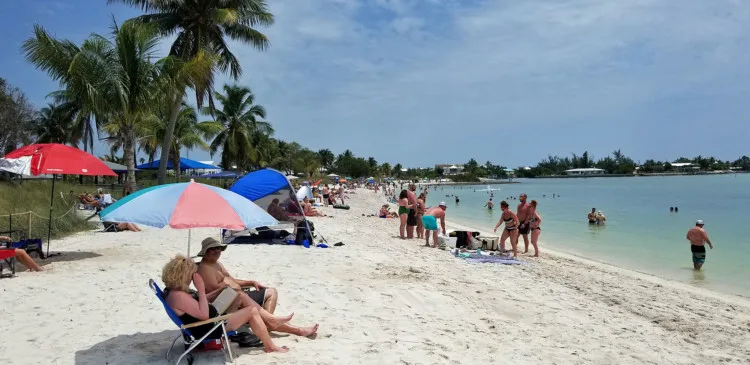
One of a few “real” beaches in the Keys. Turn south at the Publix Shopping Center and follow Sombrero Beach Road to the end. Plenty of parking. Beach has been fully restored since Hurricane Irma. Launch your kayak to the mangrove tunnels of Boot Key.
Read More: Our 15 favorite beaches in the Florida Keys
50.0 — Publix Supermarket, 5407 Overseas Highway @ Sombrero Beach Blvd.
50.0 — Kayak — 61st Street Gulfside runs through an indescript neighborhood, past the La Isla food truck, to the Gulf, where an unmarked hard-pack sand drive cuts to the right into an open lot with a small boat ramp.
50.0 — Skipjack Resort and Marina, 19 Sombrero Blvd..
49.5 — Cracked Conch Cafe. Ocean side.
49.4 — Tilden’s Dive Center | Tripadvisor Reviews
49.0 — Florida Keys Steak and Lobster House
49.0 — Overseas Pub and Grill. One of Marathon’s oldest landmarks (1937). “Coldest beer in town.”
49.0 — The Stuffed Pig. Favorite breakfast destination for its flaky, battered fish filets with your eggs.
49.0 — Keys Fisheries, 35th Street Gulfside. Funky eatery and seafood market right on the lobster and crab docks, surrounded by stacks of wooden traps and lobster boats. Perfectly Keysy.
48.7 — Hospital — Baptist Health Fisherman’s Community Hospital, 3301 Overseas Highway, Marathon. 305-743-5533
MM 48.5 — Turtle Hospital
Located in a former motel bayside, the Turtle Hospital rescues and rehabilitates injured sea turtles through admission paid by visitors.
48.3 — Faro Blanco Resort and Lighthouse Grill
48.0 — Chiki Tiki Bar at Burdines Waterfront, one of the best casual restaurants and tiki bars in the Keys. Go east on 15th Street, past an old trailer park and stacks of lobster traps, and arrive in a large working marina. The Chiki Tiki is upstairs with an excellent view.
Castaway Restaurant on the same back street as Chiki Tiki is very popular and very good. Highly recommended.
Read More: Tiki bars you’ll love in the Florida Keys
47.5 — Captain Pip’s Marina & Hideaway. Ernest Hemingway, Jimmy Hoffa, Elizabeth Taylor and Eddie Fisher were regulars here. Food is good and reasonably priced.
47.3 — 7 Mile Grill and Porky’s Bayside BBQ. Roadside dining with outdoor bars.
47.3 — Sunset Grille and Raw Bar. Oceanside restaurant with sunset views on Knight’s Key.
7 Mile Bridge — Mile Marker 47
Famously, the longest bridge in the Keys. (Really just 6.8 miles long.) The old bridge was replaced by the new bridge in the 1980s, leaving a 2.2-mile spur to Pigeon Key. The spur was rebuilt and reopened in January 2022 for hikers and bicyclists. Great place to view sunset.
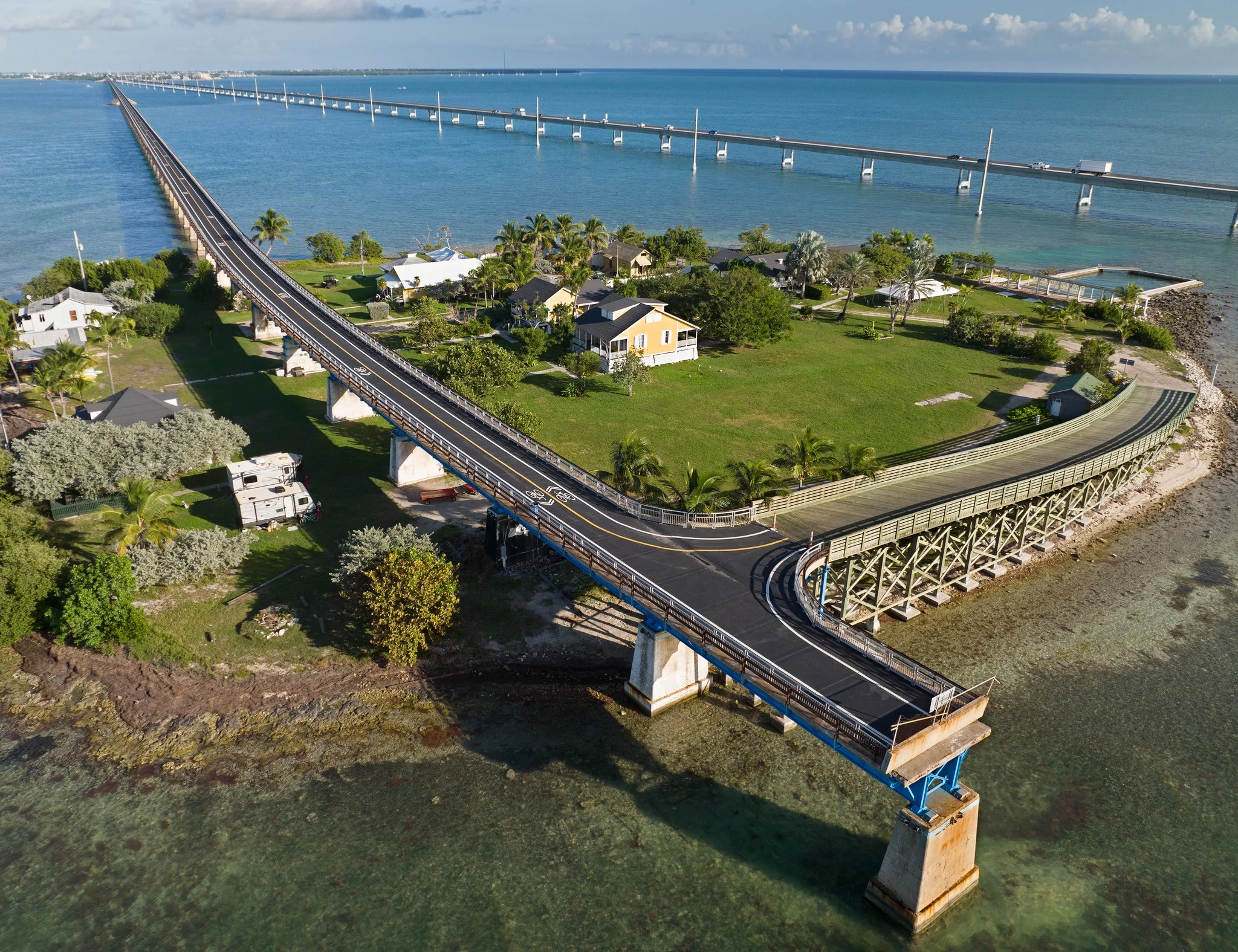
Read more: The Old Seven Mile Bridge, most scenic hike or bike ride in the Keys.
MM 47 — Pigeon Key
Pigeon Key is the beautiful and historic island where workers building Henry Flagler’s Seven Mile Bridge lived from 1909 to 1912. You can visit it via a cute train-themed tram that takes you on a tour. For tickets, go to the visitor center, 1090 Overseas Highway, Marathon. This new location for the visitor center is on your right (bayside) in a gravel lot with a small marina just a little past the 7 Mile Grill, close to the start of the bridge.
Read more: Pigeon Key: A favorite stop in the Keys
43.9 — Moser Channel, highest point on 7-Mile Bridge. Sombrero Light can be seen oceanside
40.0 — West end of the Seven Mile Bridge
The Lower Keys — Mile Marker 40
Tourists pass through the Lower Keys en route to Key West, so there are fewer visitors here and lots of open spaces on land and sea. These scenic islands go deep, offering access to undeveloped backcountry treasured by kayakers and anglers. Get off the Overseas Highway and explore!
Read this article: Paradise Found: Things to Do in the Lower Keys
40.0 — KAYAK Little Duck Key Wayside Park. (oceanside) Good place for a picnic or use the restroom. There’s a beach where you can wade or swim and palm trees lean like they are waiting to be captured in a postcard. Easy kayak launch.
39.5 — Missouri-Little Duck Channel Bridge
39.0 — Ohio-Missouri Channel Bridge
38.8 — RV — Sunshine Key RV Resort and Marina. Completely rebuilt since being wiped out by Hurricane Irma in 2017. Pool, docks, playground, beaches, boat ramp and marina on 75-acre island. 399 RV sites, book a mobile homes on Hotels.com.
38.7 — Ohio- Bahia Honda Channel Bridge
MM 37 — Bahia Honda State Park
Bahia Honda State Park features an award-winning beach, a boat launch, marina, campground and cabins. The Sandspur campground and Sandspur Beach have reopened. Enjoy a day of sunbathing and with iconic views of the crumbling old railroad bridge.
Read more about Bahia Honda State Park
36.0 — Bahia Honda Bridge (4-lanes)
35.0 — KAYAK Bahia Honda Bridge launch. Access to both ocean and bay.
34.5 — Scout Key Girl Scout Camp, oceanside.
34.1 — Camp Sawyer, Boy Scouts, oceanside.
34.0 — West Summerland Key
33.7 — KAYAK Spanish Harbor Bridge Boat Ramp. (East end of bridge, Marathon side.) Paddle to No Name Key and a cluster of islands.
Bridge fishing guides at fishthebridges.com or call 305-204-9772
Big Pine Key — Mile Marker 33.5
SPEED WARNING: Big Pine is home to the endangered Florida Key Deer, and the speed limit is strictly enforced — 45 mph, daylight; 35 mph at night. Off the highway, the speed limit is 30 mph.
33.8 — KAYAK — Boat ramp alongside highway.
33.0 — RV — Big Pine Key RV Resort. Upgraded campground with some sites on a canal with docks. RV sites with full hookups, RV rentals, lodge, rustic sites without hookups. Previously known as the Big Pine Key Fishing Lodge.
33.0 — KAYAK. Long Beach. Take Long Beach Road about a half-mile. Turn left onto dirt road to Long Beach. There are three launch points. Or you can drive all the way to the end of Long Beach Road and hike out to the beach from the turnabout.
31.0 — Lower Keys Chamber of Commerce, Old F.E.C. railway marker, oceanside.
MM 30.3 — National Key Deer Refuge Visitor Center
Endangered Key deer are found nowhere else in the world. The refuge takes up most of the island, and the refuge’s Visitor Center is on U.S. 1 in a new log-cabin structure.
Read More: Where to see Key deer
MM 30.2 — Key Deer Boulevard (Traffic Light)
- Big Pine Shopping Center is north of the traffic light on Key Deer Blvd, hidden behind dense vegetation. Winn-Dixie Supermarket, novelty shops, and restaurants, including locally popular PizzaWorks.
- No Name Pub. Take Key Deer Blvd to Watson Blvd., then turn right. Go through a residential area, and No Name Pub is on your left.
- Old Wooden Bridge Resort and Marina, past No Name Pub. Houseboat and cabin accommodations. Kayak rentals and guided tours.
- The Blue Hole is an abandoned rock quarry with boardwalk overlook to view birds, snakes, alligators, key deer, and green iguanas.
30.0 — DIVE — Looe Key Reef Adventures and Strike Zone Charters
30.0 — Big Pine Rooster, Bayside.
29.5 — Kayak Pine Channel Nature Park. Boardwalk leading to scenic viewing area. Bike racks, kayak/canoe launch, picnic areas, rest room, swimming hole and outdoor shower. Historic Henry Flagler concrete mile marker more than a century old.
Read more about Pine Channel Nature Park.
29.3 — North Pine Channel Bridge
28.5 — Little Torch Key. Parmers Resort is highly rated on TripAdvisor. The resort is off U.S. 1 on Barry Avenue. Well-maintained cabins and motel rooms on the water.
28.5 — Kiki’s Sandbar Bar and Grille, 183 Barry Ave. Downstair open-air bar with entertainment. Upstairs dining. Overlooks the North Pine Channel with boat docks.
28.0 — Legendary Watersports Snorkel Looe Key. Sandbar trips with boat rental. | TripAdvisor reviews
28.0 — Torch Channel Bridge
27.8 –– KAYAK Middle Torch Key Causeway. North off U.S. 1 for several miles to Big Torch Key sign. Turn left. Launch from second and third culverts along this road.
Read More: Things to do in the Lower Florida Keys
27.8 — Bike Trail — A natural area with a bike path that’s 15.5 miles round trip from U.S. 1 on Middle Torch Road.
27.7 — Torch-Ramrod Channel Bridge
27.6 — Ramrod Key, Named for a ship, the Ramrod, wrecked on a reef south of here in the early nineteenth century.
27.3 — DIVE — Looe Key Reef Resort, Dive Center and Tiki Bar. Tiki bar is popular with locals. Dive boat, paddle boards, kayaks and boat rentals. Ramrod Key.
26.6 — South Pine Channel Bridge, east end of bridge, oceanside
27.5 — Boondocks Grille and Drafthouse. Hot spot with largest tiki bar in the Keys, featuring entertainment in season. Performers often add this venue to their Key West bookings.
26.0 — Niles Channel Bridge, middle.
24.9 — KAYAK. Summerland Key. Take Horace Street (bayside) to Northside Drive (2nd right) and turn left on Niles Road. Go to the end of Niles Road (about 1.5 miles). Launch is on the left where the road ends.
24.0 — Summerland Key Sea Base
23.5 — Kemp Channel Bridge, east end of bridge, oceanside
22.5 — Square Grouper. You’d never know it from the warehouse look, but this is a classy joint serving gourmet dishes, named after local slang for a floating bail of marijuana.
22.3 — Fanci Seafood. Excellent seafood market on Cudjoe Key. Recommended by local fishermen for having fresh catch daily. Best homemade crab cakes I’ve ever tasted. The yellowtail filets and Key West pink shrimp were very fresh and competitively priced. (Not a restaurant.)
22.2 — KAYAK. Spoonbill Sound Hammocks. Launch on gulf side (Cudjoe Key). Check out nearby salt ponds for photo ops.
21.0 — KAYAK. Cudjoe Gardens Marina, where you can rent kayaks, guided kayak tours.
21.0 — Blimp Road, named for “Fat Albert,” an Air Force surveillance blimp that was taken down in 2013.
Read more: Oh no, Fat Albert bites the dust!
21.0 — KAYAK. Follow Blimp Road all the way to the end on the Gulf side (north side of U.S. 1). There is a launch ramp for easy access to back-country islands, such as Tarpon Belly Key, once home to a shrimp farm.
20.2 — Bow Channel Bridge to Sugarloaf Key.
20.0 — RV — Sugarloaf Key/Key West RV Resort.
20.0 — Mangrove Mamas. Roadside eatery. Cracked conch and conch chowder, along with a healthy serving of Keys atmosphere.
19.8 — RV — Lazy Lakes RV Resort.
19.5 — Bike Trail. Paved bike path follows Crange Boulevard (Bayside) all the way to Florida Bay.
19.0 — KAYAK. Sugarloaf Sound. Oceanside, near yellow traffic barrier, there’s a short path to the launch site.
18.6 — Upper Sugarloaf Key
18.8 — Park Channel Bridge
17.8 — North Harris Channel Bridge
17.7 — Sugarloaf Lodge and Tiki Bar — Laid back, circular open-air tiki bar overlooking a tranquil beach and bay.
17.6 — Harris Gap Channel Bridge
17.5 — Lower Sugarloaf Key
17.0 — KAYAK. Blinking light, Take Sugarloaf Blvd (oceanside) about two miles to stop sign, then another two miles to Sugarloaf Creek bridge. Park on west side of bridge.
There is also a launch ramp at the Sugarloaf Marina (Bayside), where you can rent kayaks and purchase accessories. Nominal fee to launch if you bring your own boats. Guided tours of Sugarloaf waterways offered.
17.0 — Bike Trail — Bike path is on Sugarloaf Road in a residential area. Round trip from Sugarloaf Lodge is 15 miles.
Mile Marker 17 — Bat Tower
Relic of the early 20th Century was testament to early mosquito control, but it didn’t work. The bats escaped the next day and never returned. The tower blew over in Hurricane Irma in 2017, but it’s still there.
16.0 — KAYAK. Harris Channel Bridge. Good access off U.S. 1 to both bay and oceanside.
15.8 — Lower Sugarloaf Channel Bridge
15.0 — Baby’s Coffee. Beans roasted fresh daily. Highly rated and a mandatory stop on your way home from Key West. Baby’s is also a good place to park and bicycle the Florida Keys Overseas Heritage Trail to Key West and back.
15.0 — Kayak Bay Point Park. (Behind Baby’s Coffee) Picnic tables, BBQ pits, sand volleyball court, a basketball court, tennis court, and pickleball. Sandy playground and a large grassy field. Small rocky area offers water access as a kayak or paddle board launch.
14.6 — Saddlebunch #2 Bridge
14.5 — Bluewater Key RV Park. Luxury RV park.
14.2 — KAYAK. Saddlebunch #3 Bridge. Pullover on oceanside; launch under bridge.
13.1 — Saddlebunch #4 Bridge
12.8 — Saddlebunch #5 Bridge
11.4 — Shark Channel Bridge
11.0 — KAYAK. Shark Key Boat Ramp, oceanside.
Big Coppit Key — Mile Marker 11
Mile Marker 10.5 — Boca Chica Road; Clothing optional beach
- Take Boca Chica Road south to the Geiger Key Marina, where you’ll find a popular tiki bar/restaurant, fishing charters, and a small RV campground with dockside sites.
- If you follow Boca Chica Road further west as it winds around the Key West Naval Air Station, the road ends at Geiger Key Beach. There is a half-mile of paved road closed to cars that makes a pleasant walk along the natural beach at the end of the runway. (Beyond the pavement, the beach is clothing optional.)
9.7 — Rockland Channel Bridge
9.2 — East Rockland Key
8.5 — Tourist welcome center
8.0 — NAS Boca Chica Overpass; Entrance to Key West Naval Air Station. Oceanside. Turnoff from both directions on US-1.
6.1 — KAYAK. Boca Chica Channel bridge. Launch on either end of the bridge. Ample parking.
5.3 — KAYAK. Public Boat Ramp. Oceanside ramp between Boca Chica and Stock Island. Heavily used.
Stock Island — Mile Marker 5.3
This rustic gateway to Key West is home to a commercial seaport, live-aboards and houseboats, a few hotels, a couple of RV parks, and a handful of unique dining experiences. The island’s name derives from herds of livestock once kept here to feed Key West.
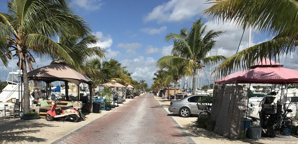
Read More: Stock Island: Key West’s fishy, funky, promising neighbor
MM 5.2 — College Road, North Side of Island (Hospital)
- Lower Keys Medical Center, 5900 College Rd, Stock Island. Go north on College Road. Across from Florida Keys Community College. (305) 294-5531
- Key West Tropical Forest and Botanical Garden, a tranquil spot for plant lovers.
- Key West Golf Club, designed by Rees Jones
- Florida Keys Community College.
MM 5.1 — 3rd Street, South Side of Island
- Boyd’s Key West Campground. Turn south onto 3rd Street (Stock Island); go one block and turn east onto Maloney. Boyd’s is a decent, clean campground, and it’s scenic. There are 150 RV sites with full hookups, some oceanfront, and another 53 sites for tents. You can book your reservations online.
- Fishbusterz Fisheries. Largest wholesale fish house in Florida. Retail outlet is at 6406 Maloney Avenue, , directly across the street from Boyd’s Campground.
- Hogfish Bar and Grill. A great place, if you can find it. On the docks near Boyd’s Campground, at 6810 Front Street, The Hogfish is one of the best open-air restaurants in the Keys. Their specialty — the world-famous “Killer” Hogfish Sandwich, tender white hogfish meat, smothered in onions, swiss cheese and mushrooms piled high on a Cuban hoagie.
- El Mar RV Resort, 6700 Maloney Avenue.
MM 4.8 — Cross Street, South Side of Island
- Leo’s Campground. Cute little campground with lowest prices in Key West. Very good Wi-Fi, bathhouse and laundry. Go south on Cross Street from U.S. 1, one block, turn left. (305) 296-5260
- The Perry Hotel, 7001 Shrimp Road. Recently renovated low-rise hotel with dockage, dockside bars and restaurants, overlooking marina and fishing fleets coming and going in the basin. Nice place.
- Stock Island Marina Village, 7005 Shrimp Rd. Next to the Perry Hotel, Marina Village is home to Key West live-aboards and houseboats.
4.6 — Hurricane Hole Restaurant and Marina, south side of U.S. 1, across from College Road. Rents houseboat acommodations.
4.1 — Cow Key Channel Bridge
Key West — Mile Marker 4
The southernmost city in the United States, Key West is the end of the road. It’s vibrant history, funky bars, colorful characters, and laid-back vibe attract two million visitors every year.
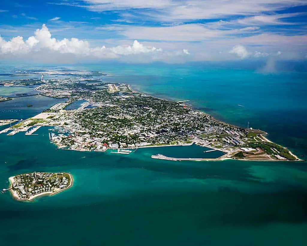
MM 3.9 — Traffic Light
“When you come to a fork in the road, take it.”
— Yogi Berra
If you go left: State Road A1A
- Houseboat Row. All but gone today, the seawall and protected basin on your left was once home to a famously colorful houseboat community. The houseboats moved to Garrison Bight and Stock Island.
- Key West International Airport.
- Smathers Beach. The longest beach in Key West is lined with palm trees and has restrooms, volleyball courts, and picnic areas.
- A1A eventually rejoins U.S. 1 at Whitehead Street.
If you go right: U.S. 1 on Roosevelt
2.3 — Salt Run Bridge, N. Roosevelt, Key West
1.9 — Publix Supermarket, Searstown Shopping Center, 3316 N Roosevelt Blvd,Key West.
1.7 — Publix Supermarket, Key Plaza, Key West. (Yes, these Publix are that close to each other).
1.7 — Palm Ave; U.S.C.G. Group; Naval Air Station, Trumbo Point. There is a campground here for military families, the Sigsbee RV Park.
1.5 — Winn Dixie Supermarket, 2778 N Roosevelt Blvd.
Roosevelt becomes Truman Ave.
Historic Key West Cemetery (@ Windsor Lane)
The Key West cemetery is a lot like the city itself: quirky, crowded, colorful and full of history. The cemetery was founded in 1847 after a terrible hurricane in October 1846 washed away the old cemetery, scattering the dead throughout a forest. As a result, the oldest gravestones in this cemetery — built on the highest point in Key West — are actually older than the cemetery itself. They date to 1829 and were moved here after the hurricane.
Read More: Historic Key West Cemetery: A scenic stop full of stories
Windsor Lane — Historic Basilica of St. Mary Star of the Sea
U.S 1 Turns Right at Whitehead Street
938 Whitehead Street — Key West Lighthouse & Keeper’s Quarters
Read more: 6 ways to experience Key West, Hemingway style
907 Whitehead Street — Hemingway Home & Museum — Ernest Hemingway ended up in Key West like many others — by accident. He came for a day and ended up staying for a decade. That was close to a century ago, and the town has yet to recover from his presence. Papa’s spirit permeates the island. His former home, complete with a gaggle of six-toed cats, remains a popular tourist attraction. Tour information and tickets.
Bahama Village
- 600 Whitehead. Courthouse Deli. Grab a sandwich or Whit’s Frozen Custard and hang out on “The Bench”, across the street from the Green Parrot.
- 601 Whitehead. The historic Green Parrot Bar. Oldest bar in Key West. Popular with locals but tourists are treated warmly. It’s a melting pot and great spot for people-watching.
Read more: Most beloved ‘locals’ bars in Key West
Read More: Fort Zachary Taylor State Park, Key West hidden gem
Welcome to Key West
One of the best ways to see Key West is to take a tour, especially if this is your first visit. The famous Conch Tour Train is probably the most well-known sightseeing tour. For a strange adventure, try the spooky Ghost and Gravestones Tour.
Great Read: Key West chickens: Noisy, colorful, just like Key West
Required stops on a saloon tour — this is, after all, Key West — are Sloppy Joe’s, Captain Tony’s (the original Sloppy Joe’s), the Bull and Whistle, raucus honky tonk saloon Cowboy Bill’s, and ultra-funky Blue Heaven, a historic Bahamian Village watering hole where Ernest Hemingway officiated boxing matches in the 1930s.
Read more: Most beloved “locals” bars in Key West.
There are dozens of B&B’s and unique lodgings through the city, including a few of our favorites: The elegant Heron House, Key Lime Inn. Key West Bed and Breakfast, and the historic Eden House. (For a bargain, book one of the four second-floor rooms that share two bathrooms.)
Try something unique: Key West houseboat rentals
A Chicago foodie shared with Florida Rambler his favorite spots for authenticity: Eight Key West restaurants for local flavor. We also recommend La Te Da, Louie’s Backyard, and the rustic, moderately priced Half Shell Raw Bar.
Here’s our guide of free things to do in Key West, including a great free walking tour. Here’s more: Key West on the cheap isn’t easy, but here are tips
After dinner, try a slice of Kermit’s Key Lime Pie at 200 Elizabeth Street.
The Florida Keys Gazetteer explains the history behind the colorful names of Keys places.
Acknowledgements:
The original mile-marker guide used as a base to build this guide was created by Jerry Wilkinson for the Historical Preservation Society of the Upper Keys at keyshistory.org.
Many thanks to Judy Rowley and Paul Koisch of PizzaWorks in Big Pine Key and Judy’s son, charter captain Kevin Rowley, for taking us off the beaten paths of the Lower Keys.
A few of the kayak launch areas were gleaned from Bill Keough’s Florida Keys Paddling Guide, which we recommend for Keys paddlers.
We’d also like to give a nod to Wikipedia, where we have gleaned additional historic information.
Last, kudos to our family members who are often saddled with a clipboard and an iPad, identifying points of interest and updating listings, and to friends and readers who contributed to this report.
A note about links
Links in this guide take you to more information about points of interest, parks and businesses. Courtesy links are not sponsored and are not for sale.
Some links go to reviews on TripAdvisor or Hotels.com with which we have affiliate agreements. Reservations made through these links may result in a modest commission to support our travels.
Veteran journalists who worked together at Fort Lauderdale’s SunSentinel newspaper, Bonnie and Bob founded FloridaRambler.com in 2010 to explore the natural, authentic Florida, writing about their natural interests in hiking, biking, paddling, RV and tent camping, wildlife, unique lodging, dining and historic places.

Pam
Tuesday 19th of December 2023
This is a very interesting guide, thank you for putting it together! Is there one for traveling northbound? It’s similar but different!
Pam
Tuesday 19th of December 2023
@Bonnie Gross, thank you!
Bonnie Gross
Tuesday 19th of December 2023
Thanks for visiting our site! I'm afraid we don't have a northbound version. We'll consider that.
Brenda Turner
Tuesday 1st of November 2022
Is there a way to get all this information on paper.
Bob Rountree
Wednesday 2nd of November 2022
Hi Brenda, We don't have a print version, but you are free to print it out directly from our web site for your personal use (about 50 pages, depending on your printer). Tap the "Print" icon at the top of the page. I would suggest, however, that the best version is online so you always have the updated version. We update the guide frequently, as often as daily. It's designed to be easy to read and scroll on smartphone, tablet, laptop or desktop. -- Bob Rountree, co-publisher.