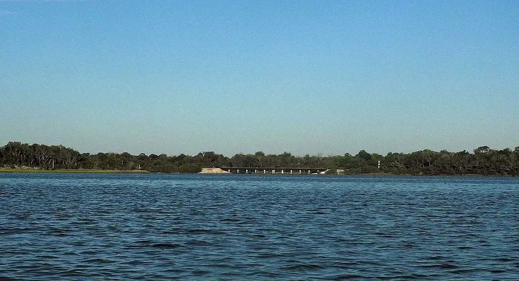
The railroad bridge is your landmark. It spans the mouth of Spruce Creek as it flows into Strickland Bay.
Beyond the bridge is a 7-mile snake known as Spruce Creek, once a pristine waterway lined with live oaks, sable palms and majestic hardwoods as it wound through the wilderness west of Port Orange and New Smyrna Beach.
Just 15 years ago, the only nearby development I can remember was the Spruce Creek Fly-In, once a lonely landing strip deep in the woods on a lonely road with a dozen or so houses where you could land your plane and taxi to your front door.
Today, the area is overflowing with new subdivisions and new schools, suburban sprawl from nearby Daytona Beach, and more houses than ever are encroaching on the creek. But there’s still plenty left to enjoy with portions of the creek set aside as a preserve.
It’s a pleasant, peaceful paddle, and beautiful stretches remain. Indeed, it could be argued that much of the development to date has been respectful of the eco-system, and aside from the docks jutting out into the waterway, most of the homes have attractive landscaping with tall legacy trees with dense vegetation.
Spruce Creek Lower Creek Access Points
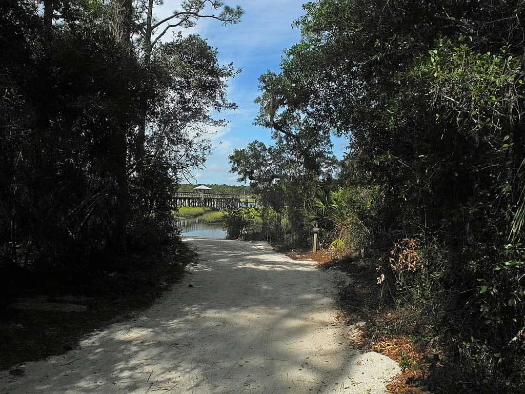
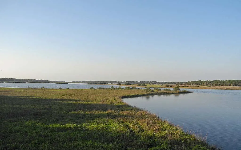
Access Point 1 — Spruce Creek Park – High Tide Only! On the west side of the twin U.S. 1 Spruce Creek/Strickland Bay bridges is this well-marked Volusia County park with parking, hiking trails, a kayak/canoe launch and a long fishing pier. I really like this park, especially the fishing pier, but you should not launch or take out here near low tide. The narrow channel through the grass is muddy, and you’ll sink to your knees if you have to get out of your boat. But the view of Strickland Bay, marshes and grass savannah from the pier is absolutely stunning. Worth a stop, even if you don’t launch here. It’s a great place to pause, especially in early morning. The park is open daily from sunrise to sunset.
Access Point 2 — Strickland Bay Bridge ramp – This is an unimproved access point on the east side of U.S. 1, just before the bridge crossing the Strickland Bay wetlands (2.2 miles north of the entrance road to the New Smyrna Beach Municipal Airport). An easy pull-off with limited parking, this is a popular launch for small boats, kayaks and canoes. This is where I launched my kayak. Even at low tide, the water is deep enough for a shallow draft boat to weave through the oyster bars, under U.S. 1 and west into Strickland Bay. This launch site is open 24/7.
Access Point 3 — Divito Park – Almost directly across U.S. 1 from Access Point 2, you’ll see a sign for Divito Drive, a hard-pack sand road that disappears into the woods. When we visited, there were no signs identifying a public park, but there is one! When you drive back, you’ll come to a T and a split rail fence along the water. Just below the fence is a narrow, long beach ideal for launching a kayak or canoe. The spot is marked by a parks department garbage can. Be aware there is a gate at U.S. 1 that closes off access to the park after 7:30 p.m.
Spruce Creek Upper Creek Access Points
The upper portion of Spruce Creek was once accessible to kayaks and canoes from a dirt pull-off alongside the South Williamson Blvd. bridge. That access is long gone, and I searched hard for a public ramp. But the only place to launch your kayak on the upper creek is at Cracker Creek Canoeing, a private livery with a boat ramp, kayak and canoe rentals, pontoon boat tours, group camping and shady grounds for weekend outings.
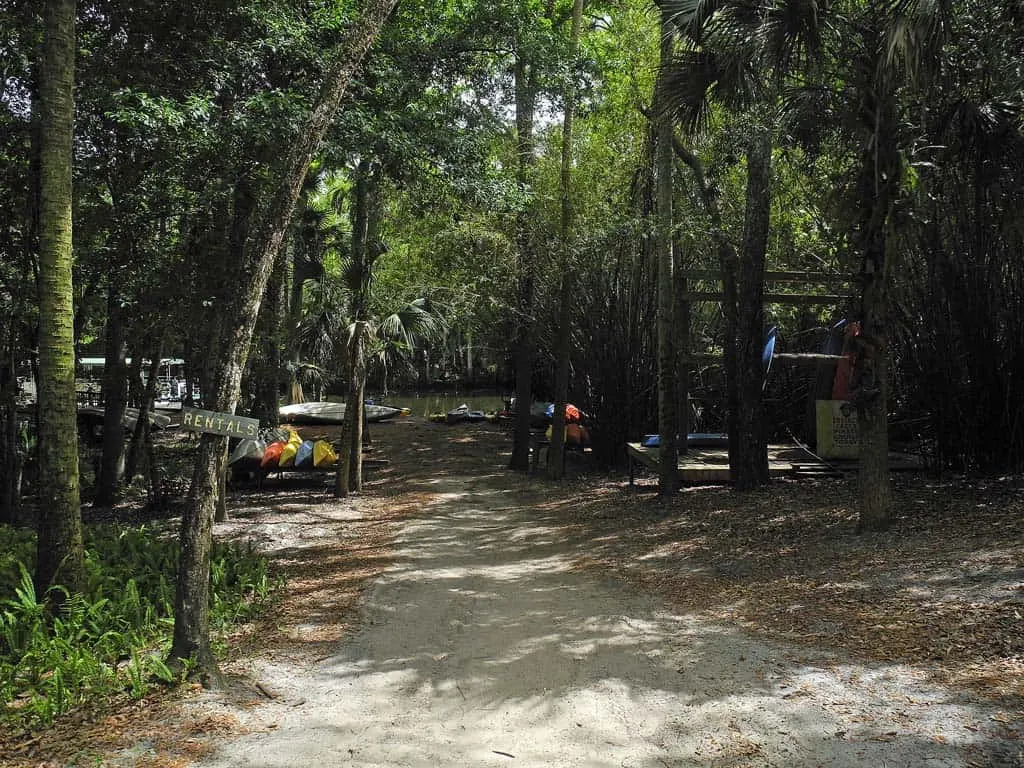
Access Point 4 – Cracker Creek Canoeing. This privately owned, well-shaded park is at 1795 Taylor Road, Port Orange, west of I-95. (Taylor Road is the western extension of Dunlawton Blvd.) There is a $5 launch fee for your own boat. You can rent kayaks or canoes at a reasonable rate. Single kayaks are $18 for one hour, $24 for two hours and $40 all day. Tandem kayaks (two persons) and canoes are $24 for one hour, $36 for two hours and $70 all days. (Rates as of 6/1/2022) This woodsy park seemed like an oasis in an area rapidly being developed into housing subdivisions.
Paddling through Strickland Bay and up Spruce Creek
I launched from the Strickland Bay bridge ramp in mid-morning with the tide going out, but despite the low levels I didn’t have any problem paddling around visible oyster bars to the bridge, then up into Strickland Bay.
You can see the railroad bridge from the highway, and although it disappears behind the saltwater marsh when you are sitting at water level in a yak, it’s fairly easy to get your bearings before you launch.
There are oyster bars everywhere, so work around them to the left after going under U.S. 1 and follow the deeper water into the open bay, which grows to great expanse to the south and north. You’ll notice some markers that define leaseholds for oyster beds. If you choose to harvest oysters along the way, stay outside the markers that define the leases. The oystermen pay for those leases, and they work hard for their living, so give their leaseholds wide berth.
As I crossed the bay towards the railroad bridge, now clearly visible, I paused several times to take in the wildlife that thrives in this environment – tailing redfish near the oyster bars, mullet leaping to cleanse their skin by slapping back to the surface, hawks gliding on the breeze, egrets pecking at oysters while other shorebirds and waders work through their morning rituals.
Rambler Tip: Water shoes are essential gear. Mosquito repellent is advisable near dusk or dawn, and don’t forget the sunscreen.
You could spend an entire day exploring and fishing in Strickland Bay, and many do. I easily saw a dozen fishing kayaks slowly working their way into little cuts in the marsh and along the shoreline, sidling up alongside the oyster bars in hopes of catching the elusive drum or sea trout.
It’s a testament to the strong sun bearing down on these waters that all were wearing face and neck coverings to protect themselves from the rays. If you spend more than an hour out here, you should consider the same.
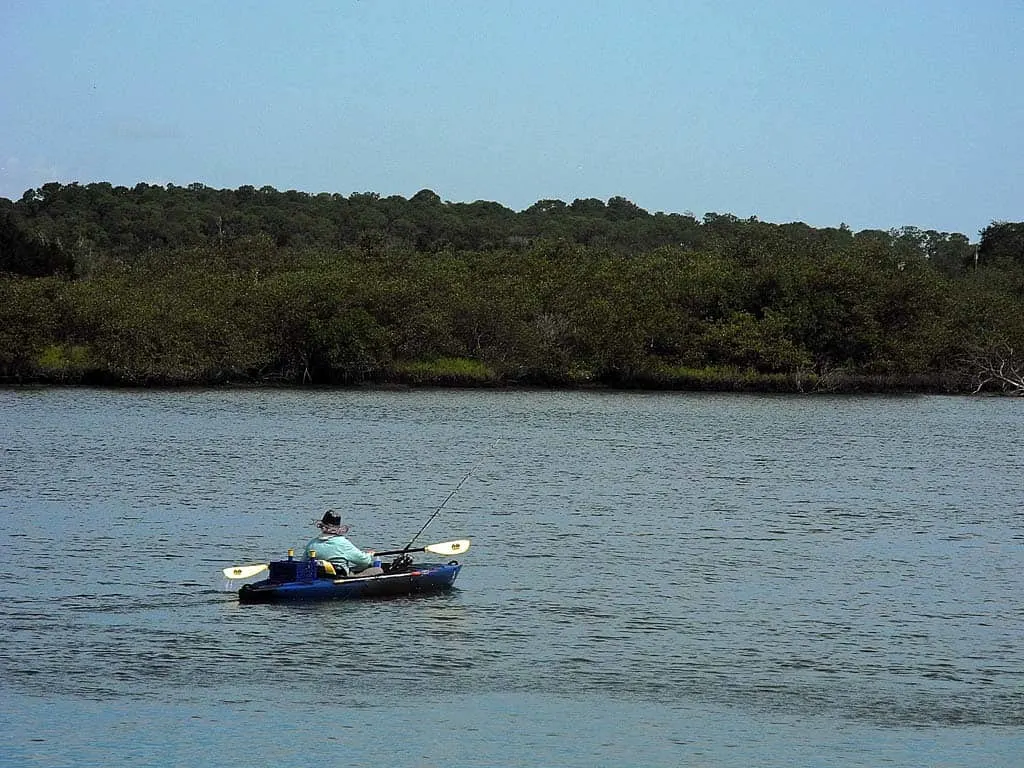
Off to the south spreads Turnbull Bay, which widens out into a New Smyrna Beach neighborhood of waterfront homes and docks behind the New Smyrna Beach Municipal Airport.
Strickland Bay is where the freshwater from Spruce Creek flows into the saltwater tidal areas, creating a brackish water that feeds on biodiversity. Locals familiar with the estuary say it is flush with both fresh and saltwater species.
I paused when I reached the railroad bridge to gauge the water flow to the outgoing tide, identifying the deepest points and more manageable currents. Even so, I found myself dragging along an oyster bar on the other side and had to get out of my kayak to walk it over to deeper water.
The next time I’ll stay farther to the right of the sign that seemed to mark a channel. (Not so.)
As you paddle up the creek, you witness a change in the vegetation as the mangrove and grasses in the bay give way to live oaks and palms along a shoreline marked with long docks that extend from houses hidden in the trees.
This is pretty much standard along much of the lower creek, which winds another 6 miles west to Cracker Creek Canoeing’s launch and take-out. I paddled about a mile, then turned back so that I could drive up to Cracker Creek and check out the other end of the trail.
It’s worth noting that the return trip to Strickland Bay required extra effort against an easterly breeze on the bay’s open water, even though I was on an outgoing tide. Open-water paddlers know that drill.
Cracker Creek and Gamble Place
Once my kayak was loaded back onto my truck rack, I headed down U.S. 1 to Nova Road, then over to Dunlawton, where I turned west towards I-95. From there, Cracker Creek is a straight shot.
Once you drive under I-95, Dunlawton changes to Taylor Road. From this point, Cracker Creek is another 1.5 miles on the left. (If you are going to Cracker Creek directly from I-95, use Exit 256 to State Road 421 West, which is Taylor Road.)
Access to Cracker Creek is a shellrock road through the woods off Taylor. You’ll first come to Gamble Place, 175-acre historic property built in 1907 by James N. Gamble (Procter & Gamble) for a winter retreat.
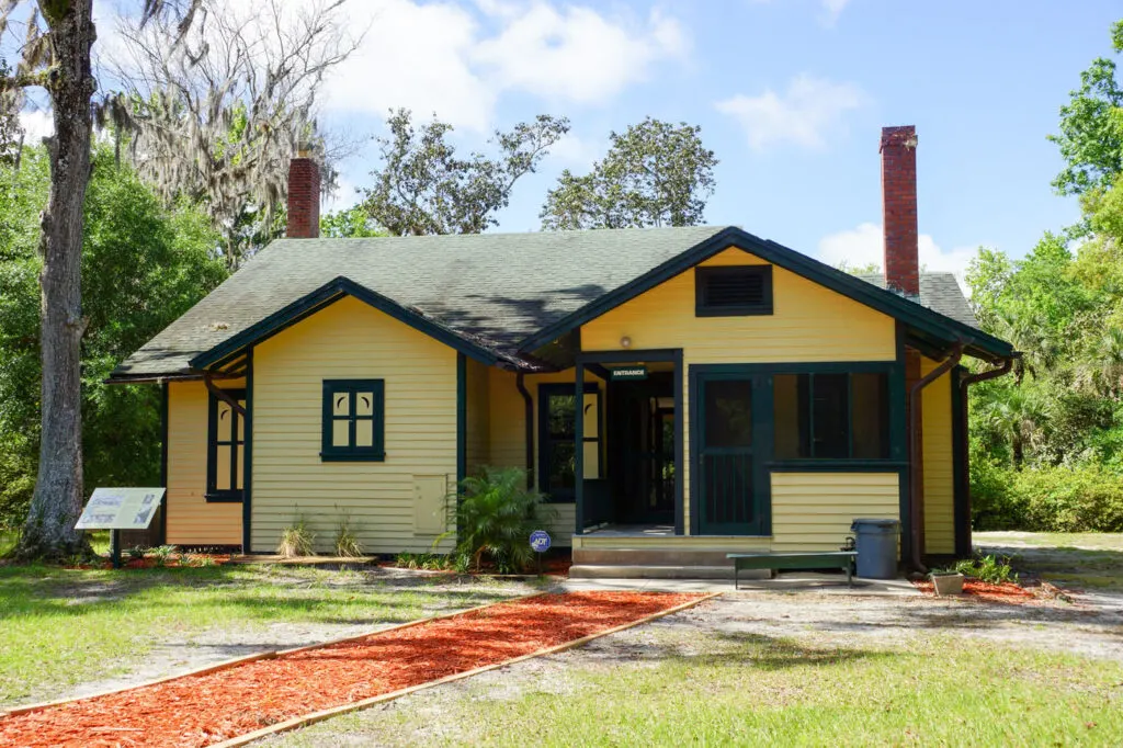
Just past the gates to the Gamble Place is the entrance to Cracker Creek Canoeing.
Unfortunately, my plans to paddle the upper Spruce Creek were spoiled because I was visiting on a Monday, and Cracker Creek is closed on Mondays and Tuesdays.
But owner Jill Williams was there to cater a birthday luncheon, so she allowed me to wander the grounds, view the launch ramp and slip down a few trails through the woods.
If you are bringing your own kayak, canoe or paddle board, there is a nominal fee. And while the ramp is 100 yards or so from the parking area, Jill says you can drive down to the ramp and drop off your boat unless the sandy road is too dry, lest you get stuck.
The creek here is narrow and well-shaded, and like most slow-flowing Florida creeks and rivers, curvy. I really wish I could have gotten into the water for a better look. Next time.
Cracker Creek is designed for weekend or summer outings with the family. They have an outdoor café, group camping and a motorized pontoon boat that gives tours of the creek, and plenty of canoes and kayaks to rent.
Pontoon Boat Eco-History Tours: Explore diverse habitats and eco-systems associated with this blackwater cypress swamp. Learn about the earliest visitors and settlers. Tour Cost: $12 per adult | $10 per senior adult (age 65 and older) | $8 per child (age 12 and under). Reservations required. Call (386)304-0778
There are five group camping sites that can accommodate 20 to 30 tents each, but by the looks of the sites, I think they would be too crowded with 30 tents. Jill said the smallest group size would be 10 people. Recreational vehicles are OK, she said, but there is only one water tap and one electric box per group site.
There is also a picnic pavilion with a grill and campfire, and the café serves breakfast and lunches, but only days the property is open (Wednesday through Sunday).
For more information, call Jill at 386-304-0778 or visit their web site.
What about a Spruce Creek shuttle?
To me, the ideal paddle would be to start at Cracker Creek and paddle the 7 miles downstream to the U.S. 1 access points around Strickland Bay, so I asked Jill if they provide a shuttle service.
“Very few do that,” she said. “Most people just come for a couple of hours.”
She suggested two vehicles. Keep one on Strickland Bay and launch from Cracker Creek.
Useful Links for Spruce Creek
More things to see and do near Spruce Creek
- Ponce Inlet: A delightful outdoor oasis near Daytona Beach
- 9 cool things to do near Daytona Beach
- Tiger Bay State Forest (and an old brick road)

Bob Rountree is a beach bum, angler and camper who has explored Florida for decades. No adventure is complete without a scenic paddle trail or unpaved road to nowhere. Bob co-founded FloridaRambler.com with fellow journalist Bonnie Gross 14 years ago.

Justin
Thursday 15th of September 2022
Hi I do maintenance at gamble place it is open for self guided tours you have to go through cracker Creek. it's $3.
They're also planning to extend Williamson right through parts of the preserve check out "save spruce creek" I'd love to see an updated article! Your information is always appreciated and we can use all of the publicity we can get