Gulf Islands National Seashore, which occupies the barrier island at the far western end of the Florida Panhandle, is an expansive place.
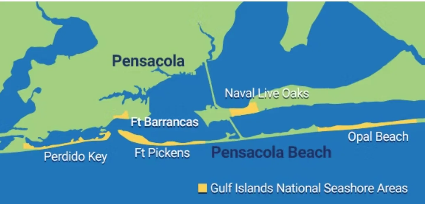
It has park land in two states – Florida and Mississippi (but skips right over Alabama.) It includes several hard-to-reach islands. It has a dozen distinct different areas.
With all that geography to sift through, I found it hard to figure out what to see and do here on a recent Panhandle trip. Complicating matters is that admission is $25 per car, so vacation planners want to make sure they’re making the most of it.
I’m covering just the Florida section, and my assessment is that there are three key highlights:
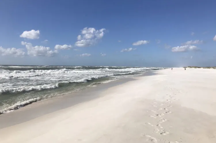
- Experiencing a pristine barrier island with white sand like sugar.
- Exploring Fort Pickens, a fort built largely by enslaved people in 1834 out of 21 million bricks.
- Visiting Fort Barrancas, a hilltop Civil War era fort overlooking Pensacola Bay, with 6 million bricks, walls 4 feet thick and 20 feet high.
These places are remarkable, and like most national parks I’ve visited, do not disappoint.
- The Opal Beach section of Gulf Islands National Seashore
- The Fort Pickens area of Gulf Islands National Seashore
- Gulf Islands National Seashore camping
- Fort Barrancas
- Other areas of Gulf Islands National Seashore Florida
- Visiting Gulf Islands National Seashore by ferry
- Planning your trip to Gulf Islands National Seashore Pensacola area
- FAQs about Gulf Islands National Seashore
The Opal Beach section of Gulf Islands National Seashore
Santa Rosa is a narrow barrier island where sand dunes stretch from the Gulf shore to Santa Rosa Sound. With the whitest sand I’ve ever seen, Opal Beach is a sight to behold. It boggles the mind to think how all Florida’s barrier islands might have once looked like this.
A big chunk of Florida’s section of Gulf Islands National Seashore is located on Santa Rosa Island west of Navarre Beach. This area was named Opal Beach after the eye of Hurricane Opal, a Category 4 storm, came ashore here, flattening the sand dunes.
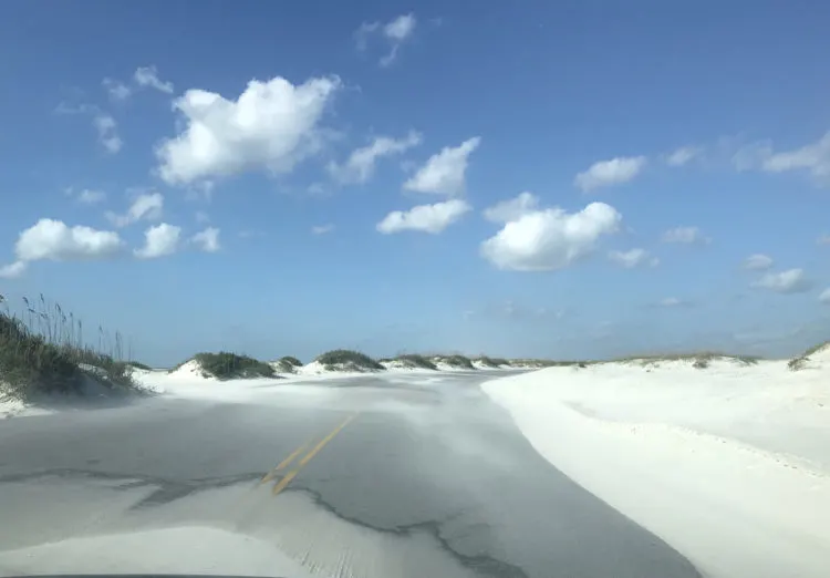
On the day we visited, the winds were blowing so strongly that it was driving sand over the highway that looked like snow drifts. It was a good example of how harsh this environment can be, even on a day that is sunny and 70 degrees. The white sand was blindingly reflective and the wind and sand particles actually stung my skin. Wind-whipped waves churned and crashed on the sand. It was awe-inspiring to see, and makes you respect the power of weather and nature here.
Even though this is within the Gulf Islands National Seashore, there is no fee to drive down Highway 399, so I recommend this route just for the spectacular views.
If you want to park, go to the beach or use the restrooms within the national park section, you need to pay the $25 admission (or use your National Park Pass if you have one.)
What is there to do here? Walk on the squeaky quartz sand, swim in the Gulf if the conditions allow, and gaze at the stark and splendid beauty of natural sand dunes, beach and waves.
There is a bike lane for seven miles along Highway 399, so this is a good place to bicycle and enjoy the view.
Don’t want to pay national park admission? On either side of the national park boundaries, there are similar stretches of beach operated by the cities of Navarre Beach and Pensacola Beach, and there is no charge for parking in these. There’s also a dog beach on the western boundary along Highway 399.
Opal Beach ends where Pensacola Beach begins; you know you’ve left the national park when there are five 25 story buildings!
The Fort Pickens area of Gulf Islands National Seashore
A few miles west of Pensacola Beach on Highway 399, you are back in Gulf Islands National Seashore in the Fort Pickens section. This time, you do have to pay the entrance fee to continue.
The road again passes through spectacular views of sand and dunes. Be aware: This is a low-lying road that is easily flooded. We visited two days after a major rain storm and had to drive slowly through water that came up to the bottom of our car doors.
The road travels through seven miles of undeveloped beach. There are three parking lots where you can stop to spend some time at one of the most beautiful wild beaches in Florida.
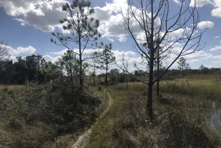
On this road, there are three turn-offs for campgrounds, which are attractive lightly wooded compounds across the street from the beach. (More on camping below.)
Along the way, you will pass some portions of the fort, gun batteries once camouflaged with sand and vegetation to hide them from aerial surveillance. Military history buffs will want to park and explore.
At the turn off for the Campground A, there is a half-mile loop Blackbird Marsh Trail with good signage that travels around a pretty wetland. This trail also connects with the Florida Trail, which runs all along Gulf Islands National Seashore, ending at Fort Pickens, 1,300 miles from its start in Big Cypress National wildlife refuge. At this point, on the Gulf side of the highway, there is a parking lot and the short Dune Trail.
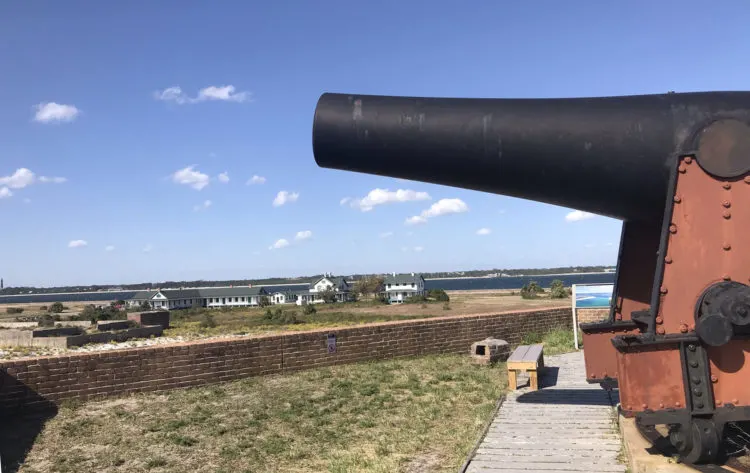
The road ends at the western end of the island at the complex of historic buildings that includes Fort Pickens, which is a remarkable site even for those not interested in military history.
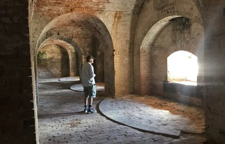
It is a massive red brick pentagonal building built before the Civil War. It saw active duty from 1834 to 1940. Much of it is left in its original condition and one of the curious things is that visitors can just wander this maze of tunnels and arched rooms on their own.
It is common to have spaces that are not designed specifically for visitors to be roped off at the slightest danger. Here, you are free to explore rooms that are dark or dimly lit, tunnels with low ceilings, spaces where water collects and the ground is uneven. I think the freedom to wander the huge spooky fort on your own adds to the thrill, but do hang onto little kids!
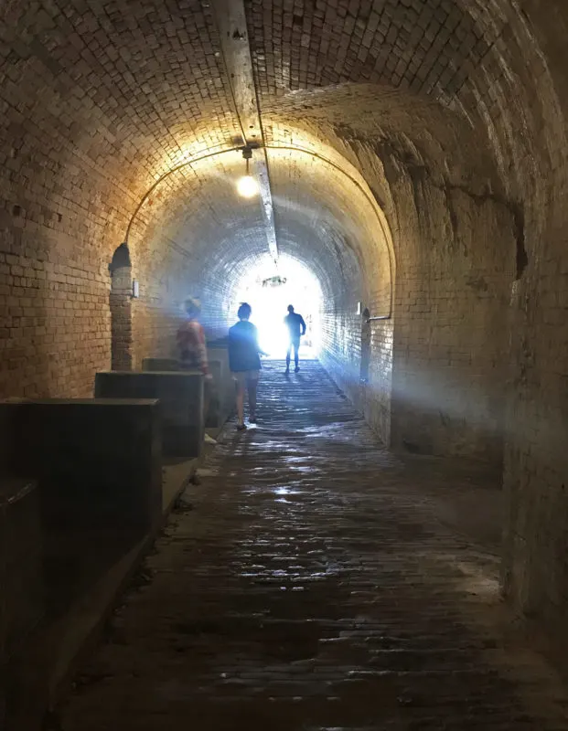
As you wander the fort, there are signs that explain what you are seeing, but if you want more information, you should download the Fort Pickens app for more guidance.
Other things to do near Fort Pickens:
- The fort area also has a fishing pier where you do not need a Florida fishing license.
- Near Fort Pickens, the Discovery Center is an interesting museum that covers the area’s natural and manmade history.
- Hikers may want to take advantage of the Florida Trail, which stretches the length of the national seashore as it reaches its terminus at Fort Pickens.
- A designated bike lane starts at the entrance to Fort Pickens and goes for four miles. When the bike lane ends at Battery Langdon, cyclists can move to the Florida National Scenic Trail which continues to Fort Pickens.
- The Gulf-facing beaches have dark skies where you can star gaze on clear nights.
- The Blue Angels are based in nearby Pensacola Naval Air Station so visitors may see them practive over Pensacola Bay from March through November. The team performs two formal air shows every year in the Pensacola area that can be seen from the national park.
- The National Aviation Museum is also located on the Naval Air Station. It’s is a world-class museum that is a don’t-miss for aviation buffs. The museum is open daily 9 a.m. to 4 p.m. The museum is closed on Thanksgiving, Christmas Eve, Christmas and New Year’s days.
Gulf Islands National Seashore camping
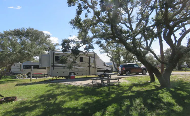
Beach and history lovers will find the setting at the Fort Pickens area campgrounds particularly appealing. Located on the eastern side of the road, the campgrounds are a short walk from water on the bay side as well as the spectacular beaches on the Gulf side.
Located near the end of an undeveloped barrier island, the campground feels remote and far from civilization. That’s a good thing, but it does mean if you run out of supplies, it is a long drive to town.
The campground contains 137 family sites with electricity (30 & 50 amp) and water hookups and 40 non-electric tent sites. Each campground offers water, grill/fire rings, restrooms, and picnic tables. Fort Pickens campsites are available to book up to six months in advance via recreation.gov . In early November, there was good availability of tent sites and spotty availability of RV sites through the next six months. (Summer beach season is prime time when camping sites are harder to get.)
Rates are $26 for tent sites and $40 for RV sites.
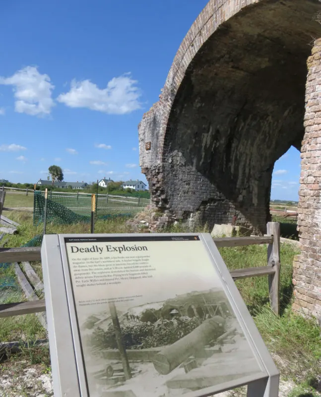
Fort Barrancas
Fort Barrancas, an impressive Civil War era fort completed in 1844, is located on Pensacola Naval Air Base. Across the bay from Fort Pickens, it is smaller and surrounded by the Naval Air Station.
The visitor center and fort are open Saturday to Wednesday from 9 a.m. to 4 p.m. Last entry to the fort is at 3:30 p.m. Visitors to Naval Air Station (NAS) Pensacola must show a government-issued identification card such as a state-issued driving license or passport. Foreign nationals must be accompanied by a US citizen.
Overlooking Pensacola Bay, Fort Barrancas is the last in a series of forts built on this strategic bluff between 1698 and 1844 and used by Spain, France, Britain, and the United States. You can tour the visitor center, Fort Barrancas, and Spanish Water Battery.
While there, hike the short Woodland Trail and the half-mile Trench Trail to the Advanced Redoubt, a nearby fortification built by the United States in the mid-1800s to protect Fort Barrancas and Pensacola Navy Yard from land-based attacks. (You can also drive there.)
No fees are required. For entrance information visit NAS Pensacola.
Other areas of Gulf Islands National Seashore Florida
There are two additional separate chunks of land – Perdido Key and Naval Oaks.
Perdido Key is located on the west side of Pensacola Bay, so it is an hour drive from Fort Pickens. Perdido offers miles of pristine beach named for Rosamond Johnson, the first black serviceman from the county killed in the Korean War. This was the “colored beach” in the days of segregation. Perdido offers another gorgeous expanse of sand, dunes and emerald waters. If you’ve spent time at the dune beaches on Santa Rosa Island, you might not make visiting Perdido Key a priority. An entrance fee is required.
Naval Live Oaks area of Gulf Islands National Seashore is located in Gulf Breeze on a separate peninsula in Pensacola Bay. I remember fondly visiting in the 1990s and seeing ancient majestic live oaks preserved in this forest.
On this visit, we hiked on some of the 7.5 miles of trails. The trails pass through thick woods, but most of the truly impressive old oaks have been felled by time and storms. As such, Naval Oaks is good for a hike or a picnic, where some of the tables have lovely waterfront views. It is not a must-visit, however.
There is no entrance fee at the Naval Live Oaks area.
Visiting Gulf Islands National Seashore by ferry
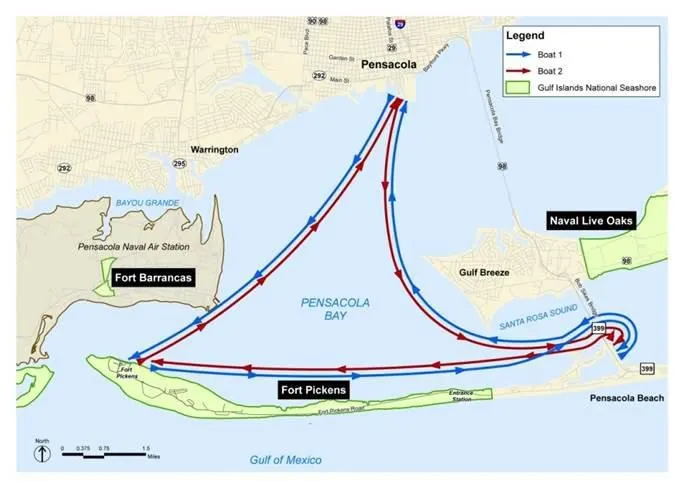
On Friday, Saturday and Sundays from March to October, you can take a ferry from downtown Pensacola that takes you to first to Fort Pickens where you spend a few hours and then on to Pensacola Beach for a few hours. The ticket is $30 for adults and $20 for youth 3 to 15. There is no additional park entry fee. Here’s more visiting the park by ferry.
Planning your trip to Gulf Islands National Seashore Pensacola area
Website for Gulf Islands National Seashore
Entrance fees for seven days
$15 per person pedestrian or cyclist
$20 per person motorcyclist
$25 per vehicle
Fort Pickens campsites can be reserved via recreation.gov.
FAQs about Gulf Islands National Seashore
Are there lifeguards at the beach at Gulf Islands National Seashore? During the summer season (mid-May through August) lifeguards are usually on duty at Opal Beach in the Santa Rosa Area, Langdon Beach in the Fort Pickens Area, Johnson Beach in the Perdido Key Area, and the designated swim beach on the south shore of Ship Island.
Is it hard to get a campsite at Gulf Islands National Seashore? Yes, but not impossible. The Fort Pickens Campground is one of the top 10 busiest campgrounds in all of the 420+ national parks and sites, according to NPS. Nevertheless, if you look at www.recreation.gov, you will often find weekday availability at most times and weekend availability if you look six or more weeks ahead.
Can I backpack into back-country campsites and camp on the beach? No, there is back-country camping, but it is only by boat. Here are details.
Also from Florida Rambler:
- Gulf Islands National Seashore is one of 11 excellent national parks in Florida, which Florida Rambler describes.
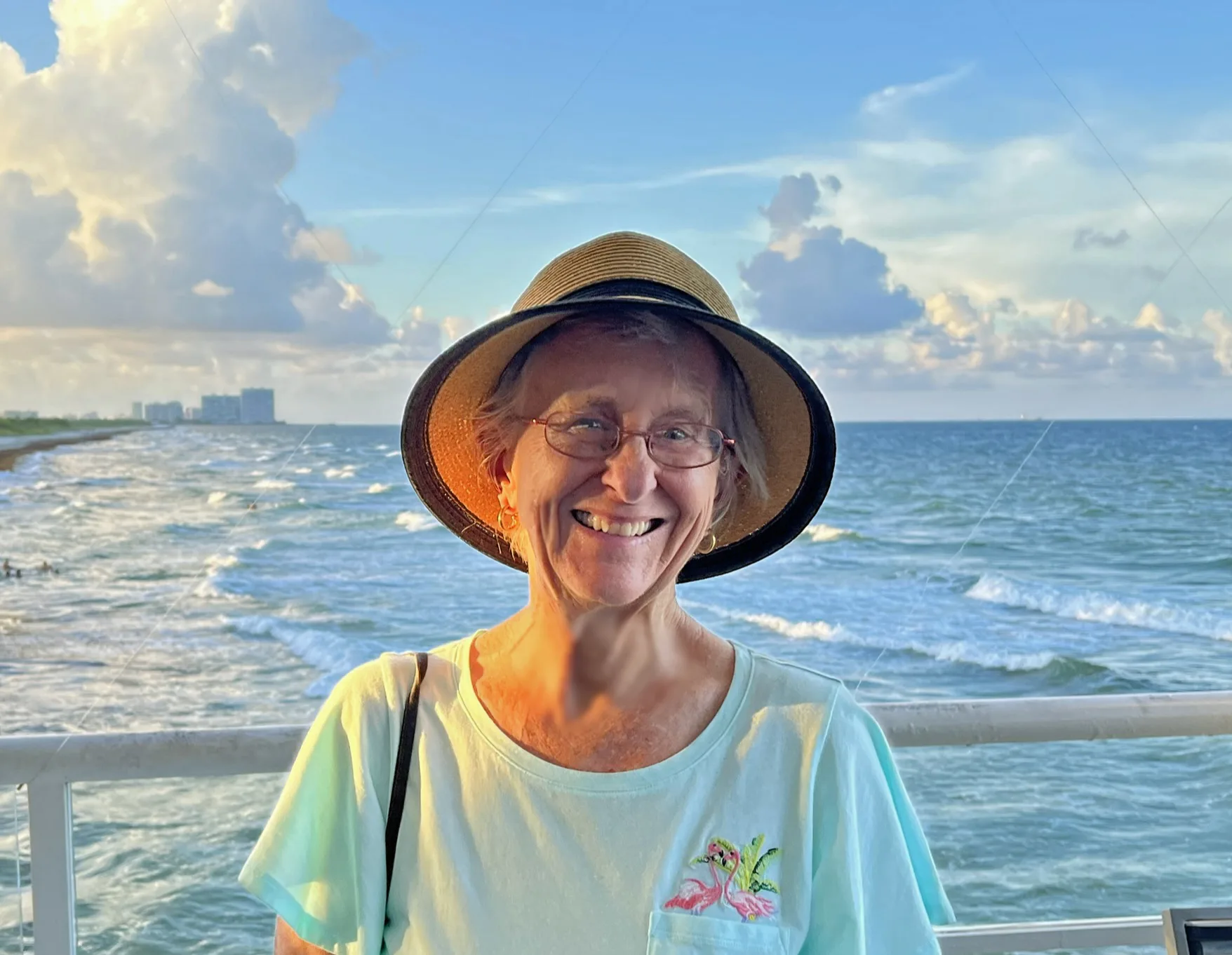
The author, Bonnie Gross, travels with her husband David Blasco, discovering off-the-beaten path places to hike, kayak, bike, swim and explore. Florida Rambler was founded in 2010 by Bonnie and fellow journalist Bob Rountree, two long-time Florida residents who have spent decades exploring the Florida outdoors. Their articles have been published in the Sun Sentinel, the Miami Herald, the Orlando Sentinel, The Guardian and Visit Florida.

Cheryl Heywood
Tuesday 22nd of August 2023
Great article Bonnie. Seeing your name took me back in time. Warmest regards to you from the mountains of WNC. Cheryl Heywood
Bonnie Gross
Tuesday 22nd of August 2023
Thanks so much, Cheryl! Good to hear YOUR name!
Bill Riley
Friday 12th of November 2021
Well done. Thanks for sharing. It has stimulated my interest to visit there. But so far from my home in Charlotte County.