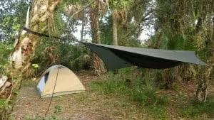
There are no fancy entrance gates, nor is there a groomed campground within the St. Sebastian River Preserve State Park.
To get to St. Sebastian River Preserve, you travel on unpaved roads that require deft handling. Other than a buffer road along the C-54 canal, which divides the park, motorized vehicles are prohibited in the interior.
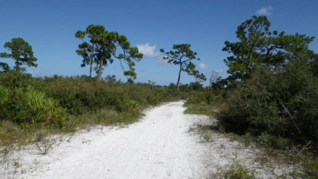
You can hike until you drop on 60 miles of trails through 22,000 acres of wilderness, trails that are also open to mountain bikes and horseback riding.
Backpackers can enjoy six primitive campsites, some deep in the grassy forests of longleaf pine, grassland prairies, low-lying scrub, cypress domes and swamps.
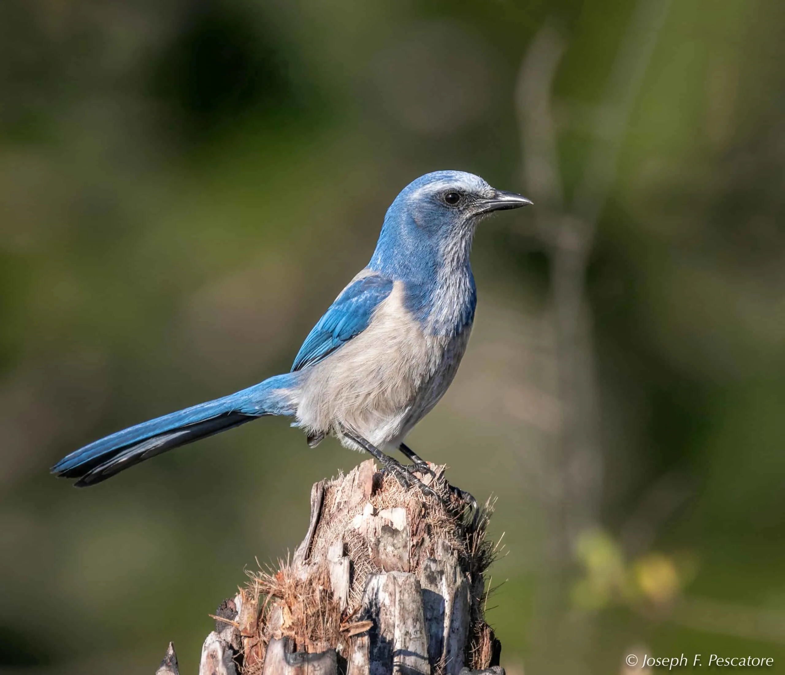
The rare Florida scrub jay makes its home here, as does the red-cockaded woodpecker, Bachman’s sparrows, Eastern indigo snakes, bald eagles and gopher tortoises. And then there is the occasional rattlesnake and the ubiquitous frog.

Wild turkeys can often be seen trailside, and river otters are common, while bobcats roam more clandestinely. Blackberries are plentiful along the trails, and wildflowers are abundant, many of them rare.
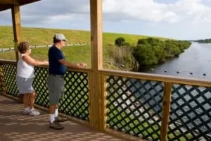
The C-54 Canal is a haven for manatees, who gather here from November through March and can be viewed from a platform near the end of the unpaved Buffer Preserve Drive. The manatee-viewing platform is handicap-accessible.
Orientation, access to St. Sebastian River Preserve State Park
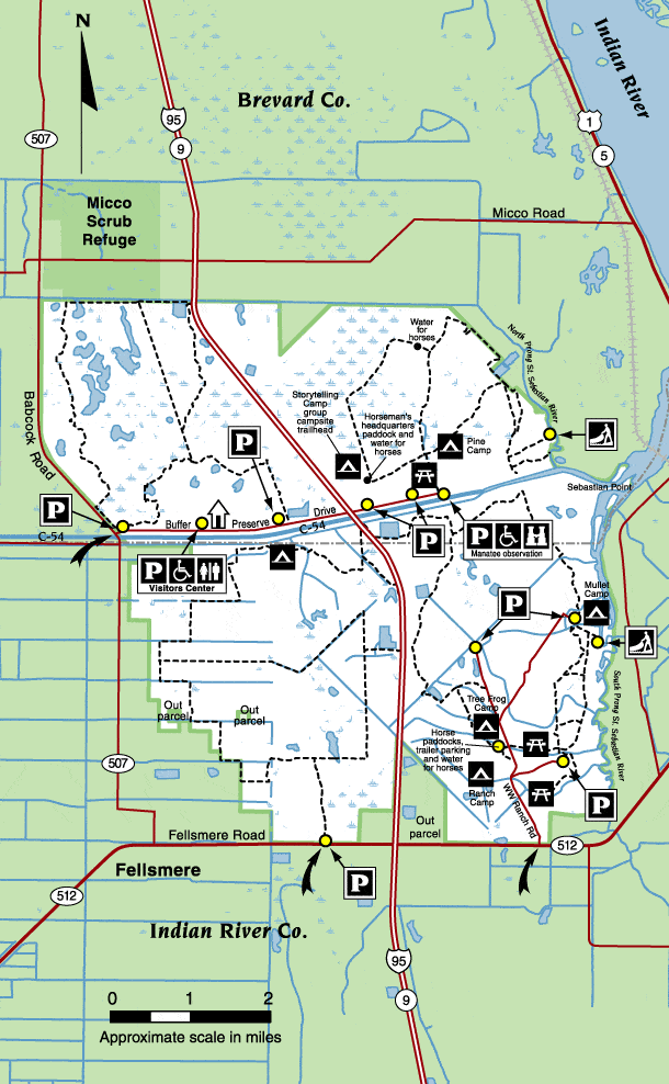
St. Sebastian Preserve State Park is divided into four quadrants, carved out by the C-54 Canal and Interstate 95, and each quadrant has its own network of trails.
There are three public access points:
- The main park entrance is north of Fellsmere on County Road 507 — on the north side of the C-54 canal at the foot of the northwest quadrant. Here you will find a new Visitor Center, the park office and the unpaved Buffer Preserve Road, which parallels the canal with access to the northwest and northeast quadrants, the main equestrian area and the manatee viewing platform. The Visitor Center has an informative nature display, trail guides and a ranger or volunteer on duty from 8 a.m. until 5 p.m. daily.
- The Southwest quadrant is accessible from a parking lot one mile west of I-95 Exit 156 (Fellsmere Road). Parking is just off the highway in a fenced corral, which is designed to accommodate trailered horses.
- The entrance to the Southeast quadrant is 1.8 miles east of I-95 Exit 156, on WW Ranch Road behind Indian River County’s Fran Adams North County Park. A few blocks east of North County Park, at the intersection of 510 and 512, is the Sebastian Canoe Launch, which offers access to the South Prong of the St. Sebastian River.
The preserve is managed cooperatively by Florida State Parks and the St. John’s River Water Management District, which also manages a patchwork of nearby preserves and recreation areas.
The trails at St. Sebastian River Preserve State Park
There is no drinking water or trash receptacles along any of the trails in St. Sebastian River Preserve State Park, so bring your own water and take out your own trash. Pets are allowed on trails, but not in camping areas. Be prepared for rapid changes in weather, and arm yourself with sunscreen and insect repellant at any time of year.
If you are bicycling off-road, keep in mind that most of the trails are also equestrian trails, so the going can get rough, especially messy after a rain. This is no place for thin-tired bikes, but you already figured that out.
Download official trail map and brochure PDF
- Blue Trail – Southeast Quadrant – 10 miles of hiking, biking and horse trails. There are three primitive campsites along the Blue Trail, which loops towards the river. There are several historic sites along the trail, including the early 1900s Carlton House, the 1920s-era Hanshaw-Widner House (private occupied dwelling), the Yates Homestead (from 1897), the Graves Brothers Tram Line (elevated logging road) and the Dinky Line (a 1910 railroad bed used to haul timber).
- Red Trail – Southwest Quadrant – 17 miles for hiking, biking and horse trails. There is one very remote campsite (Eagle Camp) and a loop trail for birders. This section of the preserve is flush with wildlife and harbors the largest population of the endangered scrub Jay in Florida. The best viewing is along the three-mile Scrub Jay Link, which cuts through large areas of open sandy prairie with scrubby flat woods and oak scrub.
- Yellow Trail – Northeast Quadrant – 19 miles of trails and two campsites. An equestrian center is located at one of the trailheads, making this a popular trail for horseback riding. This section of the preserve was once a ranch that was managed with environmental concerns in mind, which enabled many rare and endangered species of plants and animals to survive. This area was heavily timbered in the early 1900s, though vegetation has reclaimed the land today. This trail is at the far eastern end of the Buffer Preserve Drive along the C-54 Canal and is near the manatee observation deck.
- Blue Trail – Northwest Quadrant – 9 miles of trails, no camping, and probably the best bet for bikers and hikers because equestrians are drawn eastward to the facilities serving the Yellow Trail. The Blue Trail traverses five wildly beautiful communities of pine flatwoods, oak hammock, wet prairie, mixed wetland hardwoods and cypress. You’ll see the remains of homesteads dating back to the 1800s, when citrus farming and cattle ranching flourished in the area. Trailhead is located behind the Visitors Center. There is a 1.7 cutoff trail called the Bobcat Link. Get a detailed map at the Visitor Center.
Paddle the river in a kayak, canoe or paddle board
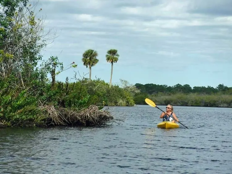
Surprisingly, there are no facilities within the St. Sebastian River Preserve State Park for launching a kayak or canoe, although one primitive campsite in the preserve is accessible by boat. (See Mullet Camp below).
The best place to launch a kayak or canoe for the most scenic paddle is the Sebastian Canoe Launch, a one-acre park on the north side of the intersection of County Roads 510 and 512.
A popular paddle trail is from the Sebastian Canoe Launch down the South Fork of the St. Sebastian River to Dale Wimbrow Park on Roseland Road in Sebastian, the perfect place to park your shuttle vehicle.
Kayak rentals, river tours and shuttle service can be arranged at About Kayaks, directly across Roseland Road from Dale Wimbrow Park. They also offer guided and self-guided tours. Call (772) 589-3469.
There is also a boat ramp at nearby Donald MacDonald Campground Park.
Primitive camping inside the preserve
Reservations are required to camp inside the preserve, and the fee is $5 per person per night. Up to 20 campers are permitted at each site, except Mullet Camp, which has a capacity of 6. Pets are not permitted in the campsites, and you must pack everything to your site, including firewood.
Each campsite has a fire ring, and a cleared area to pitch a tent, but that’s about it. You much have a reservation, which can be obtained by phone by calling 321-953-5005 or 321-953-5004.
One campsite is accessible from the river, Mullet Camp, and there is a landing where you can pull your canoe or kayak ashore. Mullet Camp is also accessible by backpackers from the Blue Trail.
Southeast Quadrant
- Ranch Camp – On WW Ranch Road. Drive one mile to the horse trailer parking on the left, passing Duck Pond Road. Parking is 100 yards from the site. Ideal for families and within walking distance of North County Regional Park (and the swimming pool).
- Tree Frog Camp – Take WW Ranch Road 1 ½ miles into the Preserve, then take the left fork onto Indigo Road and the parking area. Hike just 50 yards to this secluded site nestled under large pines.
- Mullet Camp – Take the right fork at Indigo and continue another 1 ¾ miles to the parking area, which is 3/8 mile from the campsite. This site can also be accessed from the river, where you can land your kayaks or canoes.
Southwest Quadrant
- Eagle Camp – This is the most remote camp in the park, requiring a hike (or ride) of 6 miles to the campsite, which has a horse corral in addition to a fire ring. Access the Red Trail entrance on Fellsmere Road, one mile west of I-95.
Northeast Quadrant
- Storytelling Camp – This site is a tenth of a mile from the Horseman’s Headquarters on Buffer Preserve Drive . It has horse paddocks, a composting restroom, non-potable water for horses and picnic tables. This campsite is obviously intended to serve the equestrian community, although it is often reserved by Boy Scout groups.
- Pine Camp – From the park entrance on County Road 507, drive approximately 4 miles east on Buffer Preserve Drive, under I-95, and turn left into the Stumper Flats parking area. This camp, with its scenic views of cypress and pine forests, is about a half-mile north of the parking area.
Improved campground outside the preserve
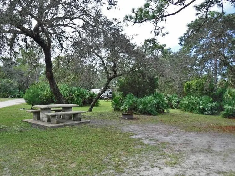
There is a very nice, wooded and shady public campground near the preserve with excellent river access. Donald McDonald Campground Park on Roseland Road in Sebastian, managed by Indian River County Parks and Recreation.
This campground is not well-known or heavily used, so sites are often available.
Only five sites have electric and water hookups suitable for larger RVs. The other 27 campsites have fire pits and picnic tables, but no hookups. Potable water is available from shared spigots throughout the campground. Many of these tent sites will accommodate tent trailers and even small RVs, sans hookups.
Donald McDonald Park and Campground, 12315 Roseland Rd, Sebastian, FL 32958. Park ranger: (772) 589-0087. Camping fees: $20 for non-electric sites (Sites 1-27); $30 for electric and water (Sites 28-31). Reservations are available online. If you want to know if your RV will fit in one of the primitive sites, call (772) 589-0087.
Also consider: Sebastian Inlet: Two great campgrounds
Wildlife in the St. Sebastian River Preserve
The Preserve is part of the Great Florida Birding Trail and has been identified as one of the top birding locations in the United States.
Many different species of birds use the preserve during migration, such as the swallow-tailed kite, various songbirds, hawks, hummingbirds and robins. The most popular sightings are for red-cockaded woodpeckers, Florida scrub jays and Bachman’s sparrows. More common sightings include sandhill cranes, wood storks, southern bald eagles and American kestrels.
The West Indian manatee migrates into the St. Sebastian River and up the C-54 canal to take advantage of the warm water from November through march, and a handicapped-accessible viewing platform is available near the end of Buffer Preserve Road.
Fishing in the St. Sebastian River Preserve
Fishing is permitted in ponds on the preserve, the shoreline of the C-54 canal and in the St. Sebastian River. The water in the St. Sebastian River and supports both saltwater and freshwater species, including tarpon, snook, bass and mullet.
You must have a fishing license, which can be purchased at any bait and tackle shop, or you can obtain one online from the Florida Fish and Wildlife Commission. You can also obtain one instantly by calling 888-347-4356. Have a pen or pencil handy to jot down your license number. This happened to me once, and I ended up carving the number into my fish ruler with a pocket knife. 🙂
Cool things to do near Sebastian
Places to Stay in Sebastian, FL
If you are not camping, check this link for Hotels in Sebastian. Or find a vacation home rental at VRBO.
Editor’s Note: We welcome lodging recommendations from our readers in comments below. Florida Rambler has an affiliation agreement with both Hotels.com and VRBO that may result in a modest commission that we use to help pay expenses.
Credits: Many thanks to Kyle Gabriel (aka kizniche) of Stuart for sharing his photos of the St. Sebastian River Preserve.
Bob Rountree is a beach bum, angler and camper who has explored Florida for decades. No adventure is complete without a scenic paddle trail or unpaved road to nowhere. Bob co-founded FloridaRambler.com with fellow journalist Bonnie Gross 14 years ago.

