Just a mile west of the tourist-packed beaches is a network of canals and natural waterways. Kayaking New Smyrna Beach can keep a paddler busy for weeks.
Our recent paddling adventure there consisted of two distinct areas along the Intracoastal Waterway with their own distinct trails. Because we caught the tide going out, flowing south to north in the Intracoastal Waterway, we started at the Edgewater boat ramp and paddled north with the current.
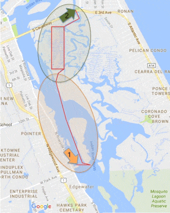
We’ll call the first section of our trip Zone 1 and the second section Zone 2.
Paddling beyond the Intracoastal Waterway (Zone 1)
Logistics for kayaking New Smyrna Beach
The easiest access point to paddle this section of Intracoastal is the Edgewater boat ramp, across from city hall and designated on the map with the “1” arrow.
Parking is free but can fill up quickly on weekends. The park, George R. Kennedy Memorial Park, 103 N Riverside Drive, has restrooms, a fishing pier, pavilions and picnic tables too.
Best conditions for paddling
This is largely open water. Wind is going to be a factor to consider. I’d recommend early morning paddles when you kayak New Smyrna Beach because you’re much more likely to get calmer conditions at this time.
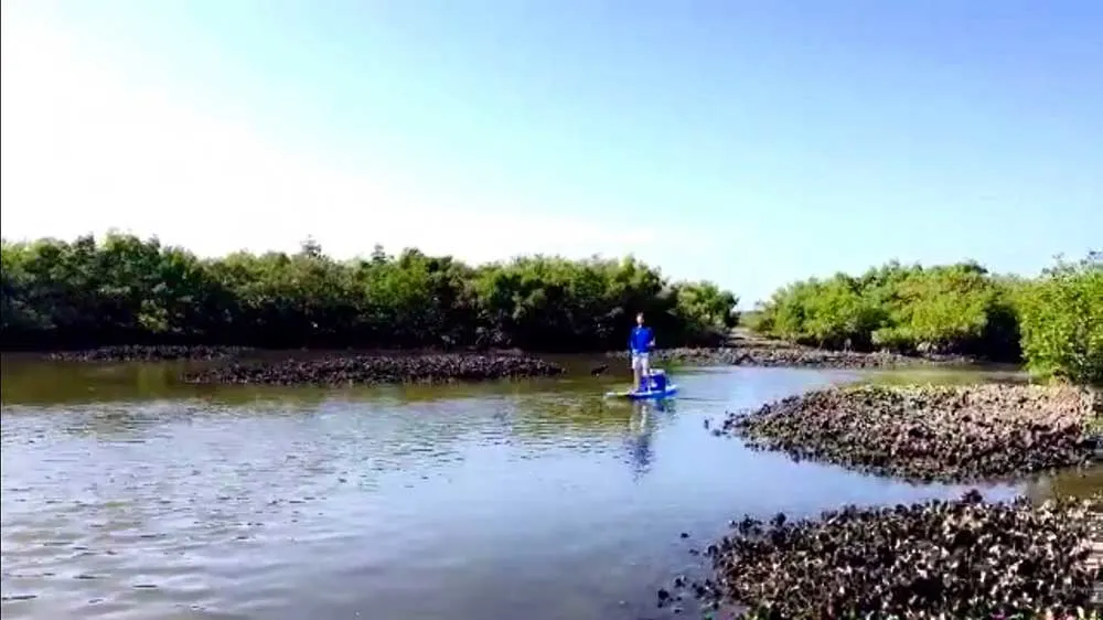
Another important consideration is the tide. If you want to launch and return to the same spot, I’d recommend catching it around a slack tide (tides are usually one or two hours delayed depending where you are in the Intracoastal, so keep this in mind).
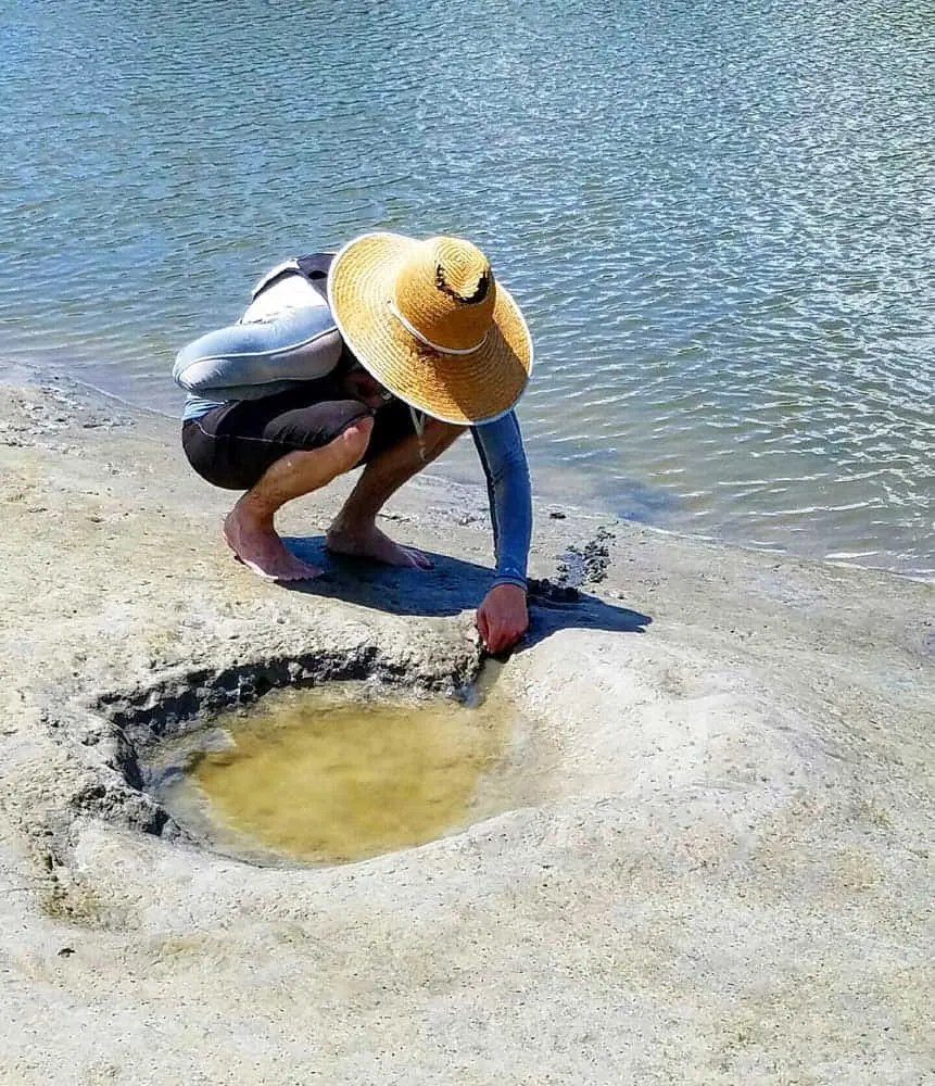
Outgoing tides move north, incoming tides move south here. Use them to your advantage. For this section in particular, I’d recommend low tide. Numerous sand bar islands pop up all over the place creating tons of little areas to explore.
Flora and fauna along New Smyrna Beach waterways
You’re more likely to see the big marine mammals in the open Intracoastal Waterway, which runs through here, and sightings of dolphin and manatees are common.
This area is known locally as Mosquito Lagoon, although technically Mosquito Lagoon is a little south on the west side of Merritt Island and the area in New Smyrna is the Indian River Lagoon.
Much of the lagoon is thick with mangroves and inaccessible, but there are a few creeks and clear channels weaving navigable trails through the back country, providing access to fishing holes around oyster bars and hiking on some of the more forested islands.
The channels, mangroves, tidal pools and oyster bars are prime breeding grounds for shorebirds, gamefish and migratory birds, so spend some silent time watching this world pass you by.
Navigation considerations for kayaking New Smyrna Beach
This is an active Intracoastal Waterway with boats frequently passing through, many leaving large wakes as if to ignore small boats..
Keep your eyes open and be aware of any oncoming vessels, especially when crossing the open waterway.
Exploring Callalisa Creek (Zone 2)
Logistics
This is the are we paddle most often from Callalisa Park (Arrow 2 on the map), which is below the bridge over Callalisa Creek on the South Causeway (State Road A1A). You can park for free under a shady tree while you go out to play all day. There’s a boat launch and picnic tables but no restrooms.
Best conditions for paddling
Callalisa Creek is much narrower than the open Intracoastal Waterway so wind won’t be as big of an issue, although it may become somewhat of a nuisance on the more open areas.
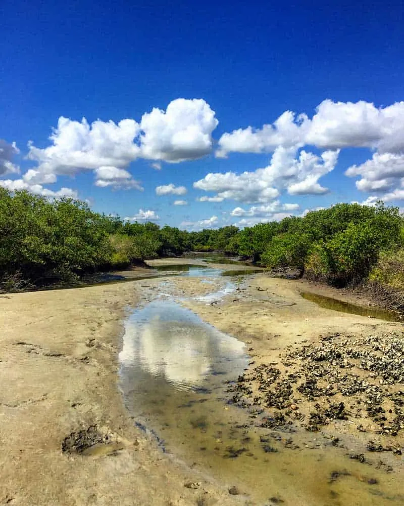
Tides however, are extremely important to consider when paddling this area. Many of the feeder canals and the creek bed dry up during very low tides. This makes for some really unique settings to explore but can definitely get you in trouble as it would be easy to find yourself short on water deep in the mangrove canals and stuck waiting until the tide comes back in.
Some areas you would be able to wade back out of, but many have deep muck or razor sharp oyster beds lining the bottom so stay aware of your way out and what the tides are doing.
Things to bring
Sun protection. Sun exposure is a real issue here, especially in the summer. Although I often refer to this area as a forest, red mangroves offer little to no canopy cover so expect to be in direct sun almost the whole time. I would recommend whatever method of sun protection you prefer. For me, that’s a big straw hat, rash guard, and sunscreen.
Foot protection. There are numerous oyster beds all over this area and believe me when I say they are razor sharp. If you decide to wade around at all, one foul step, and a stray oyster will happily unzip the bottom of your foot.
Water and food. We always bring enough for a full day just in case we get stuck deep in the mangroves waiting for the tide to roll back in. We often strap a small cooler to one of the boards.
Smartphone. You should have plenty of cell service in this particular area and having an app such as google maps is a huge help! Google maps has the canals designated on their maps although there are certain sections that are missing. We typically use the satellite map to scout out new regions to check out and see where certain canals or creeks will end up.
Flora and fauna when you kayak New Smyrna Beach
The canals hold a variety of fish species, and we have seen mullet, redfish and schools of bait fish. We’ve seen plenty of game fish in the deeper natural waterways in this area.
By far, oysters are king. At low tide, many of the vast oyster beds are exposed and are a pretty cool site to see and very carefully paddle around.
As far as plant life, its mangrove, mangroves, and more mangroves! The area is thick with red mangroves, leaving almost no access to dry land throughout most of the paddle.
Patches of raised dry earth, more common around the canals, do lead to some areas where larger trees have taken hold and these scattered gems actually make a great place to rest or picnic. They tend to pop up out of nowhere but you can also spot some of them on satellite maps.
Other considerations

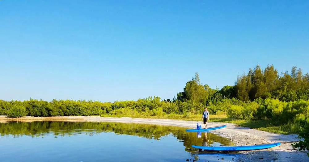
I prefer the stand up paddleboards to kayaks in this area. The water in the canals can get super shallow so the smaller draft of the boards is a plus. Also, it’s also nice to have that heightened vantage point when picking your way through tricky sections or looking around for dry land.
We’ve done this paddle in multiple conditions. Various tides offer very different experiences and while a high tide trip makes access to all the areas much easier, I very much enjoyed our recent low tide trip, as there were so many interesting features to explore.
For some sections, we actually just pulled the boards up onto the sand and walked around the canals exploring all the little streams that popped up as the last of the procrastinating puddles made a run for the main waterway.
That said, this is really a very tiny portion of a huge network of waterways that extends all the way down to Mosquito Lagoon. Much of the advice here extends to many of the areas south of here.
Resources for kayaking New Smyrna Beach
Two good put-in sites:
- George R. Kennedy Memorial Park, 103 N Riverside Dr, Edgewater, has restrooms, a fishing pier, pavilions and picnic tables. (Good for open-water paddling.)
- Callalisa Park, 598 S Peninsula Ave, New Smyrna Beach, has a boat launch and picnic tables but no restrooms. (Good for mangrove and backwater paddling.) Here’s and additional trail from this launch when you kayak New Smyrna Beach: Callista Creek paddles.
Another great NSB option: Spruce Creek paddle: A diamond in the rough
Things to do nearby:
- Oak Hill: Outpost on Mosquito Lagoon for seafood, history
- The Riverview Hotel & Spa: One Enchanting Weekend
- Apollo Beach, Canaveral National Seashore
- JB’s Fish Camp: Running with the crabs
- Bioluminescence kayak tours: Eerie glow at night on Mosquito Lagoon
A Florida native. Richard was born and raised in Orlando and spent most of his outdoor time in the Ocala National Forest and surfing near New Smyrna Beach. He spent six years at Florida Atlantic University in Boca Raton, where he was on the collegiate sailing team and an active research diver for the university. He earned a B.A. in biology and a M.Sc. in Biology Neuroscience in between surfing, spearfishing, and mountain biking. He was also a Graduate Research Assistant at the UCF College of Medicine, where he is working on his PhD in Biomedical Sciences. Outdoor adventure is how he recharges after endless hours in the lab.

Greg Westcott
Tuesday 18th of January 2022
"Just a mile east of the tourist-packed beaches of New Smyrna Beach is a network of canals and natural waterways..." Hmmm, going east from the beaches would actually put you in the Atlantic Ocean wouldn't it?
Bob Rountree
Tuesday 18th of January 2022
Ha! Yes it would! Thanks for catching. :-)