Palm Beach County parks are an easy way to commune with nature. Whether it’s a city, national, state, county or Solid Waste Authority (SWA) facility, you’ll find plenty to keep you outdoors enjoying Mother Nature.
Recently, I’ve been going for the biking trails. In many of these parks, it’s fairly easy to cobble together a long ride off busy streets. And for those with electric bikes, these trails are accommodating.

However, if your goal as a biker is to go far and fast, these parks aren’t for you. Trails are often winding and busy with bikers and walkers. And a long ride requires a lot of circling about.
If biking isn’t your thing, don’t worry.
At a Palm Beach county park, you’ll find plenty of other activities to enjoy including everything from wave riding to BMX competitions; from horseback riding to disc golf; from nature trails to ballfields.
And, of course, there are a variety of water features including lakes, rivers and wetlands to view water fowl, alligators and plenty of other animals. For the kids, there are splash parks and playgrounds aplenty.
If you don’t want to paddle, bike, walk, fish, play golf or bird watch, you can just sit under a tree and relax. Even your dog will find fun at dedicated poochie parks.
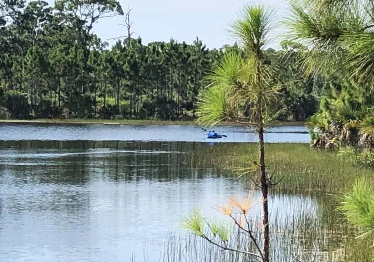
Top Palm Beach County parks: Okeeheelee Park, West Palm Beach
Where: 7500 Forest Hill Blvd., West Palm Beach
Facilities/Activities: BMX track, dog park, equestrian center, golf course, nature center and trails, bike and walking trails, ballfields, Shark Wave Park, fitness trail, tennis courts.
Hours: Sunrise to sunset. Lighted court facilities open until 10:00 pm.
More Information: 561-966-6600; Okeeheelee Park; park map.
Okeeheelee covers 1,700 acres making it one of the largest Palm Beach County parks in South Florida.
The facility spreads across Forest Hills Boulevard with the north side of the park more developed than the wetland and equestrian trails you will find on the south side of the divide.
For bikers and others who wish to take advantage of the trails in both areas, there are traffic lights to help you cross the busy street.
Although the trails in the northern section are paved, those in the southern section are mostly well-packed sand and gravel. They all work fine for bikes.
I was introduced to this park when I visited its Nature Center many years ago. They had just planted a butterfly garden that was slowly getting established.
Returning recently, I stopped to see that garden and was surprised by the number and variety of butterflies making it home.
Behind the center, you can walk trails that wind through 90 acres of woodlands.
Besides water birds in ponds, you’ll get to see white tail deer living harmoniously in an enclosure for safety. A pavilion with a pair of free telescopic glasses gets you up personal with the deer as they feed in the distance.
On my most recent visit, a raccoon joined them for lunch.
Elsewhere in the park, I’ve gotten off my bike at the track to view a BMX competition in which participants ranged from youngsters to seniors.
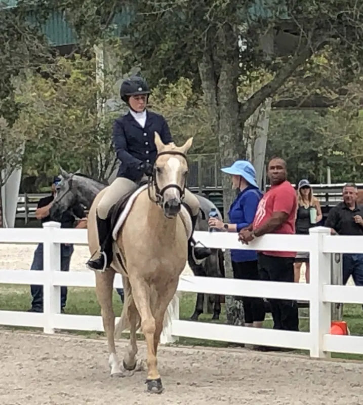
You can watch a horse show at the Jim Brandon Equestrian Center.
Motorboats are allowed on the park’s waterways and you’ll find water skiers being pulled behind them. Kayakers also ply the waters. You can rent kayaks or bring your own.
For fun, you and the kids can use the Shark Park 561’s Obstacle Island that is a floating playground complete with monkey bars, climbing towers, slides and more. And, regardless if you are a beginner or advanced wakeboarder, you can use the motorized cable system to go for a ride. It’s even fun to just watch the action.
You can also opt for either a round of disc golf on the lakeside course or a more traditional game at the nearby public Okeeheelee Golf Course that is a 27-hole championship-level course with driving range.
Rambler Tip: Bikes are not particularly welcome at the equestrian center as the horses don’t recognize what they are and get skittish. If you wish, you can bring a lock so you can leave your bike outside the competition area.
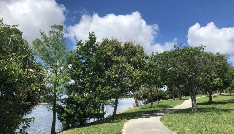
Top Palm Beach County parks: John Prince Park, Lake Worth
Where: Entrances at 2700 6th Ave S.; 2520 Lake Worth Road and 4759 S. Congress Ave., Lake Worth.
Facilities/Activities: Cricket field, basketball courts, boat ramps and boating, campground, dog park, basketball courts, biking/hiking paths, exercise course, fishing, nature trails, petanque and pickleball courts, splash park, walking trails, wheelchair exercise course.
Hours: Sunrise to sunset daily
More Info: 561-966-6600; John Prince Park; park map
On 725 acres set around the 338-acre Lake Osborne, John Prince Park offers water sports, paved biking and walking trails and more.
The second oldest county park in Florida, the reasons for its longevity are obvious.
A morning ride around the lake might have you viewing lots of wildlife including roseate spoonbills, ducks and other water fowl.
Bikers may find their way along Camp Site Road that borders a canal leading to the 48-acre campground.
This option not only adds distance to your ride but also gives you a chance to see some interesting camping rigs. I particularly enjoy the Airstream trailers that are there on most weekends.
Kayakers and other boaters can get out on Lake Osborne at the center of the park plus its more intimate waterways. There’s even a put-in designed especially for kayakers that’s protected from waves the motorboaters might create.
Morning walkers, many from nearby neighborhoods, use the park. And kids will enjoy the playgrounds and splash park while Fido is kept busy at the dog park.
Rambler Tip: For biking, we enter the park off Lake Worth Road and park our cars near the colorful playground and splash park where there’s also rest rooms, a few picnic tables by the lake and a pavillon for parties. The boat ramp and nearby kayak put-in are off a parking lot just east of here.”
Rambler Tip: Adults without children are not allowed in the playground/splash park area even though there are some nicely located picnic tables with lake views in there.
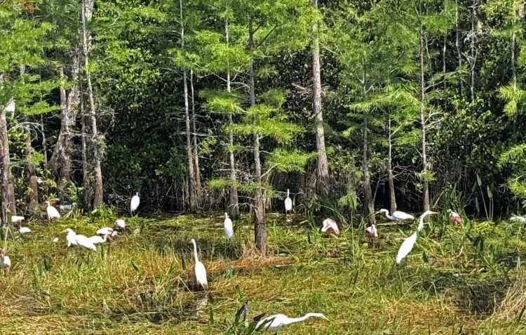
Top Palm Beach County parks: SWA Greenway Trail System, West Palm Beach
Connects to the Owahee Trail (in Grassy Waters Preserve)
Grassy Waters Preserve/SWA Greenway Trail System have a lot to offer that has been detailed in this must-read Florida Rambler post.
Where to enter the SWA Greenway Trail System: For easy bike access to both the SWA Greenway and the Owahee Trail, park at the Palmetto Trailhead Park which is actually the southern entrance to the SWA Greenway Trail System at 6600 45 St., West Palm Beach.
Walkers might prefer the northern entrance at 7501 N. Jog Road, West Palm Beach, as it is more centrally located to the SWA’s shorter nature trails.
Facilities/Activities: Chickee huts, hiking and biking trails, nature trails, informational kiosks.
Hours SWA Greenway: Sunrise to sunset daily
Hours Grassy Waters: Monday through Friday, 8 a.m. to 4:30 p.m.; Sunday 8:30 a.m. to 5 p.m.
More information on the SWA Greenway: 561-640-4000; 866-792-4636; SWA Greenway Trail System; park map
More information on the Owahee Trail: This trail is part of the Grassy Waters Preserve that borders the SWA facility; 561-804-4985; Owahee trail map
The SWA of Palm Beach County oversees the Greenway Trail System. The trails wind their way around 300 acres of natural area put aside when the SWA’s landfill and waste-to-energy facility were created on the property.
The land not only filters waste water but also forms a rookery for thousands of native birds, including the endangered Snail Kite and the threatened wood stork.
While you traverse the crushed concrete trails you might also see bald eagles, blue herons, great egrets, roseate spoonbills, sandhill cranes, pileated woodpeckers, deer and even an alligator or bobcat.
These 3.95-miles biking and walking trails in the Greenway connect with the 16.6-mile Owahee Trail. The latter is one of five trails (and the best one for biking) that you’ll find in the neighboring Grassy Waters Park.
The Owahee, a perimeter trail, follows a levee where you’ll bike on loose sand, dirt and crushed concrete. It can be rough in patches.
For walkers and bikers, the Greenway System includes the Butterfly Trail, Everglade’s Trail, Dragonfly Trail and Rookery Trail that is closed during nesting season from Feb. 1 through Sept 30.
Walkers may also enjoy the four other trails in nearby Grassy Waters Park including the Cypress Boardwalk and the Hog Hammock Trail that is a more shaded 4.5-mile biking/walking trail made of crushed concrete and boardwalks. Here you might spot a bobcat or feral hog.
Rambler Tip: Because there isn’t much shade on the Owahee Trail, you may want to save this outing for a cool day. Regardless, be sure to wear a hat/helmet and take water. If it is raining or has rained in the past few days, part of this trail also can be muddy.
Rambler Tip: The trailhead and parking lot for Hog Hammock Trail in Grassy Water Park can be difficult to find. From the Grassy Waters Nature Center and Cypress Boardwalk parking lot (8264 Northlake Blvd.), go east on Northlake Boulevard for just a few 100 feet. You’ll see a small incline in the road and just before that, on the north side of the street, is the parking lot. A small sign marks the entrance among what look like park administrative buildings. More parking information.
Palm Beach County parks: Wellington Environmental Preserve
Where: 3491 Flying Cow (Ranch) Road, Wellington
Facilities/Activities: Boardwalks, stunning butterfly garden, equestrian trails, observation tower, walking and biking paths.
Hours: 8 a.m. to sunset daily
More Information: 561-791-4005; Wellington Environmental Preserve
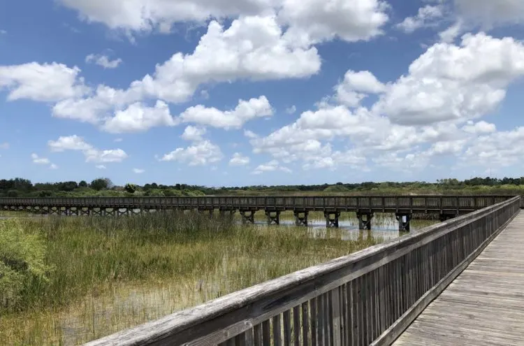
The Wellington Environmental Preserve is a 365-acre rainwater storage area with nature trails and boardwalks. Signage along the way creates learning centers.
Its smaller size might scale it better for walking or horseback riding than bike riding. But the beauty and wildlife of this park should draw anyone who enjoys being outdoors in nature.
The park includes over 3.5 miles of equestrian trails that connect with area homes and the approximately 65-mile Wellington bridle trail system.
The preserve, built through a partnership between South Florida Water Management District and Wellington, provides plenty of wetland that you cross on lengthy boardwalks.
The trails are short but wind around and intersect so that you’ll discover all sorts of secluded spots designed for wildlife viewing.
Riding in the park, we’ve spotted roseate spoonbills, rabbits, alligators, raccoons and snakes.
From a six-story (76-stair, yes, I counted) observation tower you get a sweeping view of the park and surrounding area.
The preserve and entire area are well-worth a visit.
Rambler Tip: I’ve been unable to find a good map of the trails making navigating them a matter of chance.
But the area is relatively small and there are points of reference you can see from many parts of the park including the observation tower and a white decorative trellis. You won’t get lost.
Rambler Tip: If you want to add distance to your bike ride, we suggest you explore the Aero Club Wellington where spacious homes have hangars and private airplanes lining a paved runway.
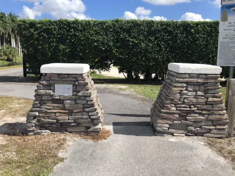
To explore the Aero Club, look for stone pillars along Flying Cow (Ranch) Road just north of the preserve’s parking lot at 3941 Flying Cow (Ranch) Road. They are on the east side of the street and mark the beginning of what’s called the “Yellow Trail” that will take you from the road towards the club.
Follow the trail east along a canal. At the end of the canal and trail, turn left on Palm Beach Boulevard and go a short distance until you come to signs marking the Aero Club. From here, enjoy exploring the development that is bordered by Greenbriar Boulevard and Aero Club Drive.
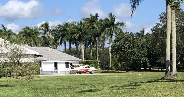
Along your way, be sure to ride down the quiet side streets to discover the homes with their own airplane or two, airplane hangars and taxi lanes to a central runway. Here’s a map of the area.
It’s even said John Travolta lived here until he bought a jet that could no longer be accommodated and moved to Ocala.
Best Palm Beach County parks: Riverbend Park, Jupiter
For more information, view this more detailed story about Riverbend Park and the adjacent Battlefield Park that appears on Florida Rambler.
Where: 9060 Indiantown Road, Jupiter
Facilities/Activities: Biking/hiking trails (about 10 miles), bike/kayak/canoe rentals, equestrian trails (7 miles), waterways (5 miles), fishing, connects with Florida Ocean-to-Lake Trail. Riverbend is adjacent to the Loxahatchee River Battlefield Park with its historic sites.
Hours: Sunrise to sunset daily
More Information: 561-741-1359; Riverbend Park; park map; traildistances.pdf (pbcgov.org)
On these 600 acres at the headwaters of the Loxahatchee River, you can access subtropical forests, wetlands and meadows courtesy of Palm Beach County and the South Florida Water Management District.
The park’s 10 miles of biking and hiking trails made of compacted shell rock can be busy, especially on weekends. And although they loop and turn, there’s good signage to keep you from getting too lost.
On hot days, there’s plenty of shade.
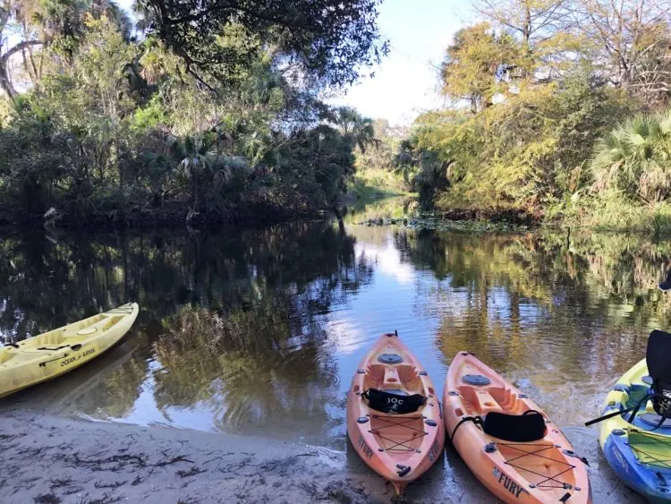
You can rent a kayak or canoe or bring your own to follow the river north to Jonathan Dickinson State Park (you’ll have to do some portaging) or south to the Jupiter Inlet and the ocean.
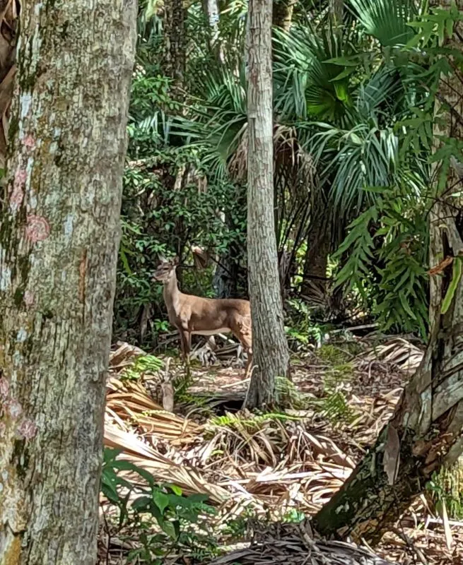
As you enjoy this natural area, you may see deer, wild turkeys, owls, ibis, herons, fox, bobcats, alligators and much more.
Rambler Tip: No pets are allowed in this park and refuse is carry-in/carry out. And because it is managed as a natural area, there are no sports fields or playgrounds. Come and enjoy nature.
Rambler Tip: Bikers may want to add more mileage to their trip by exploring the Jupiter Farms area that stretches between the park and Jupiter Farms Road. That roadway runs north/south parallel to the park. You can exit and enter Riverbend Park into the Jupiter Farms area along Jupiter Farms Road or off Riverbend Trail in the park.
Jupiter Farms Road has a paved bike path that makes it easy to ride. Take a break at Jupiter Farms Park where you may see horseback riders in a practice area.
Best Palm Beach County parks: Jonathan Dickinson State Park, Hobe Sound
This park has a lot to offer. See more details in Jonathon Dickinson State Park from Florida Rambler.
Where: 16450 S.E. Federal Hwy., Hobe Sound
Facilities/Activities: Fishing; canoeing/kayaking; boat and bike rentals and boat tours; four nature trails; picnic areas; equestrian trails, paved and off-road bike trails; cabins and two campgrounds; observation tower; nature center.
Fees: $6 per vehicle (two to eight people); $4 single-occupant vehicle or motorcycle; $2 pedestrian, bicyclist, extra passengers, passenger in vehicle with holder of Annual Individual Entrance Pass. Tickets can be purchased online.
Hours: 8 a.m. to sundown daily
More Info: 772-546-2771; Jonathan Dickinson State Park; park brochure/map.
Jonathan Dickinson State Park is named after the Quaker merchant Jonathan Dickinson who was shipwrecked off the coast in 1696. During World War II, the land was home to Camp Murphy, an army base for Southern Signal Corps School.
Today, the barracks are still visible at this well-maintained park that covers over 11,000 acres. It’s made up of 16 ecological communities including sand scrub, pine flatwoods and bald cypress swamps. And about 20 percent of the park is covered in coastal sand pine scrub, a community so rare it is designated “globally imperiled”.
You might start your outing by parking at and visiting the Kimbell Education and Visitor Center where maps are available. This lot requires a drive deep into the park. Volunteers manning the center can tell you about the park’s six different walking trails and multi-use trail.
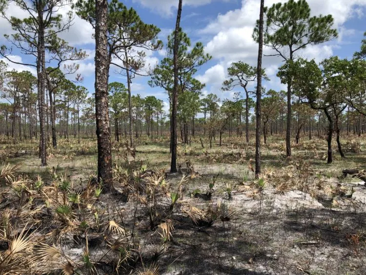
For bikers, there are well-defined paved paths, packed sand paths and less-traveled roadways that wind through the park.
For the more daring bikers, there is the Murphy Trail, a popular off-road adventure.
The wild and scenic Loxahatchee River that passes through the park is a great place to get out on the water to see wildlife. The river also provides access to the Trapper Nelson Site, a 1930’s pioneer homestead.
And don’t miss Hobe Mountain that is part of the Atlantic Coastal Ridge, a series of dunes and hills which parallel the Southeastern Florida coastline providing 86 feet of elevation above sea level and desert-like conditions. This is the highest natural point south of Lake Okeechobee.
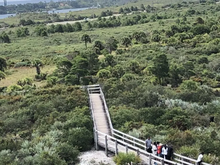
Here too you’ll find the Hobe Mountain Tower. You approach it on a boardwalk through the sand pine scrub covering the park’s ancient dunes. Climb it for a view of the dunes, Atlantic Ocean, Intracoastal Waterway and the entire expanse of the park.
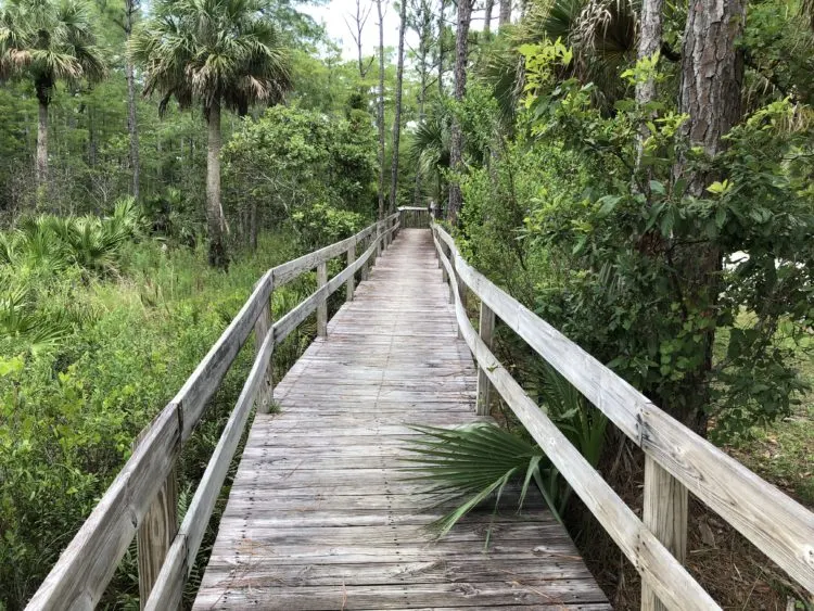
Rambler Tip: On the park map, you’ll see a “Gator Culvert” marked. As you might expect, it’s a culvert under Park Drive where gators tend to hang out. But what the map doesn’t show is a boardwalk that parallels the north side of the road and ends at the culvert. This gives you a good view of anything lurking in the water.
Story Credit: I would like to thank the members of my Sunday biking group for introducing me to many of these parks and preserves. I’d like to particularly thank Gene Tanner who keeps us organized and Ellen Joseph who leads the way. Enjoy the ride.

Deborah Hartz-Seeley is a Master Gardener whose yard is certified as Florida Friendly. With a master’s degree in agricultural journalism, she’s written for the Sun-Sentinel, Miami Herald, The Coastal Star, Cook’s Magazine, Florida Food & Farm and Florida Design. If she’s not out back growing things, you’ll find her wandering a garden path or exploring nature on foot, on a bike or in a kayak.
