A prime campground on the north rim of Ocala National Forest, Rodman Campground is a well-groomed state park adjacent to the bass-filled Rodman Reservoir, Ocala National Forest and gateway to the Cross-Florida Greenway.
Besides excellent fishing, this state park features a scenic trail for hiking and off-road bicycling atop the levy of the Cross Florida Barge Canal, construction of which was abruptly halted at this spot decades ago as an environmental boondoggle.

Left behind is the first section of the barge canal, the linear Rodman Reservoir (also known as Lake Ocklawaha) and a spillway routing the north-flowing Ocklawaha River to the St. Johns River just above Lake George.
Wildlife abounds, birds are ever present, a benefit of the vast wilderness preserves, wetlands and forests that surround the park.
Immediately adjacent to Rodman Campground are the Rodman Recreation Area and Reservoir, massive Ocala National Forest and the 110-mile linear Marjorie Harris Carr Cross Florida Greenway, an environmentally pristine wildlife corridor cobbled together from land acquired for the Cross-Florida Barge Canal along the Ocklawaha River.
The Rodman Campground
The Rodman Campground has 60 sites in two campground loops, including 34 RV or tent sites with electric and water hookups and another 26 sites for tents without hookups.
The newer loop includes ten RV sites (#59-68) that face — but do not have access to — the Cross-Florida Barge Canal.
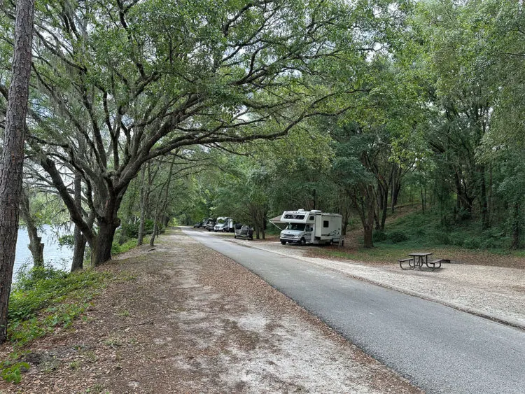
We camped in the newer loop (on Site #46), where the sites are spacious and well-shaded. We were close to a clean bath house, which has a coin-laundry pod and outdoor sinks for dish washing. (Adjacent sites #49 & 50 are handicap sites.)
Most of all, we had plenty of room to breath. There was a ridge behind us, created in the 1960s with dredge from the barge canal. The ridge has grown into a lush forest alive with wildlife and cooling ground cover.

Across from our site was grouping of shady sites that backed up to a meadow that provides a wide-open play area for kids, framed by an equally appealing forest.
I was really surprised to see most of those sites empty, given their appeal. I imagine they are well-booked on weekends, when kids are out of school.
The primitive campground loop for tents only (sites 14-39) had its own charm. Lush sub-tropical vegetation and more shade than you’ll find in most Florida campgrounds. It was magical. The photo below doesn’t do it justice.
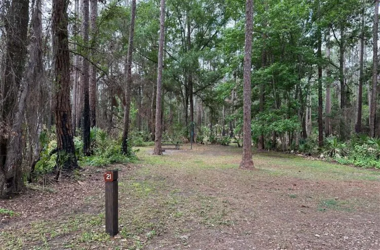
Across from the primitive campground is a string of RV sites (site #1-13), which line up near the boat ramp. These sites are perfectly adequate, shaded but somewhat close together. This RV loop includes six pull-through sites.
Things to do at Rodman Campground State Park
Things to do: Bicycling, fishing, birding, boating, hiking, mountain biking, wildlife.
Fishing is the big attraction in the Rodman Campground and Recreation Area. The 9,500-acre Rodman Reservoir has been rated in the Top 10 Trophy Bass Lakes in Florida by the Florida Fish and Wildlife Conservation Commission.
The campground has a boat ramp offering access to the reservoir and the barge canal, and prime fishing can be found near the Rodman Dam, an earthen dam with a spillway into the Lower Ocklawaha River.
Go past the spillway and turn left at the first turnoff, which will take you below the spillway to a fishing pier and kayak launch.

But casting a line into the reservoir and nearby rivers is hardly the only thing to do here.
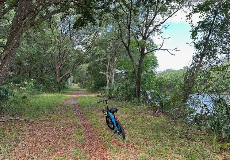
The 1,300-mile National Florida Scenic Trail runs through the park, including a 5.1-mile segment open to bicycles (and e-bikes) alongside the barge canal.
This segment of the trail was obviously created as a canal service road, so it’s in decent shape. Not necessarily smooth, but it is easily navigable with a mountain bike that can handle a few bumps. Helmets are advisable and required for children.
I took my e-bike out on the trail and was able to maneuver enough so as to enjoy the scenery and solitude this trail provides.
Birding opportunities abound throughout the park, on the reservoir and nearby forests. Shore birds are a regular year-around attraction near water.
Commonly seen species of wildlife include white-tailed deer, wild turkey, wading birds, hawks, bald eagle, osprey and alligator.
History of the Cross Florida Barge Canal
A waterway crossing the Florida peninsula was first conceived during the 16th Century by Pedro Menendez de Aviles, founder of Spanish St. Augustine, as a shortcut for Spanish galleons carrying riches from the Caribbean to Europe.
The route was originally intended avoid the treacherous rounding of the lower Florida peninsula, where pirates lay in wait, ships would wreck on coral reefs and fierce tropical storms and hurricanes would plague passage during summer and fall.
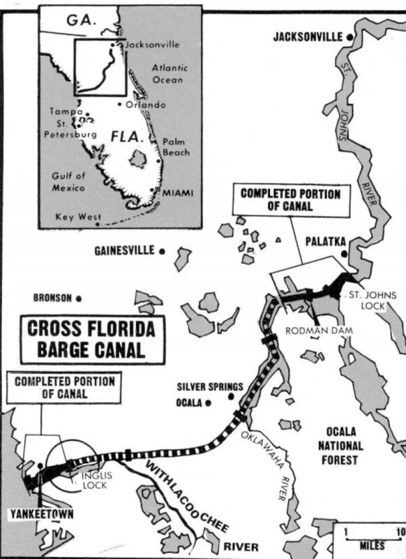
The concept for the canal was revived in 1818 by the U.S. War Department as a remedy for commercial losses from shipwrecks and piracy, but it wasn’t until the 1930s that any construction activity took place, largely at the urging of local politicians.
After multiple starts and stops during the 30s and 40s, the project was again restarted in 1963 and continued until 1971, when environmentalists led by activist Marjorie Harris Carr won a temporary injunction that culminated in an executive order to scrap the project by President Richard Nixon.
The project was officially deauthorized by Congress in 1990, and the lands were turned over to the state of Florida for use as public conservation and recreation area, becoming the Cross Florida Greenway State Recreation and Conservation Area in 1991.
The north-flowing Ocklawaha River was to be the core waterway in the canal system.
Understanding the Ocklawaha River System
This took me awhile to figure out, what with the oddly north-flowing and twisted flow of Ocklawaha River caused by man-made diversions.
A hundred-plus miles south of the Rodman Reservoir, at the river’s source, a number of man-made canals and natural creeks linking a bevy of lakes as far south as Orlando poured even more water into the Ocklawaha than mother nature intended.
At its source, the Ocklawaha is fed by interconnected Lake Eustis, Lake Harris, Lake Dora, Lake Beauclair and Lake Apopka. As the river flows north from these lakes, it’s main tributary is the Silver River, which carries the outflow from Silver Springs into the Ocklawaha.
The river’s watershed also includes the massive Green Swamp, which occupies a huge swath of wetlands framed by the Florida’s Turnpike, I-75 and the I-4 triangle.
All of that water flows into the Ocklawaha River, which carries it north more than 100 miles through the Cross Florida Greenway to the Rodman Reservoir.
From the reservoir, the river spills through the Rodman Dam into the Lower Ocklawaha River, which flows southeast through vast wetland prairies marking the northern border of Ocala National Forest to the St. Johns River at Little Lake George.
Cross-Florida Greenway
While marking the end of the Cross-Florida Barge Canal, the Rodman Campground and Recreation Area also marks the beginning of the Cross-Florida Greenway, which rose from the spoils of the abandoned canal.
Land purchased for the canal along the Ocklawaha River lay undisturbed through decades of the canal’s starts and stops, a 110-mile linear park was created, stretching from the St. Johns River to the Gulf of Mexico.
Aside from protecting the Ocklawaha River from development, the park offers more than 300 miles of trails for paddling, hiking, bicycling and equestrians.
The Greenway is also a major wildlife corridor, a protected land bridge if you will, especially for black bears who can roam freely to and from Ocala National Forest.
The varied environment of the Greenway attracts all manner of birds, including migrating species who enjoy the natural, undisturbed path the land bridge offers across the state.
There are four fully developed campgrounds along the Greenway accommodating both tents and RVs:
- Ross Prairie Trailhead and Campground, along the southern boundary of the Greenway on the east side of State Road 200, adjacent to the entrance to Ross Prairie State Forest. Sandhill and wetland prairies provide habitat for wildlife, offering a trail system worthy of exploration by foot, by bicycle and by horseback. 10660 S.W. Highway 200, Dunnellon FL 34431. Phone: 352-732-2606. Reservations online at reserve.floridastateparks.org
- Shangri-La Trailhead and Campground, along the southern boundary of the Greenway in rolling sandhills 5 miles west of I-75 at the County Road 484 exit. Evidence of the canal diggings remain, though now grown over, with access and overnight opportunities to explore the myriad network of well-marked trails through rolling sandhills and scrub. 12788 S.W. 69th Court, Ocala FL 34476. Phone: 352-347-1163. Reservations online at reserve.floridastateparks.org
- Santos Trailhead and Campground. Eighty-plus miles of single-track diverse bike trails for beginners as well as expert-level trails. Just west off U.S. 441 at 3080 S.E. 80th St.Ocala FL 34470. Phone: 352-369-2693. Campground reservations online at reserve.floridastateparks.org
- Rodman Campground. See details below.
Rodman Campground State Park, 108 Rodman Dam Road, Palatka FL 32177. Ranger station: 386-326-2846. 64 sites, including 38 with electric and water hookups and 26 primitive tent sites. Camping Fee: RV sites: $22 with hookups, plus $7 daily utility fee and a non-refundable $6.70 booking fee; Tents, no hookups, $12/night, plus taxes and a non-refundable $6.70 booking fee. Pets: OK in campground. Reservations: Book online up to 11 months in advance.
Note: As of January 1, 2024, Florida residents will have a 30-day head start to book campsites at all Florida State Parks, and the reservation window will be reduced to 10 months for non-residents.
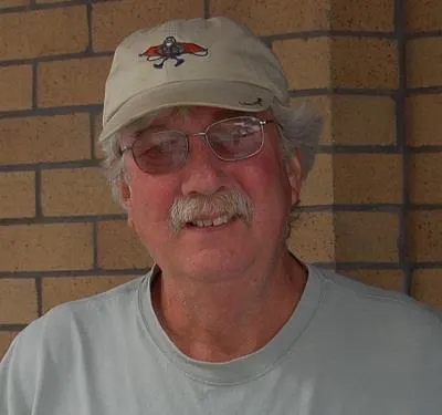
Bob Rountree is a beach bum, angler and camper who has explored Florida for decades. No adventure is complete without a scenic paddle trail or unpaved road to nowhere. Bob co-founded FloridaRambler.com with fellow journalist Bonnie Gross 14 years ago.
