
The northernmost section of Florida’s A1A weaves through some of the most unspoiled islands and oceanfront lands along the Atlantic. Happily, there’s a segment of coastal highway here that makes a great scenic drive.
Called A1A Ocean Islands Trail, this route is designated a scenic byway by the Florida Department of Transportation.
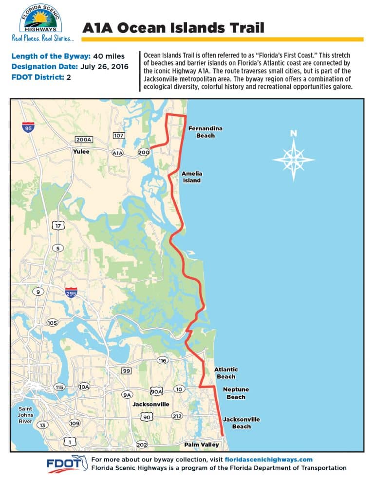
This scenic drive is the 40 miles of A1A between Jacksonville Beach and Fernandina Beach. It has sections with a shaded canopy of oak trees festooned with Spanish moss, places to stop and explore some of Florida’s most beautiful beaches, hikes and kayaking spots, plus some of the most fascinating historic sites in Florida.
Because it’s so short, you can drive it in a couple hours even with many pullovers. But with all the places worth exploring, there’s enough to do to warrant several days.
Come along with us as we drive north from Jacksonville Beach. I’ll highlight places to see and also spots worth spending a few hours or even a full day.
Jacksonville Beach
I had never driven through Jax Beach, as it is universally known, and let me say up front: This is the least scenic part of this drive. The beach itself is spectacular, but you don’t see it from A1A. If you drive along smaller roads closer to the Atlantic, it has a bit of beach town charm. But A1A and the “scenic drive” here looks like every other commercially developed road in Florida.
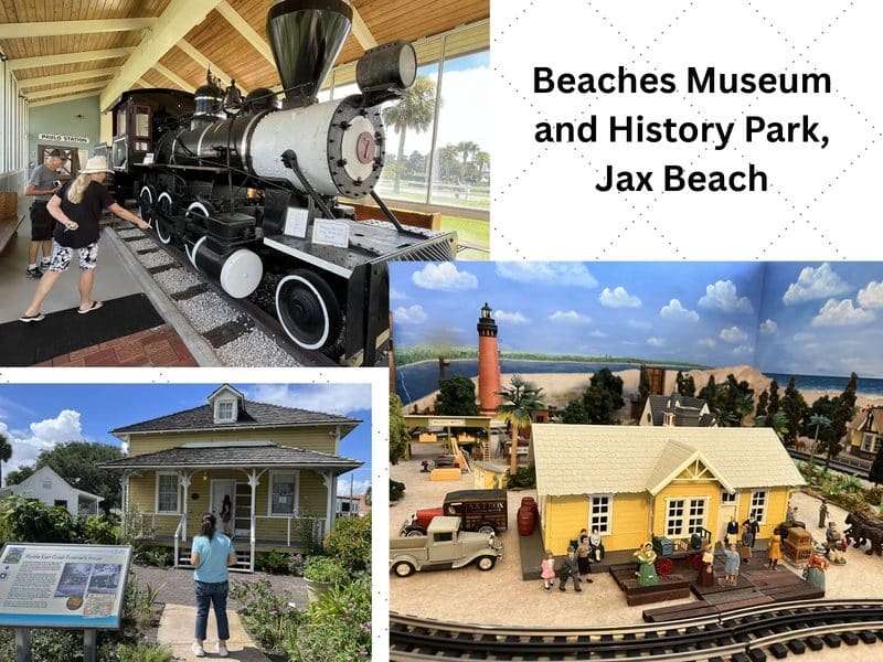
You could skip this part and start in Mayport, but if you like Florida history as much as I do or if you’re a train buff, there is a stop here I recommend: the Beaches Museum and History Park, 381 Beach Blvd., Jacksonville Beach. (904-241-5657).
The history park is a beautifully landscaped block to which half a dozen historic buildings have been moved, each with a story to tell about Old Florida and the development of this area. A docent from the museum will take you inside the buildings and tell you about each. Admission is free. Train lovers will enjoy the chance to climb into the cab of a 1911 steam engine once used to haul cypress trees out of Florida swamps. You can even ring the train bell.
Because the museum is located at the site of a depot of the Florida East Coast Railway line connecting Jacksonville to the beach, there are many interesting train-related artifacts. Train lovers will enjoy a working model railroad layout that includes miniature versions of these buildings, historic lighthouses and other landmarks.
Historic Mayport
At this historic fishing village dominated by Mayport Naval Station, you can see shrimp boats moored along the St. Johns River and stop at historic Singleton Seafood Shack, a Mayport institution since 1969. Singleton serves fresh local shrimp and fried seafood baskets dockside on the river; it is not an insult to call it a shack. It’s a no-frills experience and those who love it enjoy its rustic style.
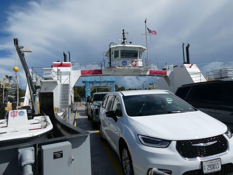
One of the novelties of the A1A Ocean Islands Trail is the opportunity to drive your car onto one of Florida’s rare car ferries. The St. John’s River Ferry (which everyone calls the Mayport ferry) runs every 30 minutes and costs about $7.
You do get to look at Mayport’s waterfront from the ferry, but don’t blink. This ride takes only five minutes and we were the only people aboard to leave our car.
Batten Island and St. George Island
When you leave the ferry, you turn right and the scenic part of this drive begins on Batten Island.
If you didn’t lunch at Singleton’s, consider the landmark Sandollar Restaurant with waterfront tables along the St. Johns River. People have been loving the views and the fresh seafood here for seven decades.
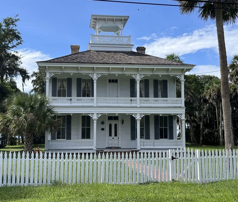
Almost immediately, you’ll see on your left a handsome 1878 two-story white home with Victorian trim. It’s not open to the public and there’s no sign, but it was the home of Florida’s 19th governor, Napoleon Bonaparte Broward. Known as the Broward House, it’s at 9953 Heckscher Dr. There IS a historic landmark sign there, because this is the site where French Huguenots knelt in 1562 and uttered the first Protestant prayer in the new world.
The Broward House is located at the intersection with Fort George Road, which is not part of the official scenic drive. But if you have the time, I highly recommend you add a detour and add a drive on Fort George Road to your route.
This area is operated by the National Park System and these lands are part of the Timucuan Ecological and Historical Preserve. There is a five-mile loop on St. George Island through undeveloped land, with trees forming a canopy over the road and views of salt marshes. If your goal is soaking up pretty scenery, this little loop is a must.
Here’s an extensive Florida Rambler article about the Timucuan Preserve.
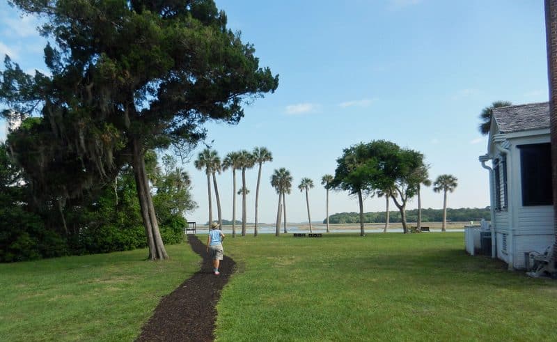
If you have more time, this loop takes you to two significant historic sites worth stopping to explore:
- The Kingsley Plantation, a well-preserved 1798 plantation house and remnants of 25 slave cabins, with grounds overlooking a scenic salt marsh on the Fort George River.
- The Ribault Club, which represents the 20th century era when millionaires wintered on Fort George Island.
The Kingsley Plantation, with a powerful story of enslaved people working here first under Spanish and then, under the different laws of American rule, is one of my favorite historic sites in Florida. Though it’s part of a national park, admission is free. Even if you can’t take the audio tour (which I recommend), it’s worth walking around the grounds. Here’s a Florida Rambler story on the Kingsley Plantation.
After your side trip to St. George Island, back on the main route, you head north on Heckscher Drive and a series of terrific parks.
Big and Little Talbot Islands State Parks
Almost immediately on your right is a county park, Huguenot Memorial Park, located on a sandbar at the entrance to Jacksonville’s harbor. It’s a prized camping location and one of many beach destinations. Here’s a Florida Rambler story on Huguenot Park.
Next you drive across Little Talbot Island, which offers two beach pavilions and a four-mile hiking loop starting from the ranger station.
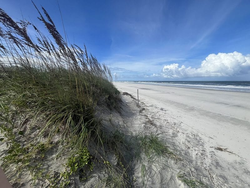
We stopped at South Beach Pavilion, parked and walked through picturesque dunes to a wide, hard-packed stretch of sand where we could have walked for miles. This is a wild and natural beach, with room for everyone and no development in site. You could easily spend a few hours enjoying this location (and the other beaches in these state parks.)
Here’s a Florida Rambler story on the Talbot Island state parks and adjoining state and federal parks.
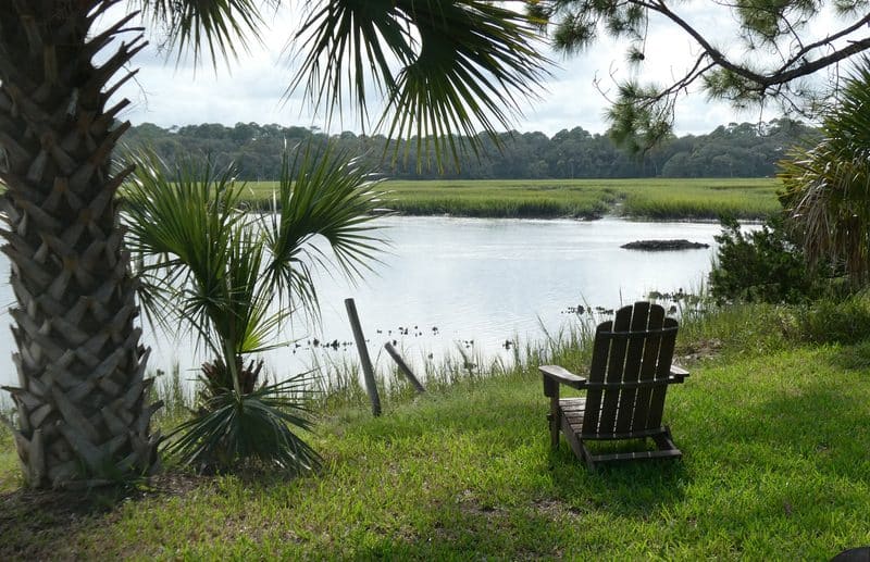
Heading north, just as you cross onto Big Talbot Island, you will pass on your left the area’s kayak outfitter, PADL Amelia and Talbot Islands. You can launch here into bird-filled salt marshes, either on a guided tour, renting a boat or launching your own. You need to launch and paddle here around high tide. Consult the outfitter for guidance.
Crossing Simpson Creek, you are in Big Talbot State Park, where there are several opportunities to pause.
If you have bikes, there’s a scenic paved four-mile trail winding through maritime forest and overlooking wetlands.
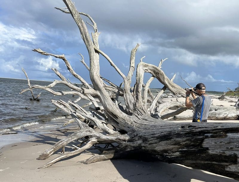
The real “don’t miss” stop here is the Blackrock Trail. Watch on the right about 2.5 miles after the kayak launch for parking for this trail. The trail is a shady half mile walk through beautiful woods to a section of beach called Boneyard Beach or Driftwood Beach. Here, there’s about a mile of beach filled with bleached tree trunks and limbs creating dramatic scenes that photographers love to capture.
At the northern end of Big Talbot is a picnic area called the Bluffs, which offers panoramic views of Nassau Sound as it opens to meet the Atlantic Ocean. On the east side of the road, the Bluffs got its name from a 20-foot eroding coastal bluff along the beach.
The last potential stop before leaving Big Talbot is the George Crady Bridge Fishing Pier State Park, a mile-long, pedestrian-only fishing bridge across Nassau Sound. It’s said to be one of the best fishing areas in Northeast Florida. Parking is in a lot on the west side of A1A.
Across Nassau Sound, immediately on your right is yet another state park, Amelia Island State Park. This relatively small beach park (200 acres) is an unspoiled wilderness on the southern tip of Amelia Island. To preserve it, the park is limited to 300 people at a time and a maximum of 600 people per day.
Amelia Island
Across Nassau Sound you enter Amelia Island, where you reach the last 12 miles of this scenic trail, and this section is truly scenic.
Everybody loves canopy roads, where the trees arch over the pavement creating a shady, green tunnel. Amelia Island features miles of the most beautiful canopy roads in Florida as you drive north toward the historic town of Fernandina Beach.
We made three special stops on Amelia Island, where there is a lot to see and do.
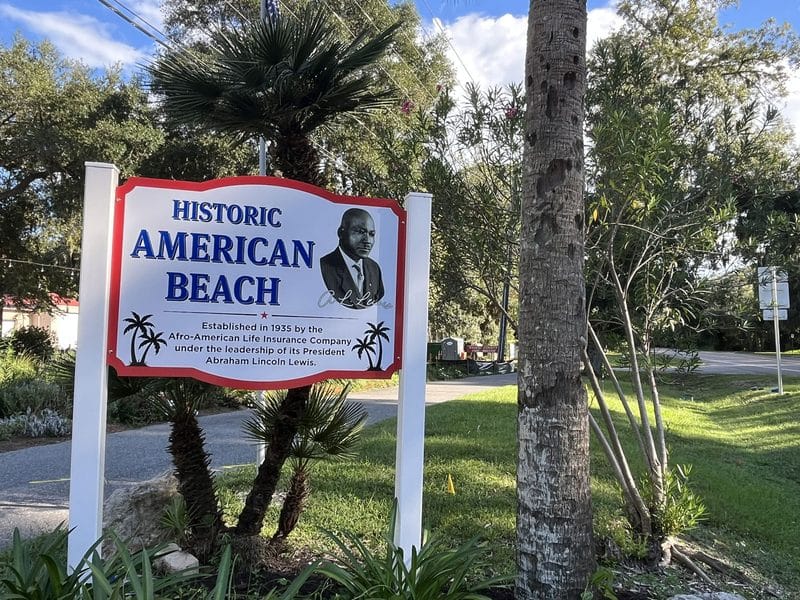
First, I have long heard about American Beach, a resort for Black families created in 1935 by Abraham Lincoln Lewis and his Afro-American Insurance Company. During segregation, this was the rare beach destination where Blacks could gather and relax.Today it looks like an appealing neighborhood beach community, with a mix of modest homes and mansions.
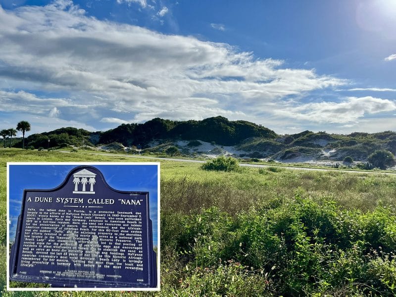
I liked the two historic markers. One marked the site of a once-popular, now closed nightclub that featured the great black musicians of the day. The other recognized the largest dune structure in Florida, a dune system called Nana, saved by a vigilant resident, MaVynee Betsch, the great-granddaughter of Abraham Lincoln Lewis and herself a fascinating environmental activist who died in 2005.
Our second stop was Fernandina Beach, a delightful historic town where we stayed at the Amelia Schoolhouse Inn, a small hotel inside a historic schoolhouse, which is walking distance from the charming downtown. (Forgive me: I will probably use the word charming a dozen times in describing Fernandina Beach. It’s that charming.)
Florida Rambler story on Amelia Island.
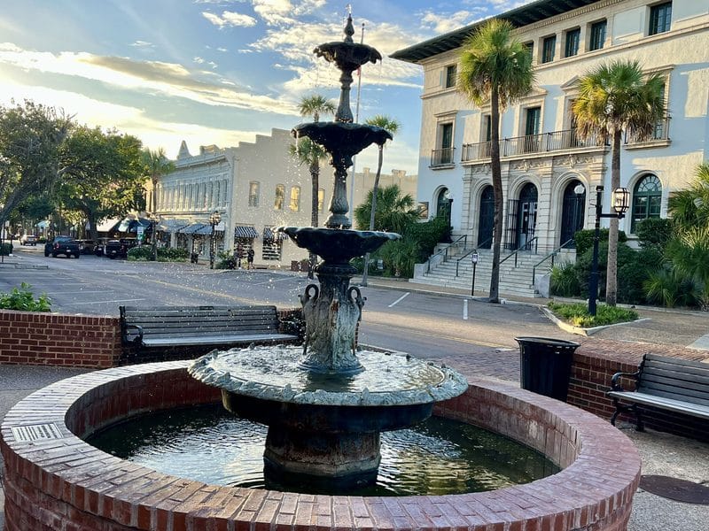
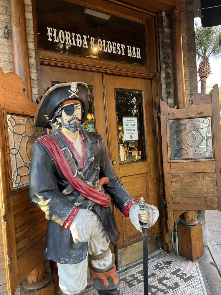
Fernandina Beach has preserved many historic buildings, including a walkable downtown full of bars and restaurants, several of which had live music (and this was a weeknight in the off-season month of September). We enjoyed a drink at the Palace Saloon at the center of the downtown; how could we not stop? It is the oldest continuously operating bar in Florida.
Fort Clinch State Park
Our third stop on Amelia Island is a must-see, whether you just drive through or you stop to spend the day: Fort Clinch State Park.
Located on the top of the island with Georgia visible across the water, Fort Clinch benefits from its end-of-the-road location. It feels like its own little world, far from the Florida of traffic and fast food outlets.
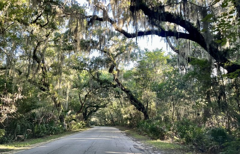
You enter by driving three miles through a pristine maritime hammock, a canopy of oak trees. Of all the scenic roads on this scenic drive, this one was my favorite.
The road splits: Left, you go to the fort; right, you go to the beach. Both are beautiful and fascinating. We thoroughly enjoyed our past visit to the fort, so this time, we went to the beach, where there were only a handful of other people and a wide beach where you could walk for hours. It was fall surf-fishing season and we stopped to watch a woman reel in her catch.
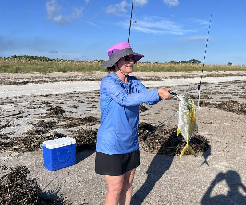
The beach offered good shelling, solitude and beauty. Here’s a Florida Rambler story on Fort Clinch State Park.
It made a perfect ending to a scenic byway through one of the rare unspoiled beachfront areas in Florida.
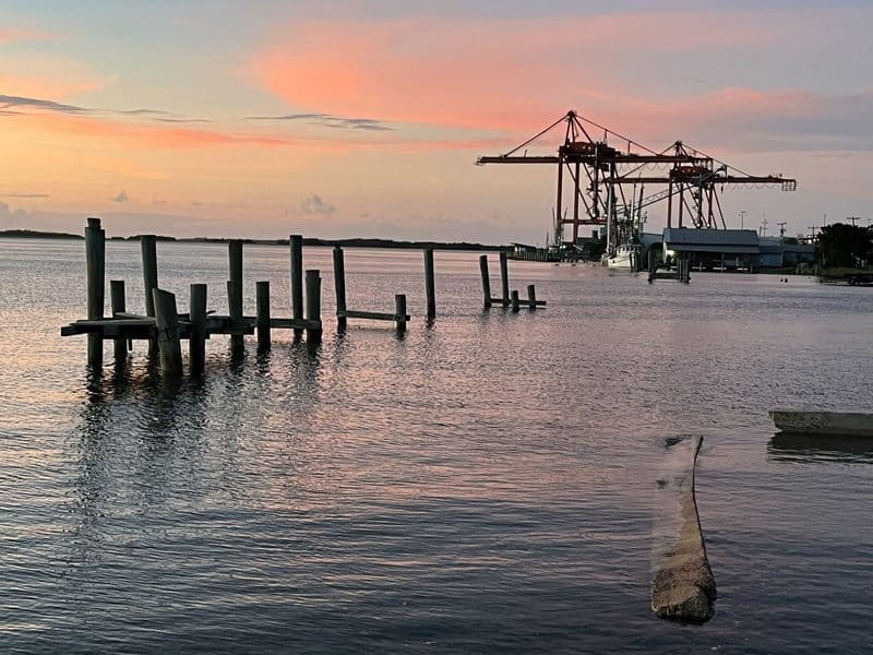
Tips on planning a trip to this area: With all there is to see, you might wonder if you should make several overnight stops along this route, but it’s so short that is not feasible, so it’s best to pick a base. If you’re a camper, a campsite at one of the Talbot Islands or other campgrounds in county parks in this area would be perfect. For non-campers, a base on Amelia Island allows you to reach any of these locations in 30 to 45 minutes.
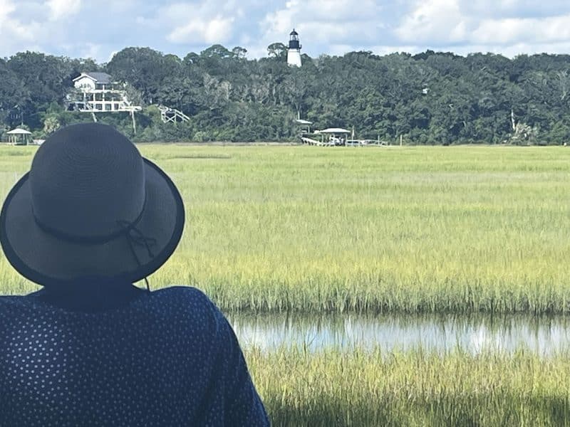
For our most recent trip, we fit this byway into a road trip north, staying one night in Fernandina Beach and seeing most of what I described above in five hours each day. (On this trip, the only museum we explored was the Beach Museum, as we had previously visited the Kingsley Plantation and Ribault Club. I will have to go back another day to kayak and bicycle!)
Here are Florida Rambler stories that will help you research a trip to this region:
- Timucuan Preserve: The Florida national park you’ve never heard of
- Kingsley Plantation: Moving tale of slavery unique to Florida
- Huguenot Park: Pristine beach with camping on a Jacksonville sandbar
- Talbot Island State Parks and adjoining lands: A grand collection of preserves and plantations, beaches to back country
- Amelia Island: 11 outstanding outdoor things to do in Amelia Island
- Fort Clinch State Park: Worth a drive to explore Amelia Island park with all sorts of fun
Wonderful and intriguing narrative
We live at Fort Lauderdale and would love to tour, visit, and partake to soak in the trip
For planning purposes where might you suggest we lodge on the South before starting the AIA experience
Could also provide a mid 40 miles lodging recommendation
And Lastly a third lodging at the end of the A1A travel
Many thanks
Steve kimmel
Skimmel7@comcast.net
301.651.1562
PS our group will consist of 6 seniors all former snowbirds who have homesteaded here in Fl and would appreciate any additional trip must stop and see/do/experience as we ingest more about our new home State
Thank you for the kind words.
I can’t recommend specific hotels where I haven’t stayed, but I can make some more general suggestions for an itinerary.
Driving from Fort Lauderdale, you could make your first night along A1A a little further south than where this article begins. I’d drive up I-95 and stop at St. Augustine Beach, Anastasia Island, or Vilano Beach.
If you start the next morning on A1A at Vilano Beach heading north, you’re on a scenic route with glimpses of the Atlantic Ocean on one side and the Tolomato River or Intracoastal Waterway on the other. You’ll soon reach the section of A1A in this article.
That day, I’d explore along A1A making whatever stops that appeal to you. I’d save stops in Amelia Island until the next days. The ideal pacing would have you crossing the river into Amelia Island in the afternoon in time for dinner and a hotel in Amelia Island.
I’d stay two nights in Amelia Island. While there are great beachfront hotel choices, I like the hotels near historic Fernandina Beach. We enjoyed the Amelia Schoolhouse Inn, mentioned in the article. The Hampton Inn Harbor Front is also a great location.
From there, I’d plan a day exploring Amelia Island, hitting Fort Clinch and other things that appeal to you, and coming back to Fernandina Beach for dinner and an evening stroll.
I hope this helps.