There are two ways to cross the bottom of the Florida peninsula — the fast four-lane Alligator Alley (I-75), or the more scenic two-lane Tamiami Trail (U.S. 41).
Both roads will take you through miles of Everglades scenery with glimpses of alligators sunning along the waterways and Everglades birds in the trees.

But the Tamiami Trail gets you closer to the scenery, and it offers several outstanding stops along the way. (You’ll also drive across 3.5 miles of bridges designed to return natural water flow to Everglades National Park. The bridges, opened in 2013 and 2019, are part of the largest construction project in the history of the National Park Service. See below for more on this.)
If you’re visiting South Florida and want an Everglades experience, a day exploring along the Tamiami Trail is a suitable substitute for a day in Everglades National Park, as long you take your time, walk the boardwalks and visit a state park or Big Cypress National Preserve visitor center along the way.
How to make the most of driving the scenic Tamiami Trail
The Tamiami Trail (U.S. 41) begins in downtown Miami at Brickell Avenue and for many miles it is Calle Ocho, running through the heart of Miami’s historic Cuban community.
About 20 miles west of downtown, at Krome Avenue, the city is behind you and the road heads into the Glades. (The corner of U.S. 41 and Krome is home to the casino operated by the Miccosukee Indians.)
Beyond the casino, the road passes several opportunities for air boat tours. The National Park Service authorizes three airboat tour companies inside Everglades National Park: Coopertown, 22700 SW 8th St., Miami, (305) 226-6048; Everglades Safari Park, 26700 SW 8th St., Miami, (305)226-6923; and Gator Park, 24050 SW 8th St., Miami, (305) 559-2255. Coming from Miami, these are all before you come to the Everglades National Park entrance.
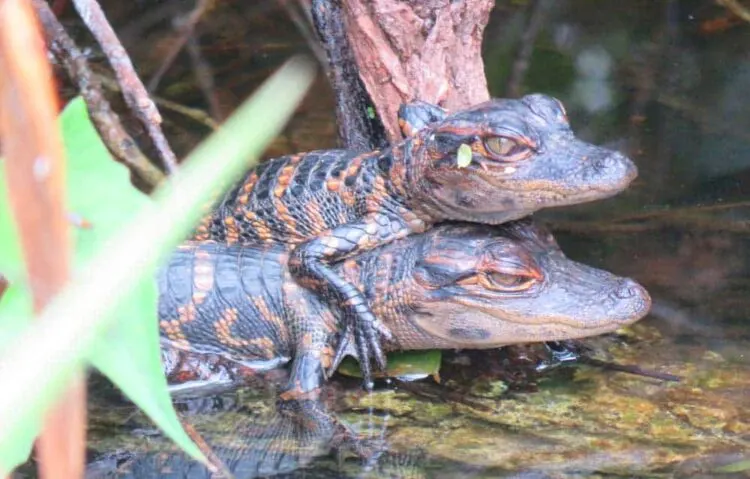
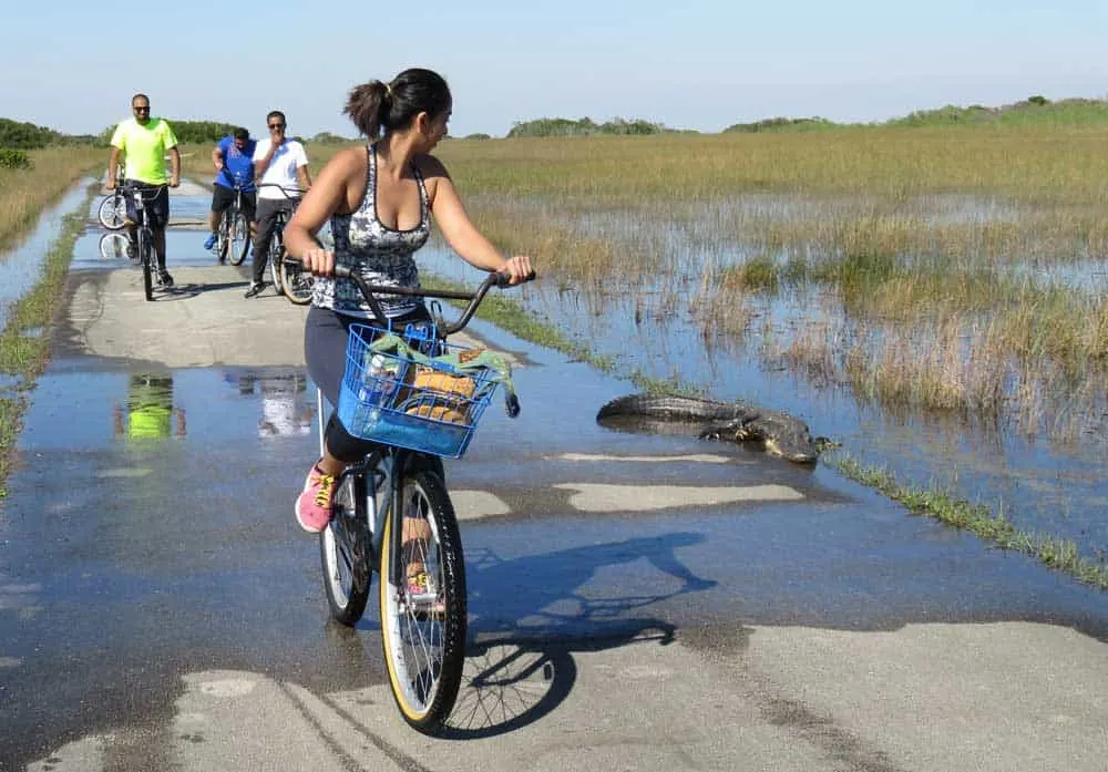
Travel west about 20 miles and you come to the one of the real “must do” stops on the Tamiami Trail, Shark Valley, one of several entrances to Everglades National park. It is a reliably wonderful outing in winter, where you can can walk, bike or take a tram on a 15-mile paved trail and see many alligators and wading birds. We think it’s the best biking trail in South Florida.
The parking lot at Shark Valley cannot accommodate all the visitors on winter weekends, but cars can park on the shoulder of the Tamiami Trail and visitors can walk in. In winter 2024, there have been long lines of cars waiting entry at Shark Valley on many days. If you reserve a tram tour, arrive at least an hour in advance.
Note: Admission to Everglades National Park is $35 per car and is good for seven days.
If you choose not to pay that hefty national park admission for a short visit, you can have an excellent Everglades experience along the Tamiami Trail by taking advantage of several free or inexpensive areas detailed below.
Just west of Shark Valley are two Miccosukee Indian attractions. The restaurant on the north side of the road offers a varied menu, including some native American favorites, such as fry bread.
The Miccosukee Indian Village and Gift Shop, also just west of Shark Valley on the south side of the road, is a commercial attraction. See what folks say here.
Your next opportunity for a side trip is Loop Road, a 26-mile road through the Big Cypress National Preserve that will take at an hour or two hours to explore. It’s an old gravel road with a colorful history; it has always attracted folks averse to civilization and its rules. For many years it was Florida’s version of the wild west.
Today, people travel Loop Road for a different kind of wild life — it’s a great place to spot alligators, birds, deer and even otter in a wild off-the-beaten-track setting. Here’s more from Florida Rambler on Loop Road.
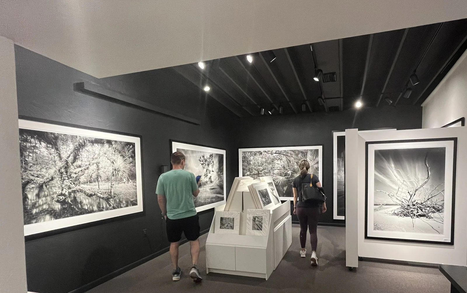
A few miles west of the entrance to Loop Road is Clyde Butcher’s Big Cypress Gallery, 52388 Tamiami Trail. Butcher is a renowned photographer whose large-scale black-and-white photos are designed to make viewers feel like they are at the center of the photo, surrounded by the amazing beauty of the Everglades. Butcher’s studio overlooks a scenic pond, where alligators and wading birds frequently appear, seeming to pose for pictures.
A stop at the studio is a great opportunity to view Butcher’s work in the setting that inspired it. While his original photographs are expensive, his gallery offers affordable calendars and posters. You can also take a five-minute walk through a pretty cypress forest behind the studio.
This stretch of Tamiami Trail that runs through the Big Cypress National Preserve is designated as a scenic highway. The thick cypress swamp hugs the highway’s edges and, if you don’t have somebody driving on your bumper, it’s worthwhile to slow down and take it in. We’ve seen an otter cross the road here, humping across the highway with its weird gait.
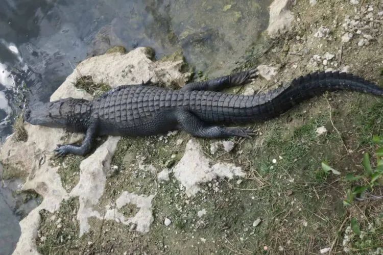
A few miles west, Big Cypress National Preserve Visitor Center offers exhibits, an introductory film and national park staff available to answer questions. The boardwalk out front overlooks a pond that attracts gators in winter and rangers periodically give informative talks here.
If you want to take a hike at this point, watch for the turn south where Loop Road rejoins the Tamiami Trail. Two miles up this dirt road is Gator Hook picnic area and trail. There’s an easy-to-hike 1.5 mile trail through dwarf cypress trees on an old logging road. Gator Hook has restrooms and shaded picnic sites.
(This corner had been the site of Monroe Station, a historic building that burned down in 2016. Back when driving the Tamiami Trail was one of the most remote stretches of road in Florida, this was a service station and general store serving passing tourists. Here’s a picture of it then.)
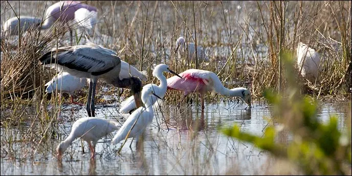
Back on Tamiami Trail, continuing west, you’ll pass Monument Lake campground on your right and then, on your left, the Kirby Storter boardwalk and picnic area, another good stop along the trail. The half-mile boardwalk is accessible to wheelchairs and strollers and takes you into the cypress swamp. There are picnic tables and restrooms.
A few more miles and on your right you’ll come to H.P. Williams Picnic Area, with tables and a viewing area where alligators and wading birds are often seen. The park is located at the intersection where Turner River Road heads north.
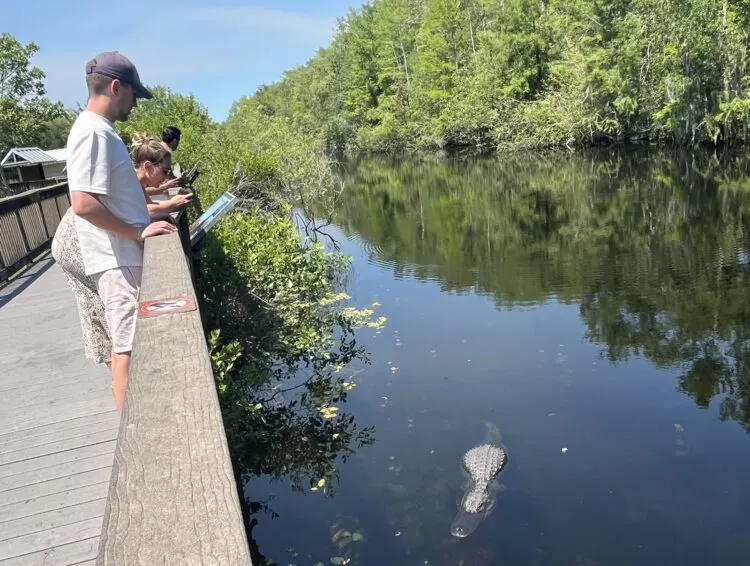
Turner River Road is a dirt road that takes you through open prairie along canals are at times full of birds and alligators. There is also a restroom here. If you want to add a back-country drive, consider driving this 17 mile loop: Turner River Road to Upper Wagonwheel Road to Birdon Road. The National Park Service created this informative guide to the route. It’s a PDF you can print out and bring along.
Back on Tamiami, a half mile west of Turner River Road, you come to the Turner River Canoe Access site, which provides parking and a boat launch for this popular canoeing and kayaking river. Kayaks and canoes can paddle upstream or downstream and back or use a livery service to make the all-day trip downstream to Chokoloskee and Everglades City.
This may be the most popular paddling trail in the region and for good reason: The scenery is spectacular and the wildlife abundant. Several outfitters run tours here and individuals bring kayaks from around Florida to put in here. Here’s our story about paddling the Turner River. (You can also stop at this site to use the picnic tables and restrooms.)
A few miles west of here at the Big Cypress Welcome Center, 33000 Tamiami Trail East, there’s a trailhead for another popular kayak trail, Halfway Creek. Here are details about it.
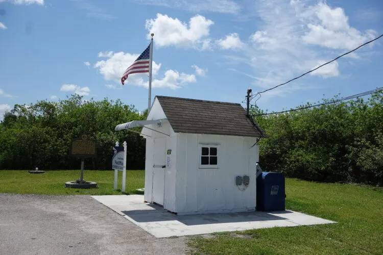
Continuing west, while you’ll see a few mailboxes along the road, you will rightly conclude that not many people live in these parts. So you may be surprised when the next landmark you see is the post office in downtown Ochopee. Of course, the post office IS the sole building in downtown Ochopee, and it’s the tiniest post office in the country — and, I’d maintain, the cutest. Go ahead: Stop and take a photo. Here’s more on the Ochopee post office.
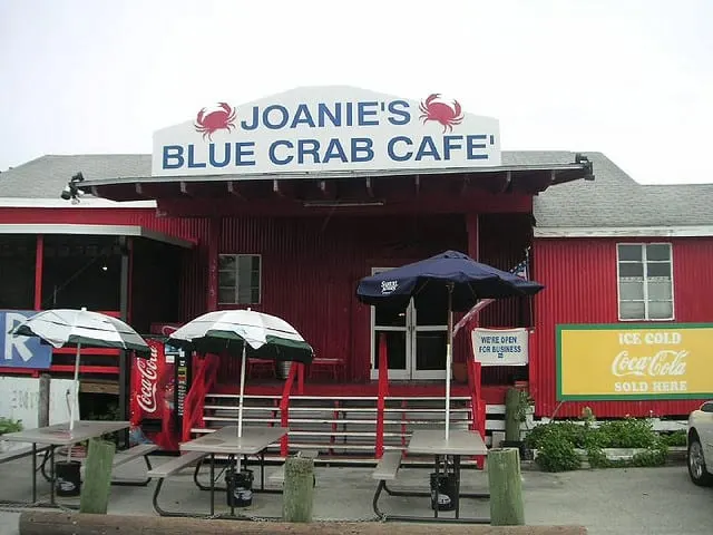
A bit west of the post office is an opportunity to stop for lunch: the historic and funky eatery, Joanie’s Blue Crab Cafe, 39395 Tamiami Trail, Ochopee. Joanie’s specializes in local foods, including frog legs, catfish, alligator, blue crab and grouper.
The atmospheric building, crammed with all sorts of memorabilia and oddities, dates to 1928, the year the Tamiami Trail was completed, and the spot attracts all sorts of folks, from bikers to European tourists. Here’s what TripAdvisor visitors says about it.
Joanie’s is 36 miles west of Shark Valley and you’re only a few miles from the Gulf Coast now.
Just west of the Big Cypress headquarters you come to State Road 29, which is the road to Everglades City, a mile further south. It’s an interesting stop well worth exploring. There are informal waterside restaurants that specialize in fresh seafood and stone crabs and the historic town is full of charm.
If you go north on State Road 29, in about two miles you come to the entrance to Fakahatchee Preserve State Park. If you have time and want to explore and hike into a wild environment, here’s the place. The park offers miles and miles of hiking, including dry, easy-to-walk trails through a vast and beautiful cypress forest filled with air plants and wild orchids. Admission is $3.
Fakahatchee is the orchid and bromeliad capital of the continent with 44 native orchids and 14 native bromeliad species. It’s where the ghost orchid, topic of a book by Susan Orleans and a movie starring Meryl Streep, lives, along with the equally elusive Florida Panther.
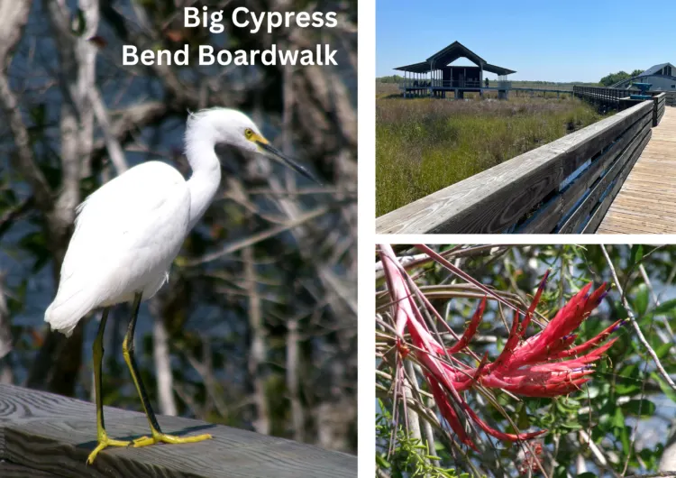
Just west on State Road 29 on the Tamiami Trail is another feature of Fakahatchee Strand Preserve State Park, the Big Cypress Bend Boardwalk. If you’ve visited this area before, you might recall the old boardwalk, which was destroyed by a hurricane. It led you through a lush cypress swamp teeming with wildlife and it was one of my favorites. Its replacement (for now) goes through a sunny prairie that is not quite as special. The upside: A spectacular open air pavilion over the prairie with a breeze and rocking chairs. Also: This boardwalk features restrooms.
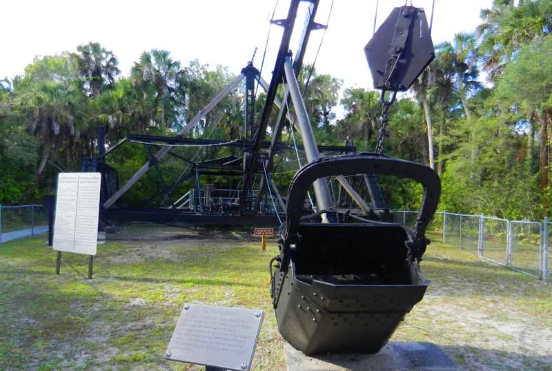
Before the Tamiami Trail reaches Marco Island and then Naples, you pass Collier-Seminole State Park, which draws people for camping, hiking and paddling. It’s also home to the 1924 Bay City Walking Dredge, which is the contraption that helped construct the Tamiami Trail. How often do you get to visit a “National Historic Mechanical Engineering Landmark”? I was surprised how interesting I found this spot.
After this park, the Tamiami Trail leaves the Everglades and becomes the major link between cities on the Gulf Coast.
Tamiami Trail: An environmental mistake we’re still fixing
When the Tamiami Trail was completed in 1928, it was an engineering marvel. Huge “walking dredges” helped forge the way and the road was an economic boon for Florida.
But the road was also an environmental disaster. It cut off the natural flow of water in the Everglades, famously called “a river of grass” by environmentalist Marjory Stoneman Douglas.
After the road was built, the Everglades south of the bridge was a dying ecosystem. After years of adding small culverts and bridges, the federal government finally went big. Congress appropriated money for a one-mile bridge completed in 2013 and then 2.3 miles of bridging completed in 2019.
The extensive bridging increased water flow into Everglades National Park by 80 percent. Additional culverts and smaller bridges are being built to help distribute the water. The whole project will be completed in 2024. Here’s an interesting article from the National Park Service about the history of the Tamiami Trail.
Links to help you plan your Tamiami Trail roadtrip
- Casino operated by the Miccosukee Indians
- Loop Road
- Shark Valley
- Clyde Butcher’s Big Cypress Gallery
- Ochopee Post Office
- Joanie’s Blue Crab Cafe
- Big Cypress National Preserve
- Big Cypress Bend Boardwalk
- Fakahatchee Strand Preserve State Park
Visiting nearby Everglades City and Chokoloskee:
- Historic Smallwood Store in Chokoloskee
- Everglades National Park Gulf Coast Visitor Center: This visitor center is being rebuilt to repair hurricane damage. Its popular (and recommended) boat trips and kayak rentals will not be available until the end of 2024 or early 2025.
- Camping and kayaking in the Ten Thousand Islands
- Ten Thousand Islands National Wildlife Refuge
Interesting Everglades City places to stay and eat:
- Ivey House Adventure Hotel, an eco-tour business.
- The historic Everlgades City Rod and Gun Club
- Joanie’s Blue Crab Cafe
- Camellia Street Grill (on Yelp)
- Triad Seafood
- City Seafood
The author, Bonnie Gross, travels with her husband David Blasco, discovering off-the-beaten path places to hike, kayak, bike, swim and explore. Florida Rambler was founded in 2010 by Bonnie and fellow journalist Bob Rountree, two long-time Florida residents who have spent decades exploring the Florida outdoors. Their articles have been published in the Sun Sentinel, the Miami Herald, the Orlando Sentinel, The Guardian and Visit Florida.

Debbie Senecal
Saturday 5th of August 2023
Can you cross Florida on the trail in a motorhome pulling a Jeep wrangler in late August.
Bob Rountree
Saturday 5th of August 2023
Yes. Tamiami Trail is a paved, two-lane highway. But if all you are doing is crossing Florida, I-75 (Alligator Alley) is probably safer.
Miller Mary L.
Tuesday 14th of February 2023
Thanks for all your research and suggestions. So much to do and learn!
Florida Road Trip: 10 Days in Tampa, Miami, the Everglades & the Keys – the xenophile life
Tuesday 5th of July 2022
[…] next day had us entering The Everglades en route to our next hotel in Florida City. This post about the Tamiami Trail from Florida Rambler has some great tips for things to see along the way. Our first stop was to Big Cypress Bend […]
uknowbeers
Wednesday 26th of January 2022
The road to Everglades City is FL-29 aka SR-29. It is not a US Highway.
Bob Rountree
Thursday 27th of January 2022
Thank you for the correction! :-)
Terry Reinhardt
Tuesday 31st of January 2017
Thank you for this wonderful article. We plan do camp the east coast next year then head to the west coast. What a great way to go across fla. I can't wait. Thank you again